OUT & ABOUT
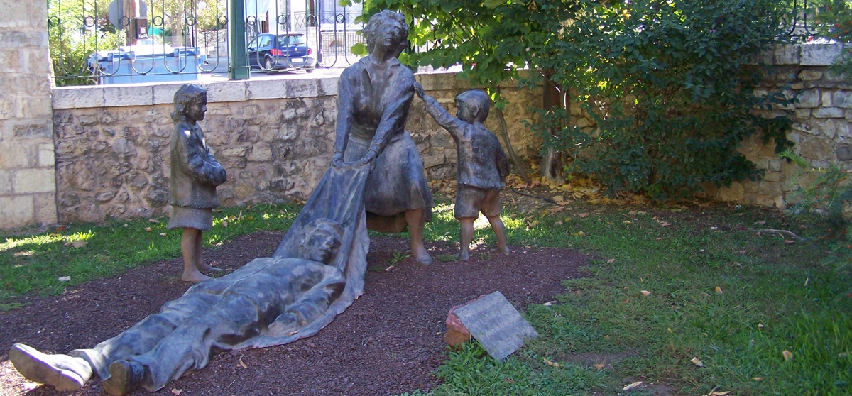
The picture above is of a sculpture outside the Holocaust Museum at Kalavryta
PLEASE NOTE THAT ALL THE PHOTOGRAPHS ON THE SITE ARE CLICKABLE LINKS
The picture above is of a sculpture outside the Holocaust Museum at Kalavryta
PLEASE NOTE THAT ALL THE PHOTOGRAPHS ON THE SITE ARE CLICKABLE LINKS
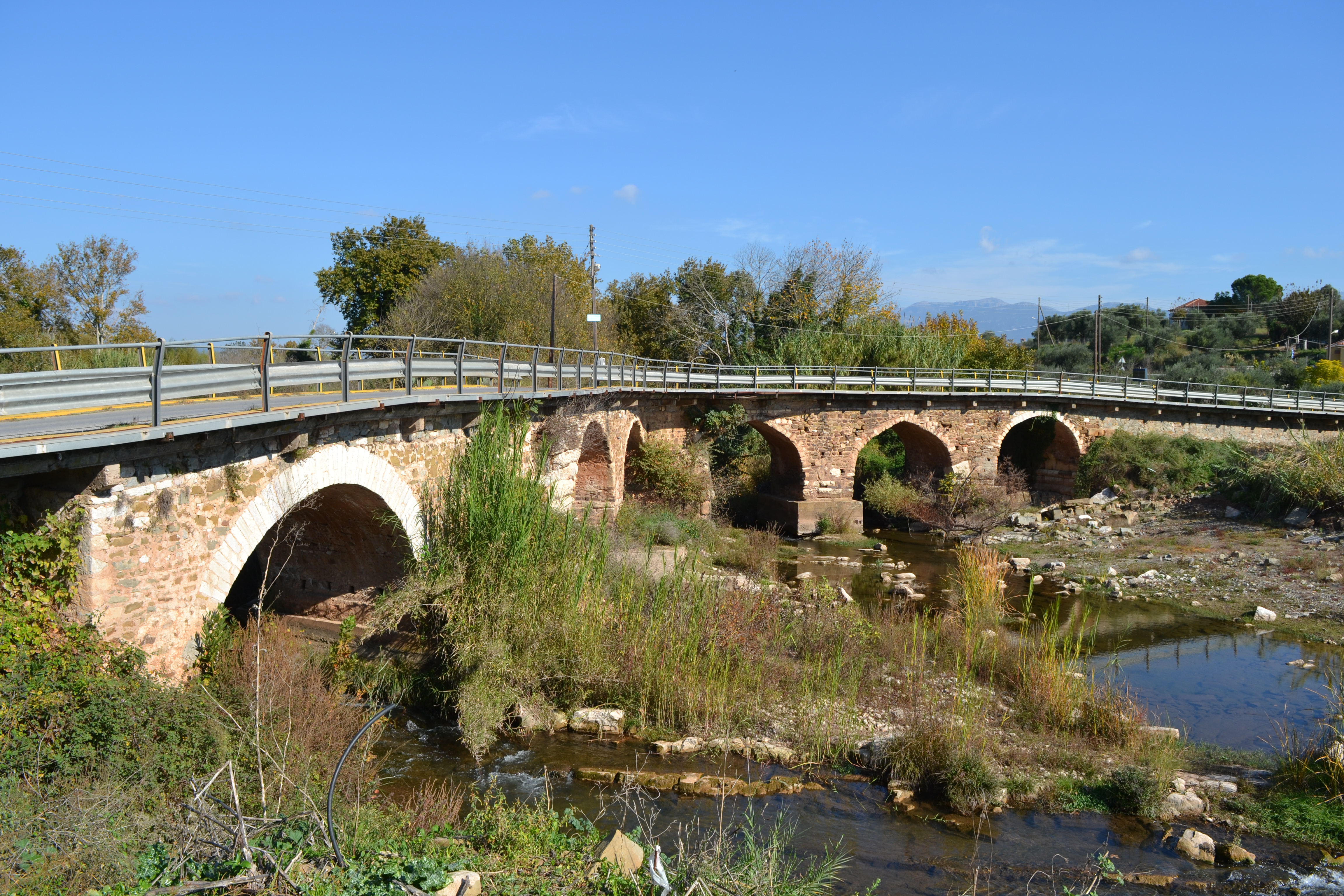
This stone bridge was built on the ancient road leading from the east to Ancient Messene just outside the village of Neochori, near Meligalas in Messinia. The bridge stands approximately 1.5km to the northeast of the Arcadian Gate, at the junction of two streams of the Pamisos River.
The foundations of the bridge as well as its lower part are constructed of large rectangular stones dating back to Hellenistic times, and the masonry of the wall is similar to the fortified walls of Ancient Messene.
The arched superstructure of the bridge was built during the Turkish occupation. The bridge, which has a total of nine arches, has three arms that meet in a Y shape.
Each of the branches corresponds to one of the three roads that connect here. It is a unique example of a bridge that was constructed against the flow of the river, which indicates that it was designed by pioneering architects of antiquity.
According to tradition it was built in medieval times by the wife of a man called Mavrozomis and this is why it was named "the Bridge of Mavrozoumena".
It was repaired during the Turkish occupation as attested by an inscription which says the bridge was restored by Sinan Soubassiou from Karitaina, (a town in Archadia) at my own expense.
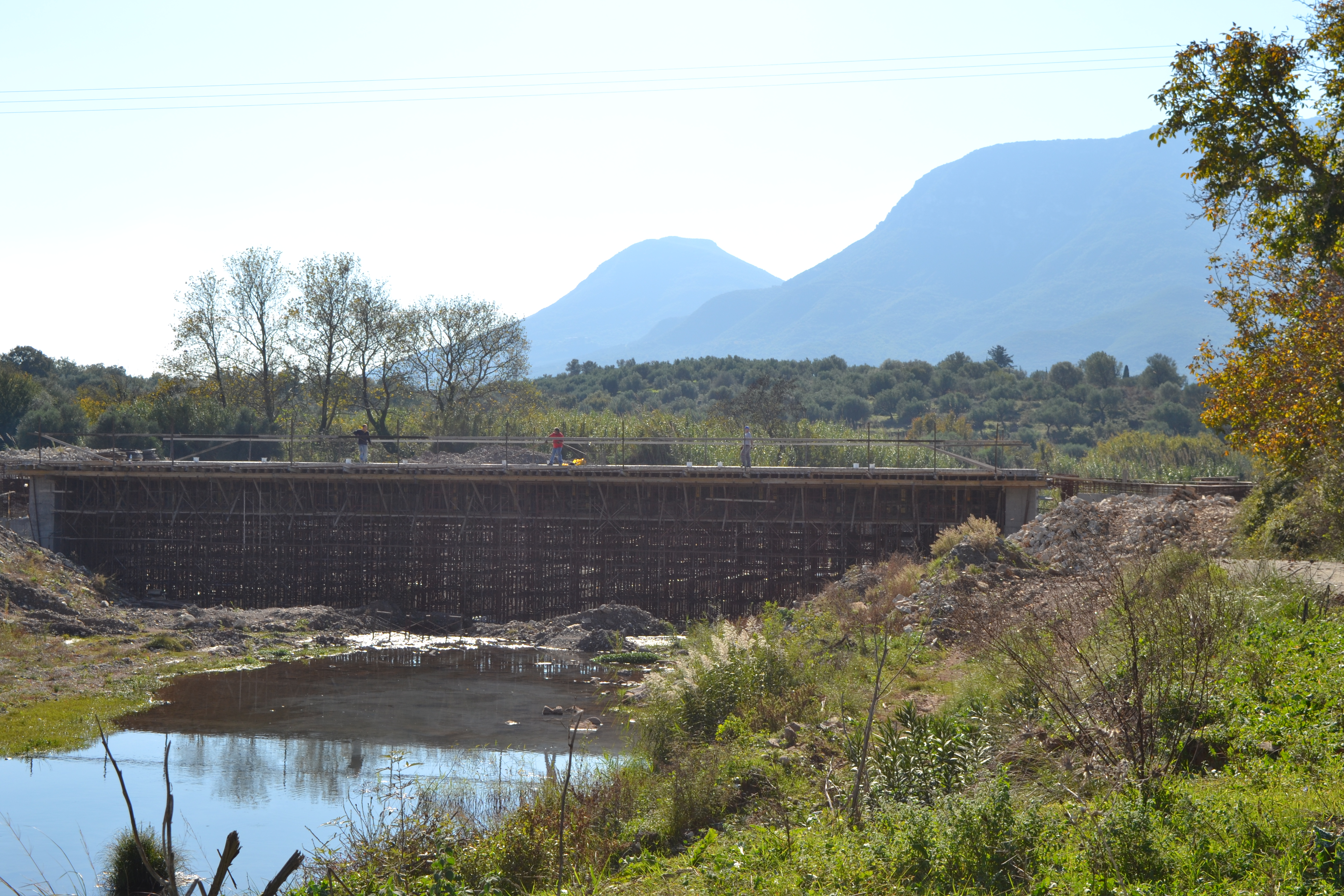
There is a new bridge being built across the river about 100m downstream.
The emperor Nero was the first to actually attempt to construct the canal, personally breaking the ground with a gold pickaxe and removing the first basket-load of soil in AD 67 but the project was abandoned when he died shortly afterwards.
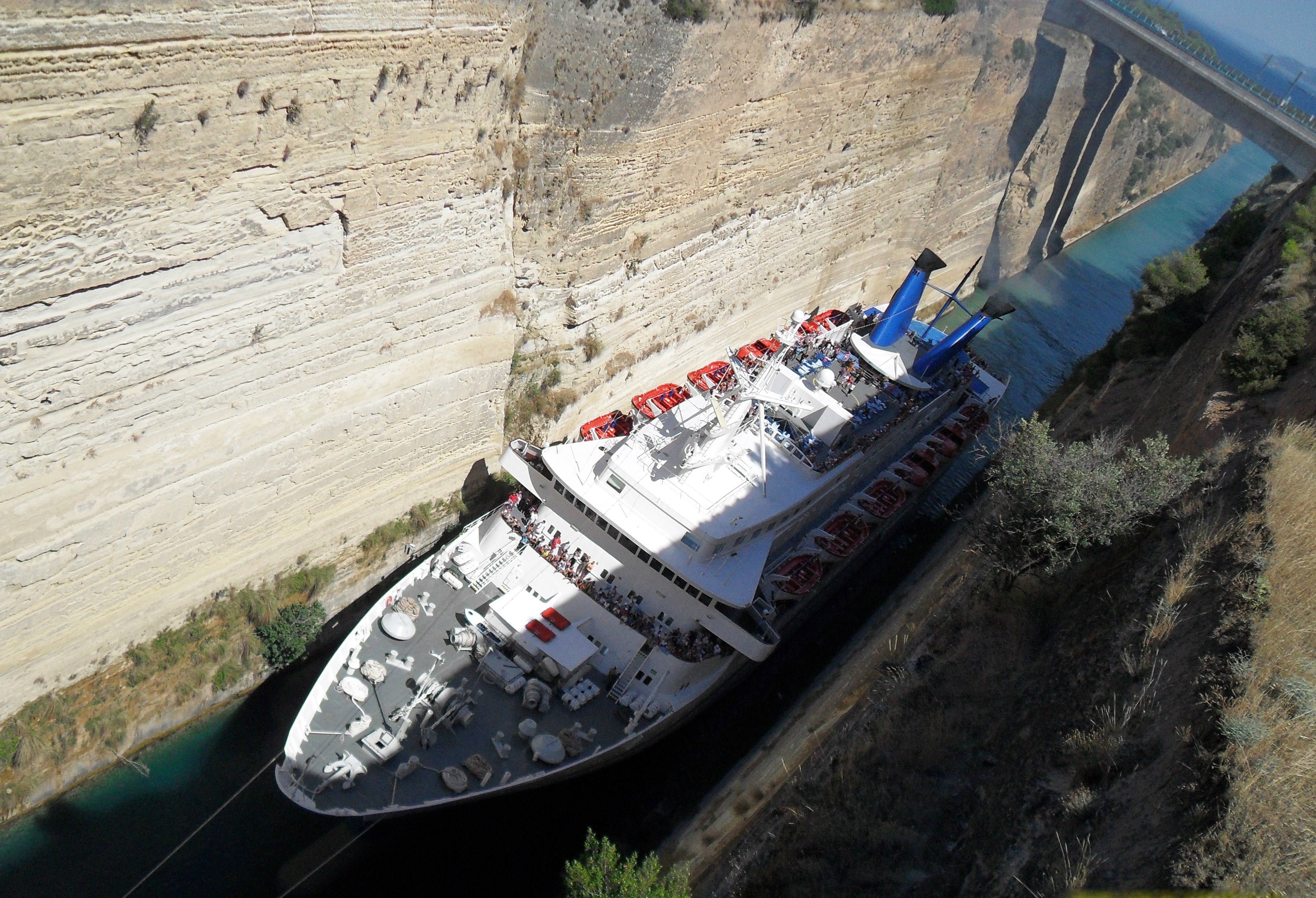
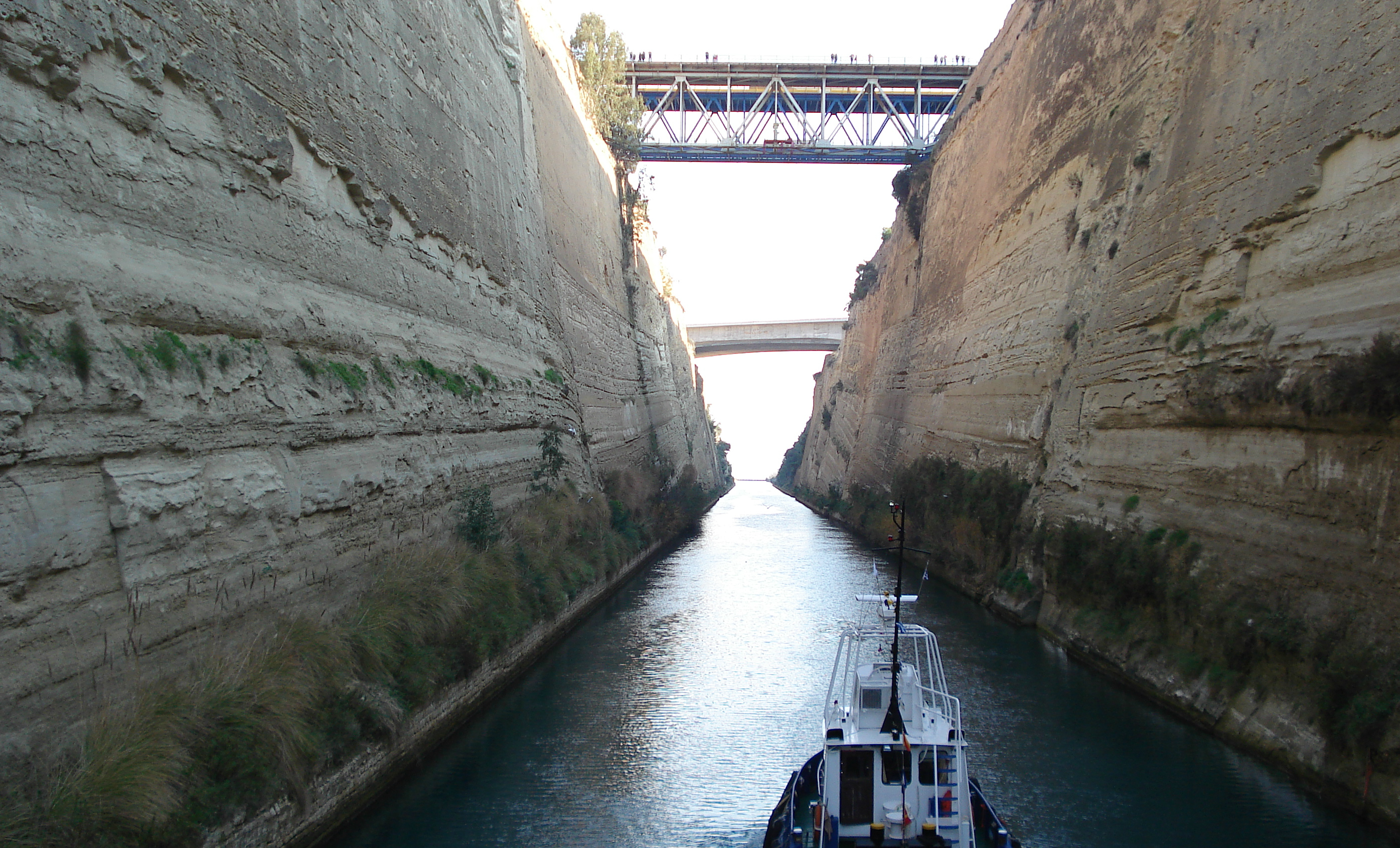
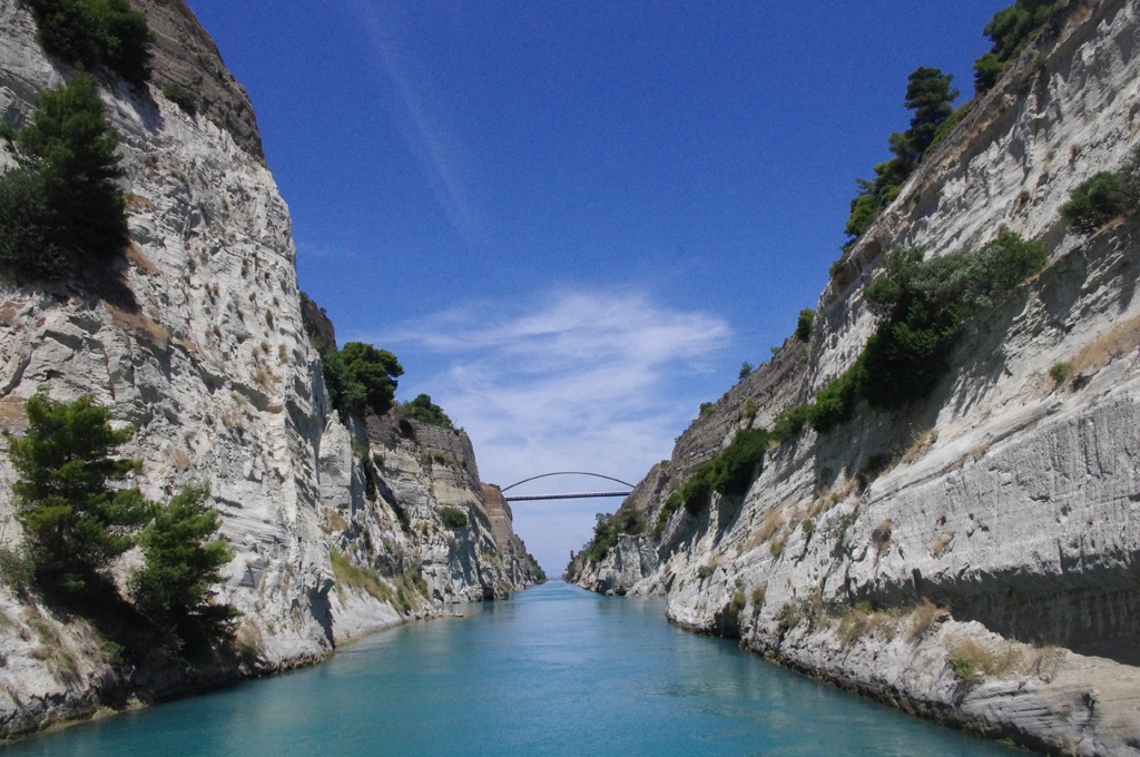
The Corinth Canal is a canal that connects the Gulf of Corinth with the Saronic Gulf in the Aegean Sea.
It cuts through the narrow Isthmus of Corinth and separates the Peloponnese from the Greek mainland, thus effectively making the former peninsula an island.
The builders dug the canal through the Isthmus at sea level and no locks have been used. It is 6.4 kilometres in length and only 21.4 metres (70 ft) wide at its base, making it impassable for most modern ships.
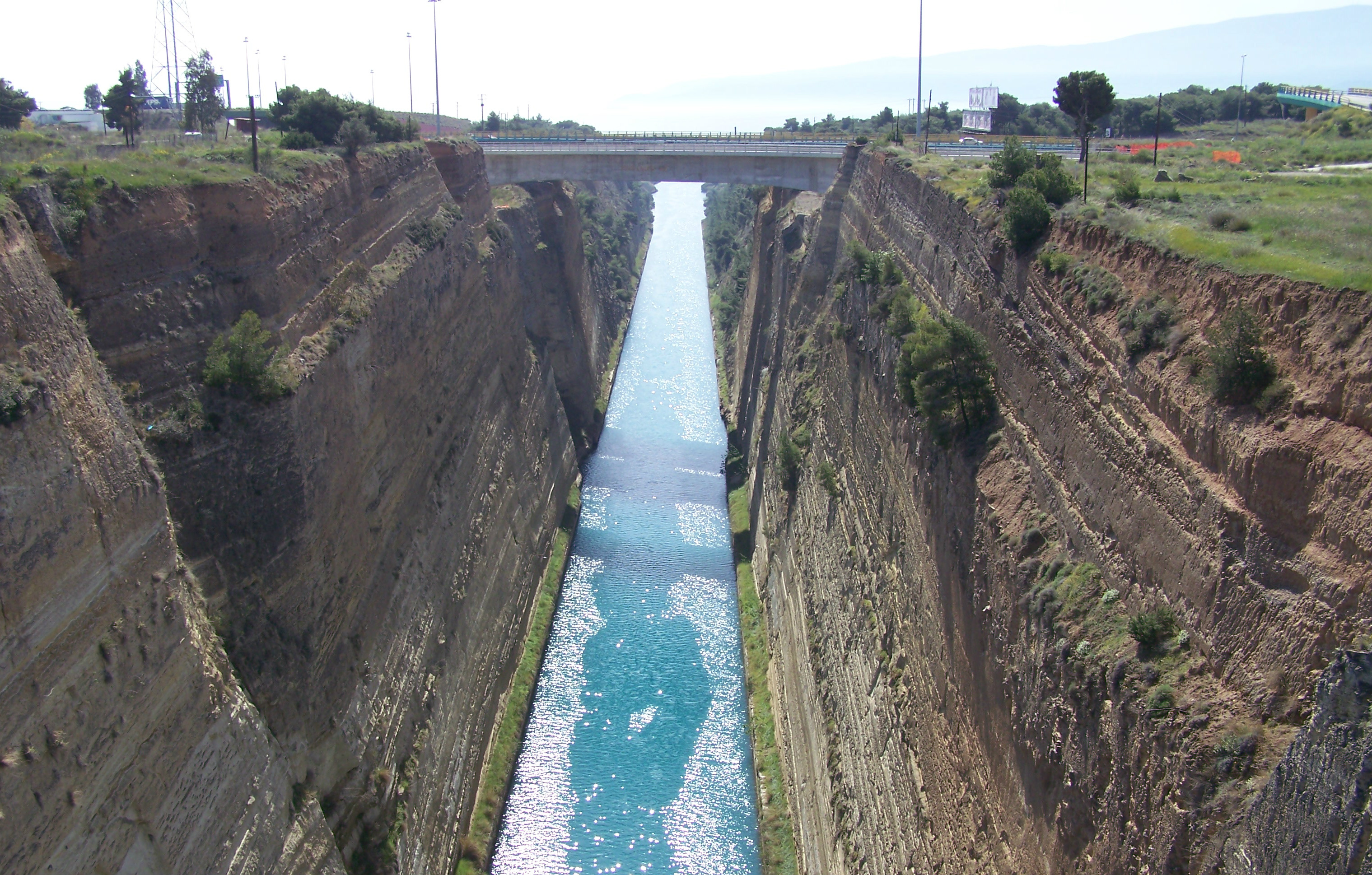
Earth and limestone cliffs flanking either side of the canal reach a maximum height of 63 meters. Construction finally got underway in 1881 but was hampered by geological and financial problems that bankrupted the original builders.
It was completed in 1893, but due to the canal's narrowness, navigational problems and periodic closures to repair landslides from its steep walls, it failed to attract the level of traffic anticipated by its operators. It is now used mainly for tourist traffic.
At various times the canal has been closed due to the unstable condition of the high limestone walls.
Serious damage was caused to the canal during World War II, when it was the scene of fighting due to its strategic importance. On 26 April 1941, during the Battle of Greece between defending British troops and the invading forces of Nazi Germany, German parachutists and glider troops attempted to capture the main bridge over the canal.
The bridge was defended by the British and had been wired for demolition. The Germans were able to surprise the defenders with a glider-borne assault in the early morning of 26 April and captured the bridge, but the British were able to set off the charges and destroy the structure.
Three years later, as German forces retreated from Greece, the canal was put out of action by German "scorched earth" operations. German forces used explosives to set off landslips to block the canal, destroyed the bridges and dumped locomotives, bridge wreckage and other infrastructure into the canal to hinder repair work.
The United States Army Corps of Engineers began work to clear the canal in November 1947 and managed to reopen it for shallow-draft traffic by 7 July 1948, and for all traffic by that September.
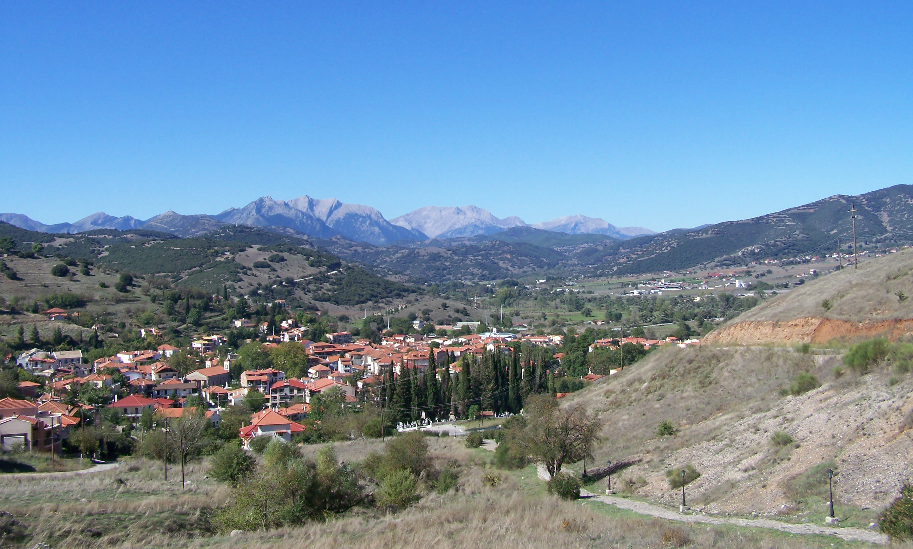
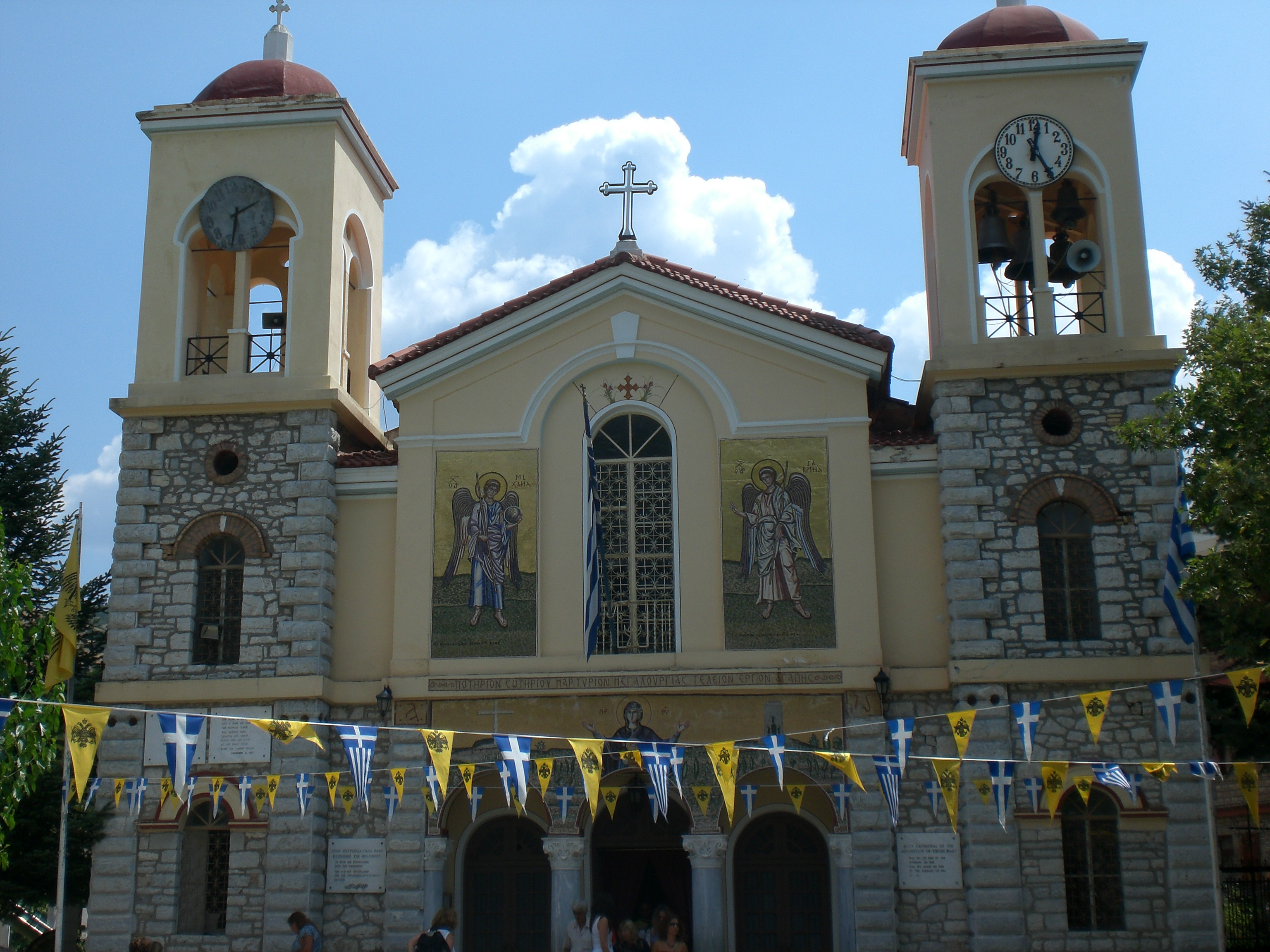
Kalavryta is the most beautiful and picturesque town of the area of Chelmos, one of the reasons that it is a popular destination, mainly during the winter as the nearby ski centre attracts thousands of visitors, especially at weekends. In the summer the town is quieter although the train from Diakopto brings many tourists.
During the late Middle Ages, the town was the centre of the Barony of Kalavryta within the Frankish Principality of Achaea, until it was reconquered by the Byzantines in the 1270s.
After that it remained under Byzantine control until the fall of the Despotate of the Morea to the Ottoman Turks in 1460.
With the exception of a 30-year interlude of Venetian control, the town remained under Turkish rule until the outbreak of the Greek War of Independence in 1821, in whose early stages Kalavryta figures prominently: it was here that on 21 March 1821 the flag of the revolt was raised at the monastery of Agia Lavra by bishop Germanos III of Old Patras.
The Massacre of Kalavryta refers to the extermination of the male population and the total destruction of the town by German occupying forces during World War II, on 13 December 1943.
Apart from the deportation and murder of over 80% of Greece's Jewish population, it is the most serious case of war crimes committed during the Axis occupation of Greece during World War II.
In early December 1943, the German Army launched Operation Kalavryta, intending to surround Greek Resistance fighters in the mountainous area surrounding Kalavryta.
During the operation, 78 German soldiers, who had been taken prisoner by the guerillas in October, were executed by their captors.
The commander of the German division ordered harsh and massive reprisal operations across the region. He personally ordered the killing of the male population of Kalavryta. Operation Kalavryta was mounted and all forces were aimed at the area.
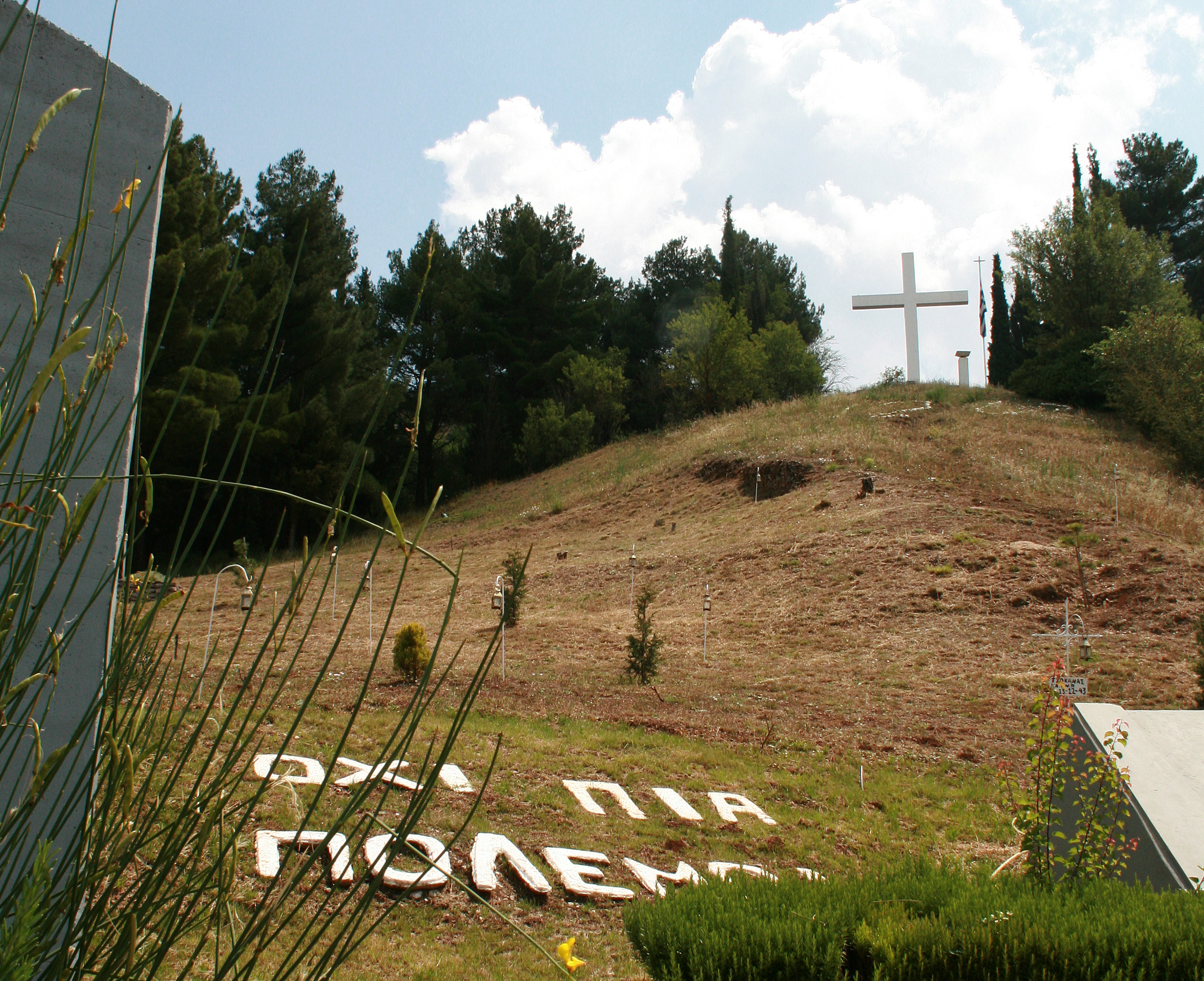
Wehrmacht troops burnt villages and monasteries and shot civilians on their way. When they reached the town they took all the women and children to the local school and marched all males 12 and older, including priests, to a hill overlooking the town.
There, the German troops machine-gunned them down. There were only 13 male survivors. Over 500 died just at Kalavryta. Survivors stated that when the Germans machine-gunned the crowd, they had been covered by the dead when they fell.
The women and children were locked inside the village school which was set alight. They managed to get out of the burning school, it is said that a soldier took pity on them and let them escape, while the rest of the town was set ablaze.
The following day the Nazi troops burnt down the Agia Lavra monastery, a landmark of the Greek War of Independence. In total, nearly 1,000 civilians were killed during the reprisals of Operation Kalavryta.
Twenty eight communities, towns, villages, monasteries and settlements were destroyed. In Kalavryta itself about 1,000 houses were looted and burned.
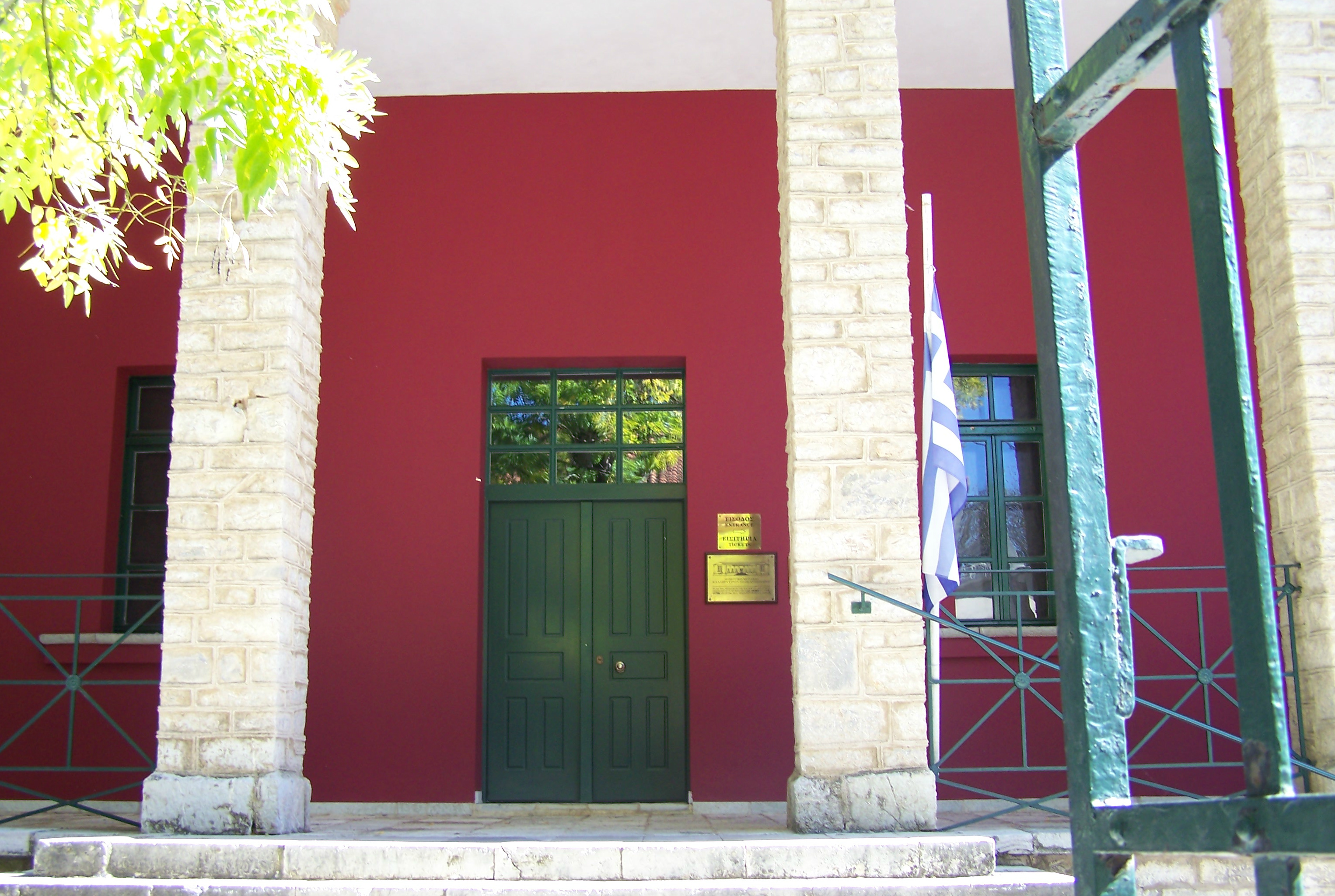
The Museum Collection housed in the old primary school is composed of personal belongings of citizens who were executed, historical documents from private collections, photographs from both Greek and German state archives, stamps, engravings by various artists, whose themes were inspired by the sacrifice of the people of Kalavryta and some of which were created immediately after the tragic event.
The main door is always kept locked in memory of the men and boys who were taken to their death through the door, and also the old clock on the church is stopped at the time the killing began. A visit to the Museum is very emotional, some of the photographs reduce you to tears.
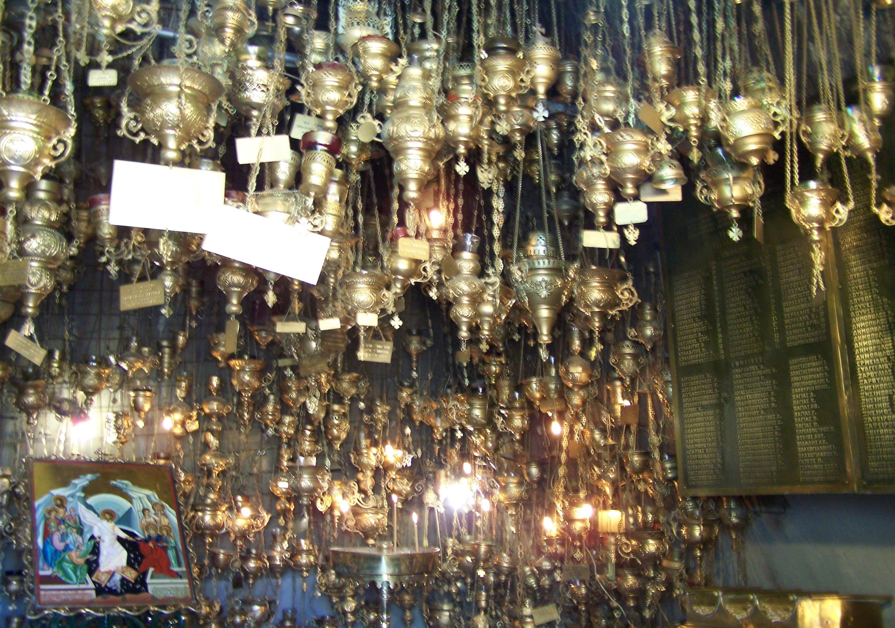
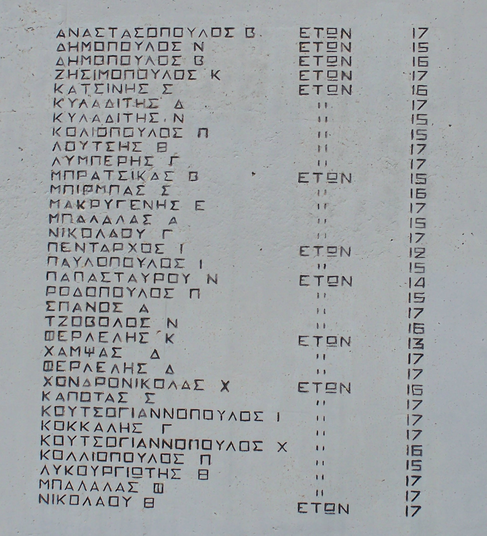
A tiny chapel is located at the holocaust monument. Inside are lamps with candles which are lit for each person who was murdered. A nameplate is attached to each lamp with the name and age of the person who died. It is very moving when you walk down the steps and inside.
It is hard to imagine what the women of the village went through. They had the terrible task of burying their dead, then trying to feed and house themselves and their children as the Nazis took all of the supplies they could find leaving the surviving villagers with absolutely nothing and homeless for the coming winter. A whole generation grew up without their fathers and brothers.
Kalavryta is very beautiful and you will love to walk through the buildings, you will also find lots of tavernas, restaurants, cafes, bars, and many shops selling local products.
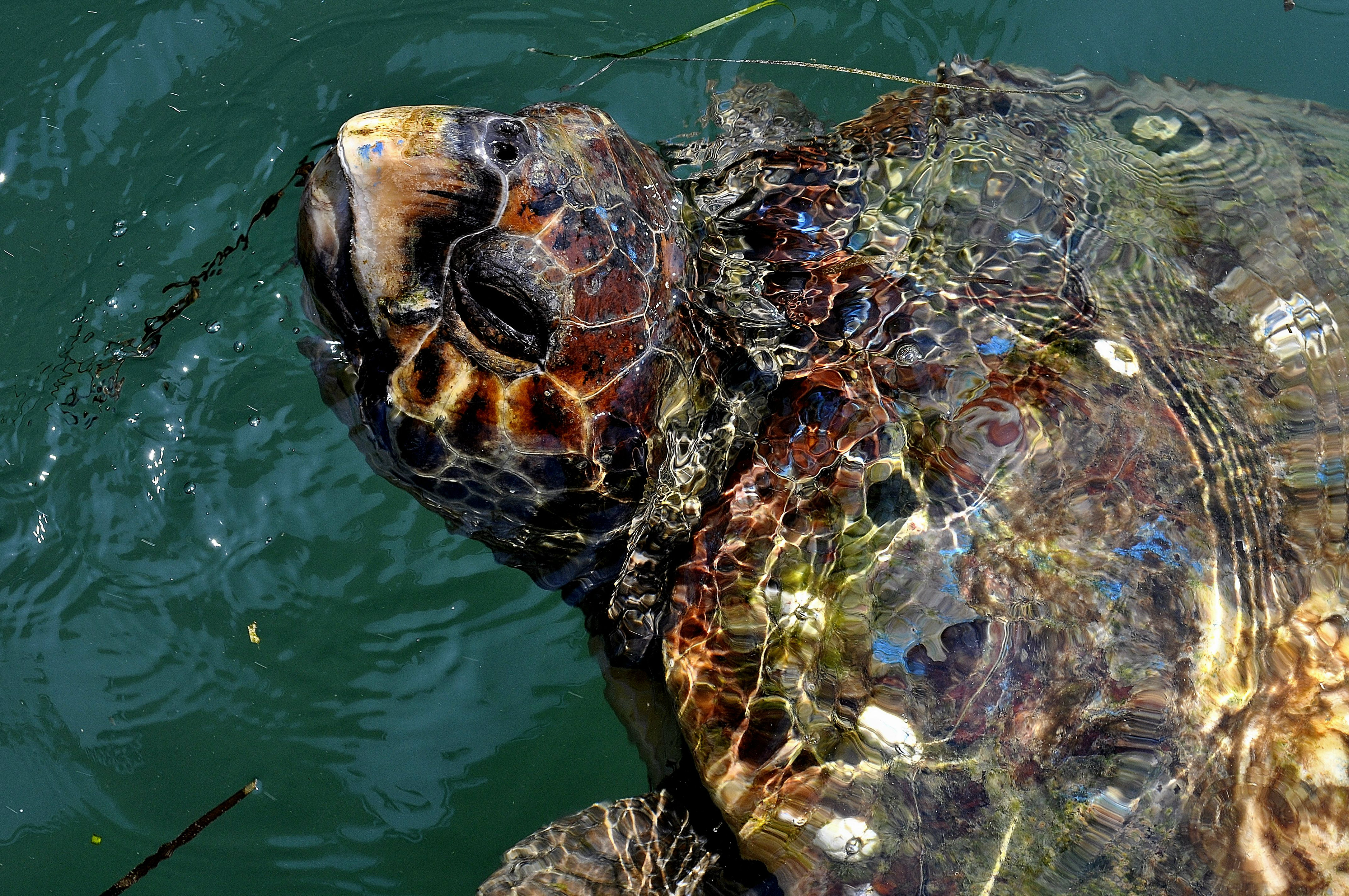
Kyparissia Bay is the second largest Mediterranean reproduction habitat of the Loggerhead (Caretta Caretta) sea turtle, and it is situated in the West Peloponnesse. The sandy beach is 46 km long and it is only broken by the Alfios River and two smaller ones, the Neda and Arkadikos.
The core of the habitat is located in the south part of the Gulf and throughout the 10km of coast between the river Neda and Kalo Nero village, where the 86% of the nesting takes place. In this section, up to the 25th July 1014 , 892 nests were protected and recorded.
Three photographs courtesy of 'addicted2pawn' at Flickr who worked as a volunteer for Archelon, the Sea Turtle Protection Society of Greece.
Since 1983, the primary objective of ARCHELON has been to protect the sea turtles and their habitats in Greece through monitoring and research, developing and implementing management plans, habitat restoration, raising public awareness and rehabilitating sick and injured turtles.
The Society relies heavily on voluntary work. Every year over 500 volunteers from all over the world are invited to help with the work on the nesting beaches and the Rescue Centre.
In the North Kyparissia Gulf, over 100 volunteers from all over the world participate in activities which operate to protect the sea turtles of the area. Archelon runs the following activities from May 15th to September 30th.

Every summer the major nesting areas in Greece (Zakynthos, Peloponnese and Crete) around 75 kilometres are monitored daily. Every year over 2,500 nests are protected against human threats, predation and sea inundation.

Every year around 300 turtles are tagged in order to monitor their movements in the sea. Recently satellite transmitters have been used. Over 50 injured sea turtles are treated every year at the Rescue Centre at Glyfada (Athens).
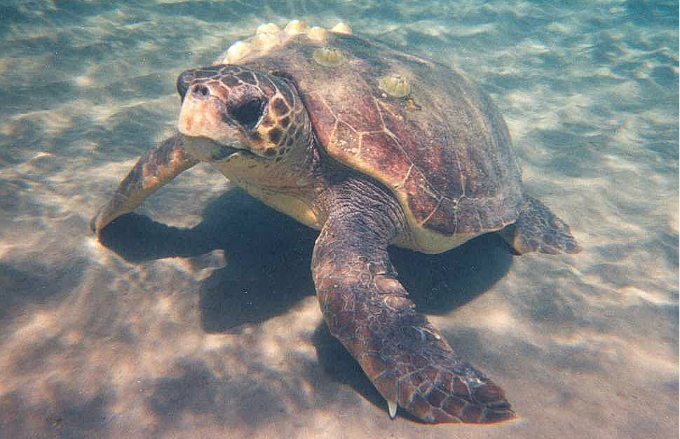
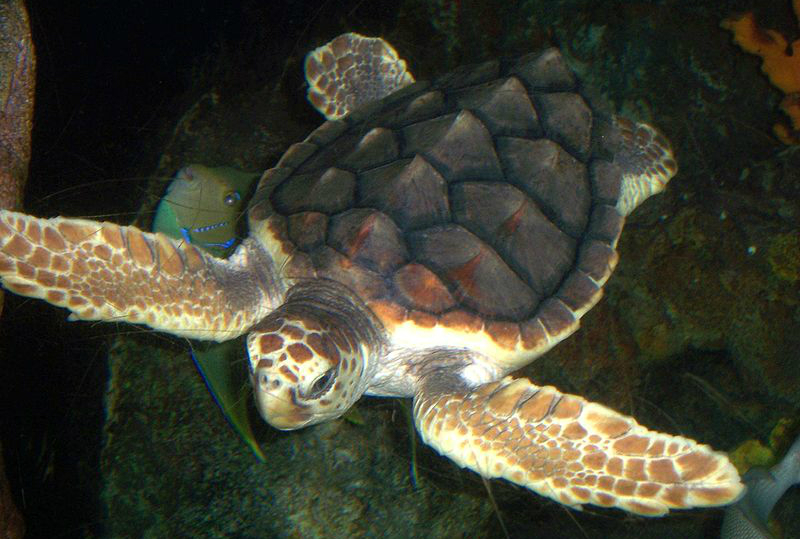
The loggerhead sea turtle (Caretta caretta), is a marine reptile, belonging to the family Cheloniidae. The average loggerhead measures around 90cm long when fully grown, although larger specimens of up to 280cm have been found. The adult loggerhead sea turtle weighs approximately 135 kg , with the largest specimens weighing in at more than 450 kg. The loggerhead reaches sexual maturity within 17-33 years and has a lifespan of 47-67 years.

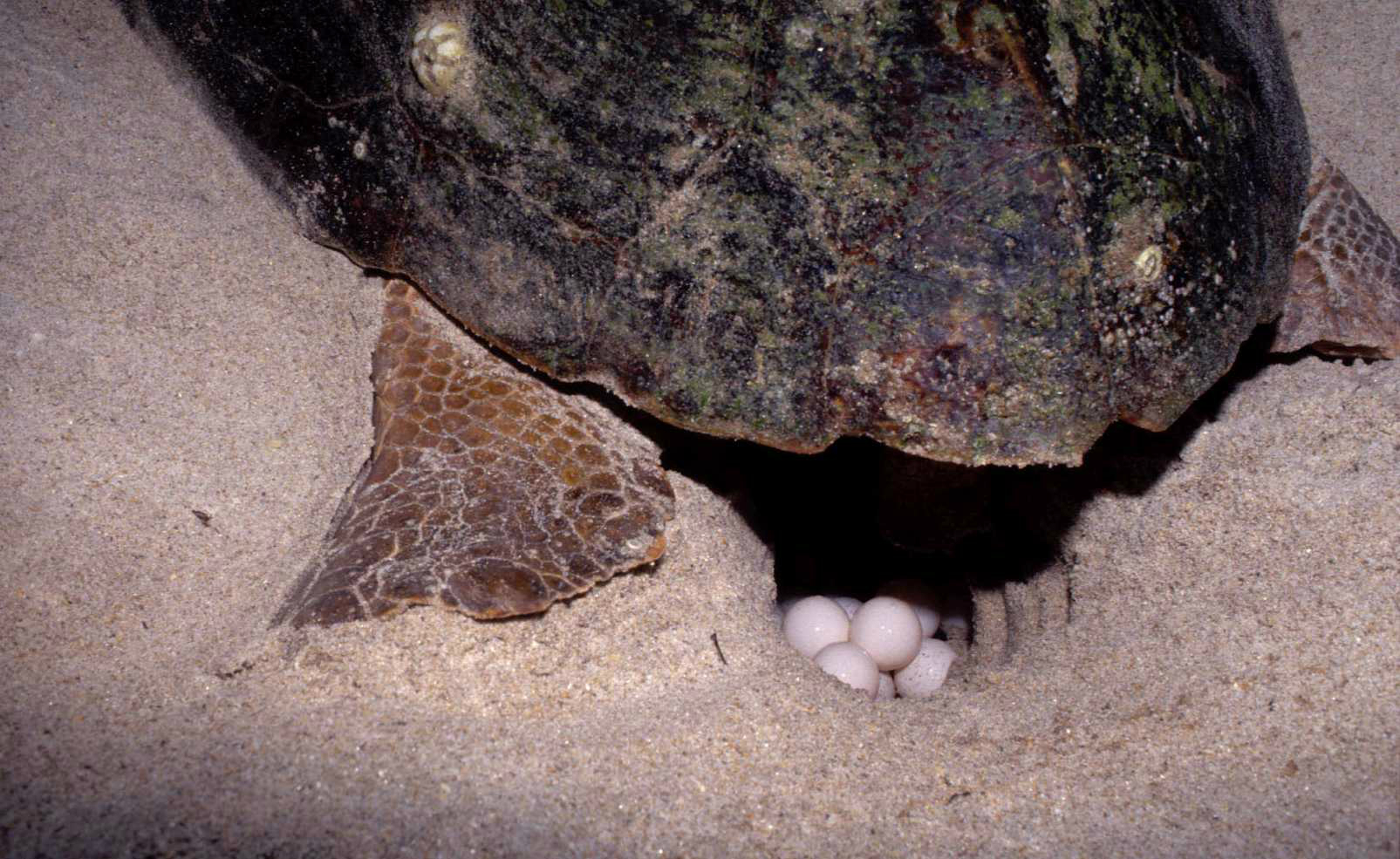
The loggerhead sea turtle is found in the Atlantic, Pacific, and Indian Oceans, as well as the Mediterranean Sea. It spends most of its life in saltwater and estuarine habitats, with females briefly coming ashore to lay their eggs, ususally at the site where they were hatched. The loggerhead sea turtle has a low reproductive rate; females lay an average of four egg clutches and then become quiescent, producing no eggs for two to three years. The average number of eggs per nest is around 100-110.
This photograph was taken when I was working as a volunteer for a few weeks some years ago. The baby was found alive in nest I was excavating. They are put at the side of the nest and allowed to make their own way down to the sea.
Hatchlings range in color from light brown to almost black, lacking the adult's distinct yellows and reds. On hatching, they measure about 4.6 cm and weigh about 20g. The eggs are typically laid on the beach in an area above the high-tide line. The eggs are laid near the water so the hatchlings can return to the sea. The sex of the baby turtles is determined by the temperature in the nest.
After incubating for around 80 days, hatchlings dig through the sand to the surface, this usually occurs at night, when darkness increases the chance of escaping predators and damage from extreme sand surface temperatures is reduced.
Photographs courtesy of JHannah_92 at Flickr.
Hatchlings enter the ocean by navigating toward the brighter horizon created by the reflection of the moon and starlight off the water's surface. So if there is artificial lighting in the area they will head towards that.
My short time working as a volunteer was very rewarding, I learnt a great deal about turtles and the work of Archelon. Even with all the work going on around the world the Loggerhead Turtle is still an endangered species. Out of thousands of hatchlings only a few make it to adulthood.
Here is a link to the Sea Turtle Protection Society of Greece. Visit Archelon
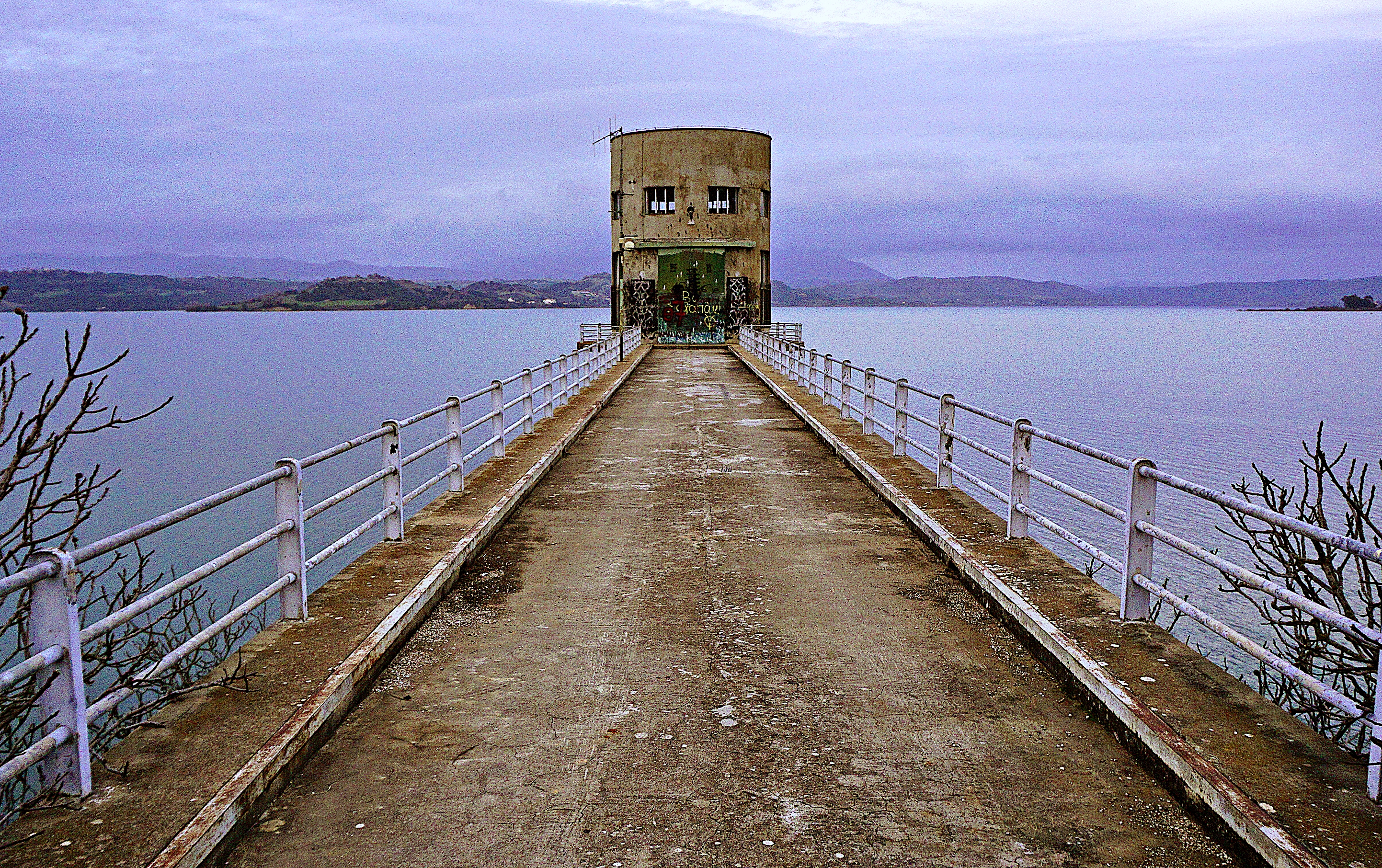
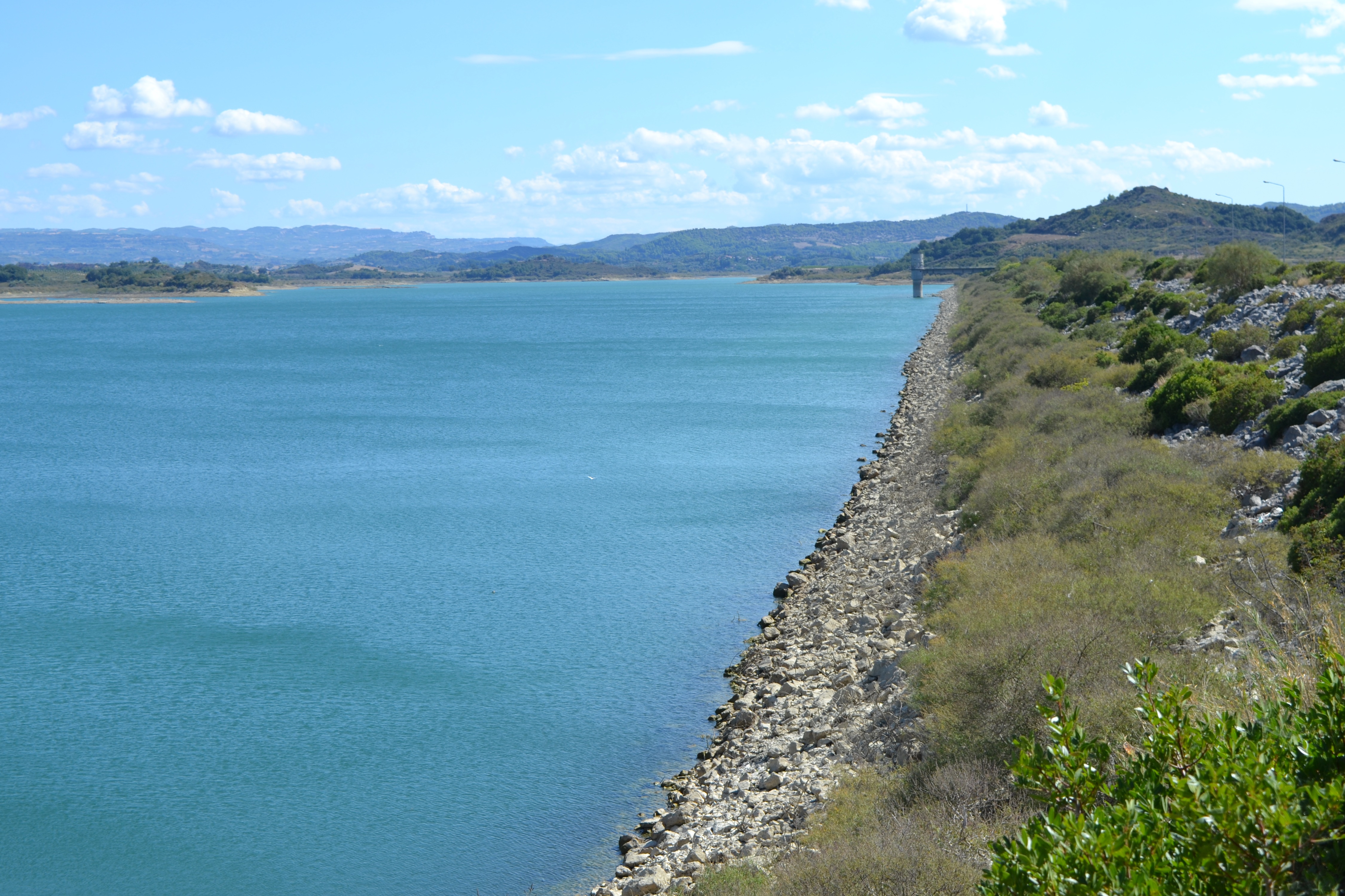
The Pineios River, on its way to the sea, supplies the artificial lake of Pineios. One of Elis most important constructions completed in 1968, the dam that holds the water of the river is located close to Ancient Elis.
Its total height is 50m and it is 2,175 meters long.
Pineios is one of the Peloponnese's most significant rivers, its total length is 70 km. Also known as Gastouni River, it has its sources in Mount Erymanthos and empties in the Ionian Sea near the town bearing the same name.

According to mythology, Hercules diverted the flow of Pineios and Alfeios rivers in order to clean the Augean Stables in his fifth labor.
After having demolished the stables' walls, the hero used the river flow to clean the dung.
Lake Pinieos is an artificial lake created by construction of a dam on the river Pinieos. It is located in Ilia prefecture. It has an area of 19,895 square kilometers and is the largest lake in Peloponnese.
Construction began on the dam, which has a thickness of 10 meters, in September 1961 and the project was completed in 1968.
With the filling of the dam with water, Xenies village was abandoned as it was be at the bottom of the lake, but Paleochora, Agia Anna and Souli villages were also evacuated.
The area of the dam basin is 723 km, and the lake's capacity is 366 million cubic meters.
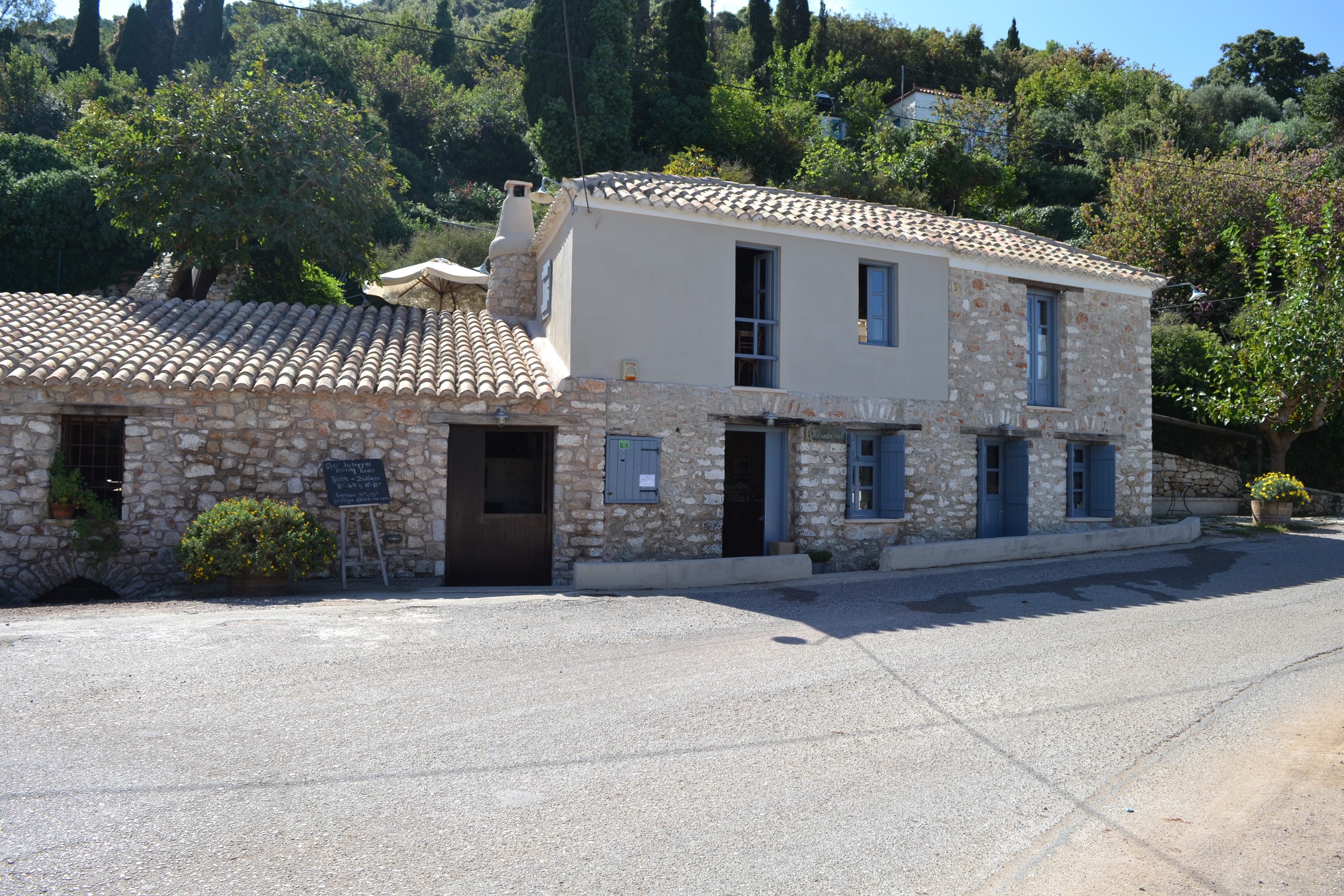
The Old Watermill is situated in a beautiful location approximately 2km from the town of Kyparissia on a country road in the village of Myloi. There is a sign on the road as you go into Kyparissia from Kalo Nero.
The mill was in operation before 1850 and has been restored by the owners with love, attention to detail and respect for its history and traditional architecture.
This was overseen by the Directorate of Contemporary and Modern Monuments of Western Greece.
When I visited the mill, the owner showed me round and then started the watermill working.
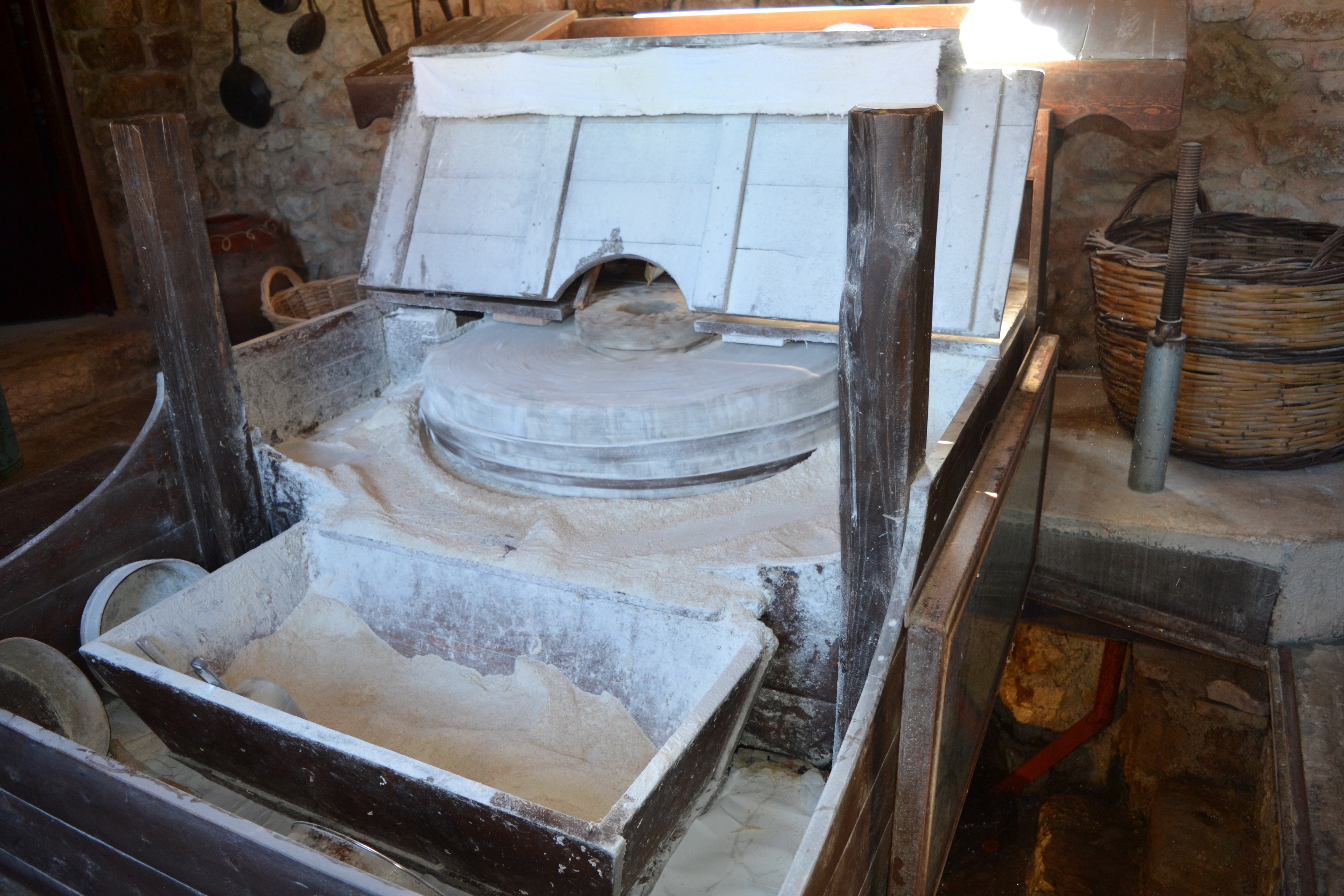
It was amazing to see the wheat filtering down a small chute and into the grinding stones, and seeing the flour actually being produced. I brought home a bag of flour that I actually saw being milled!!
The water for the mill comes down from the mountain behind the building and operates a huge wheel underneath the milling mechanism.
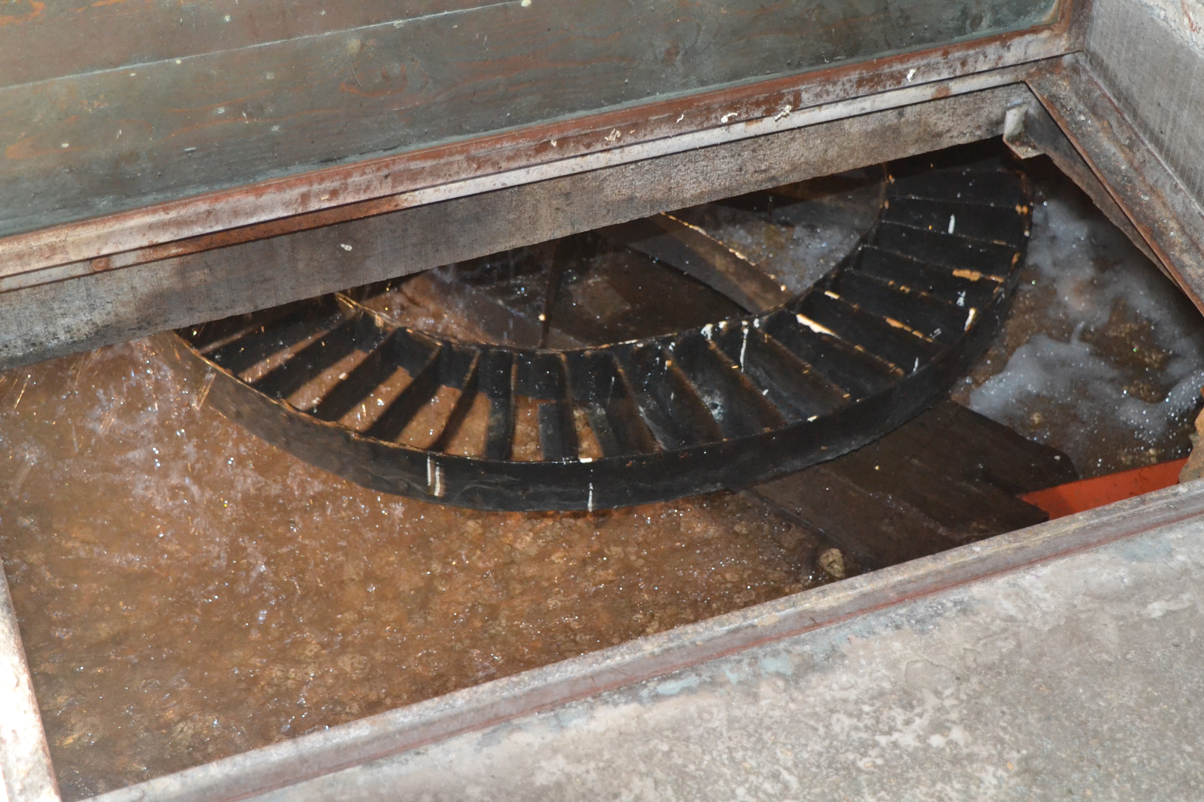
The watermill works in a traditional way, all metal working parts were salvaged from the original workings and only the wooden parts were changed.
The mill goes back a long way in history. It has changed owners many times. It has been a small shop and a taverna.
During WWII partisans and the resistance established their headquarters here. The mill was declared a protected monument by the Central Council for Modern Monument in 2012.
At the mill you can see the beautifully restored old building with the old milling mechanism that has been reconditioned and is now fully operational.
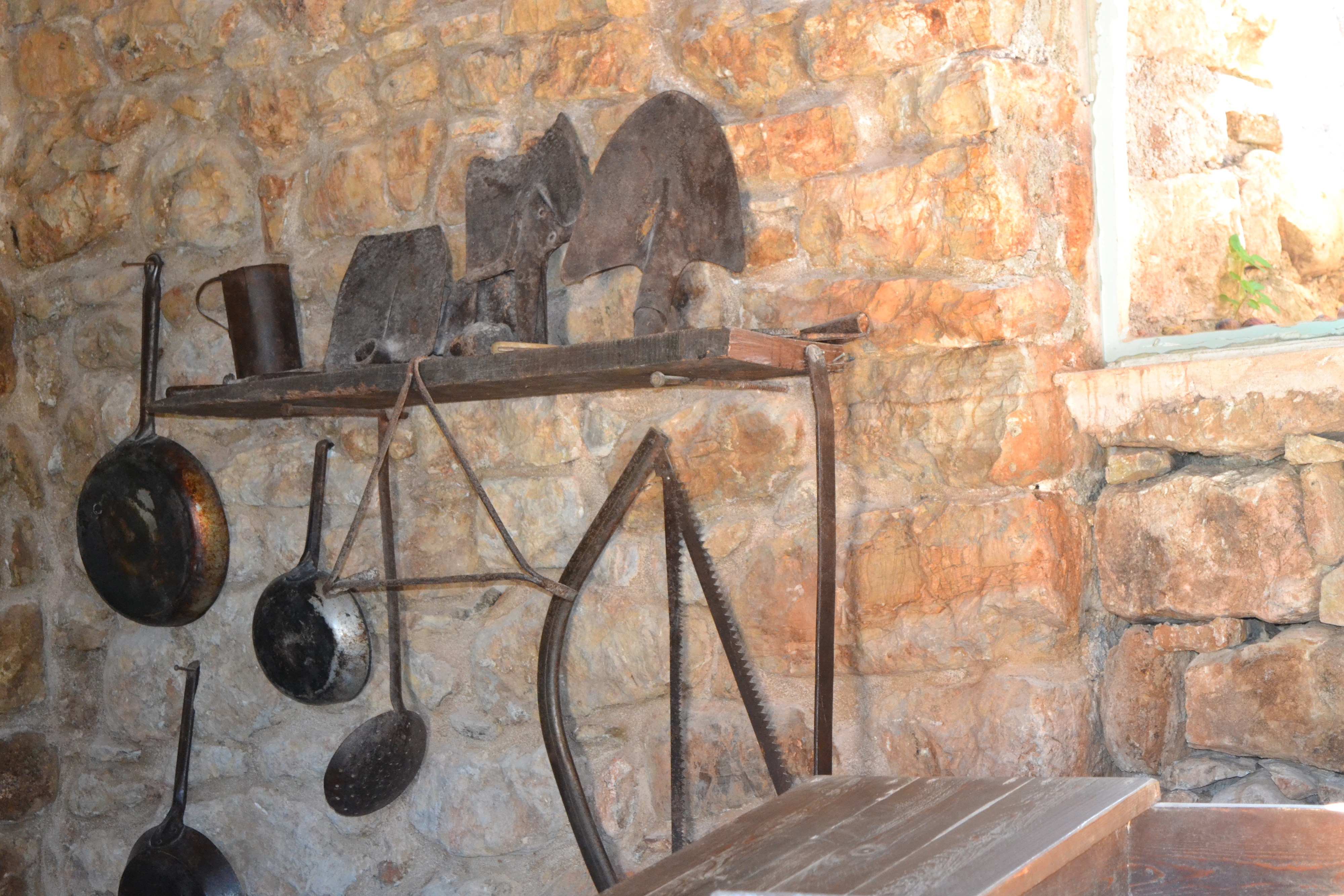
Also on display is all the equipment and tools that have been salvaged and restored,and also a lot of old documents and memorabilia from the mill.
It is actually a small museum.

In the two storey part of the mill is a wonderful shop in 2 small rooms with a beautiful array of local goods ranging from the actual milled wheat flour to herbs, sweets, spirits, liquers, pickles, pate, olive products, aromatic vinegars, pasta, jams and lots more.
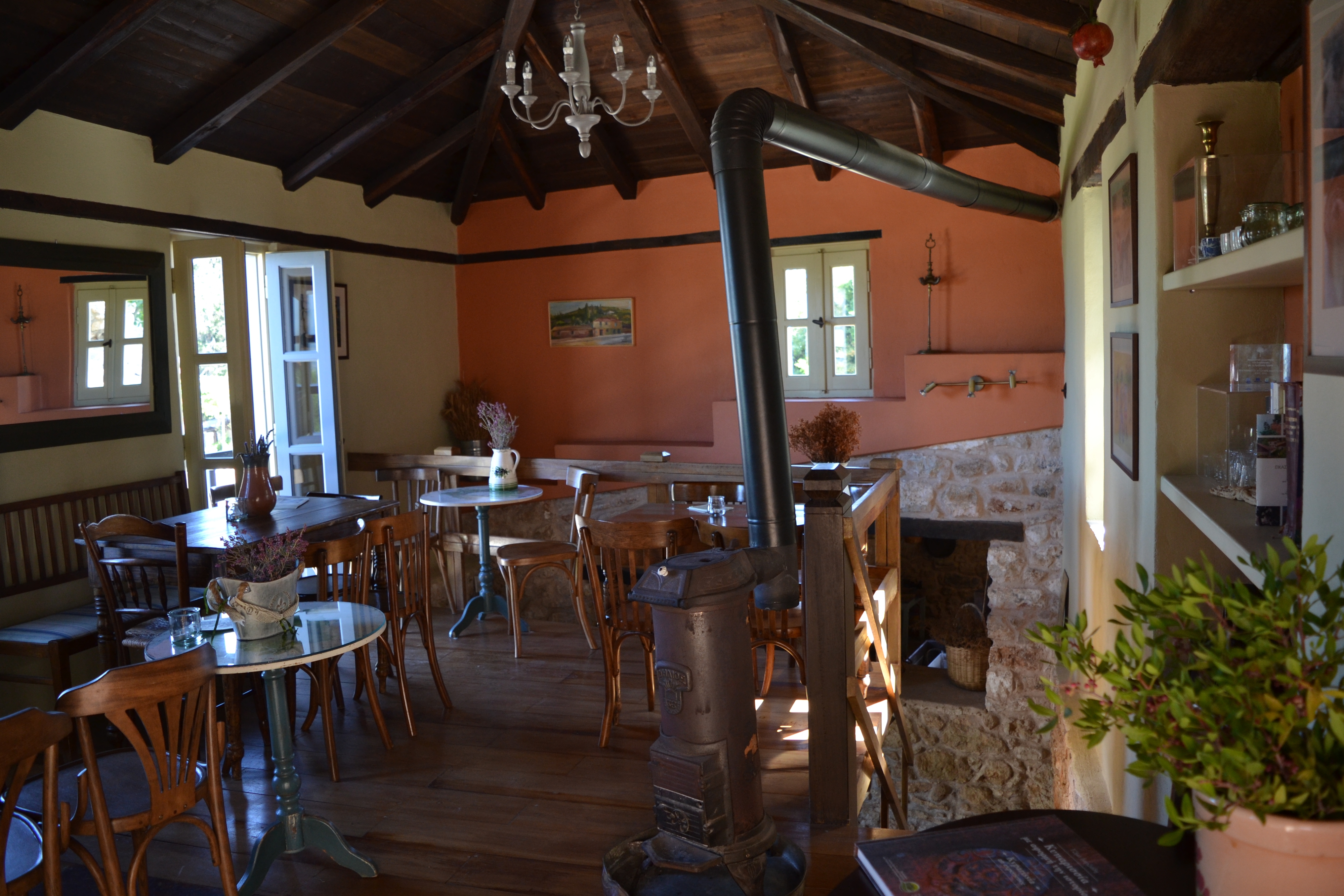
Up the wooden stairs is a lovely cafe where you can enjoy a drink, food or a dessert of your choice.
Outside there are many shaded sitting areas where you can relax and enjoy the beauty of the gardens.
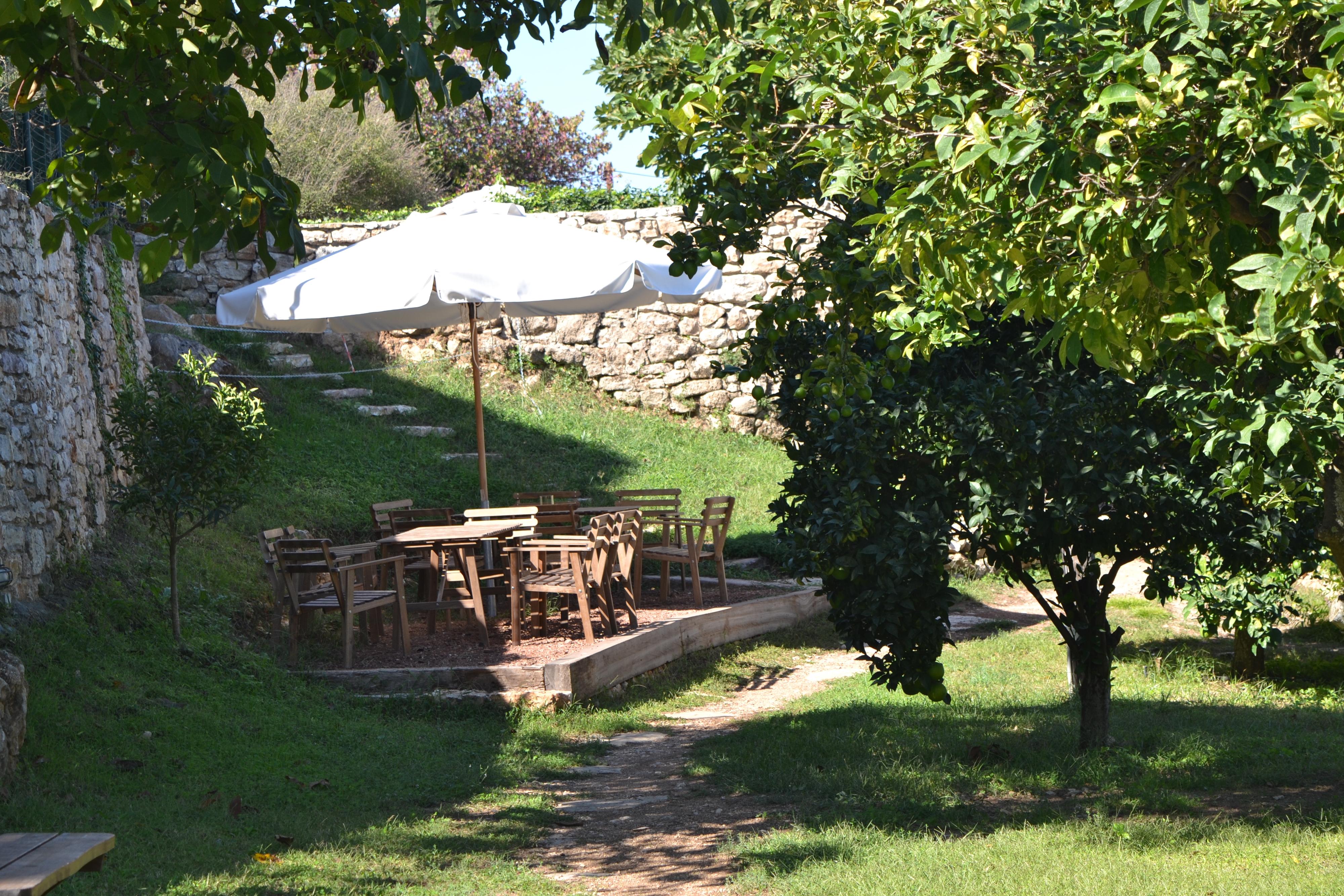
The garden of the mill is full of citrus trees, herbs and flowers. There are plane trees and a brook and water that runs through the garden and the view of the beautiful hill behind the property.
Opening Hours: Sun 9:00 AM - 11:00 PM: Mon - Fri 9:00 AM - 2:30 PM: Mon - Sat 6:00 PM - 11:00 PM: Sat9:00 AM - 3:00 PM