ANCIENT THOURIA
PLEASE NOTE THAT ALL THE PHOTOGRAPHS ON THE SITE ARE CLICKABLE LINKS
PLEASE NOTE THAT ALL THE PHOTOGRAPHS ON THE SITE ARE CLICKABLE LINKS

In spring 2007, Mr. Antonis Tsagklis, a native and permanent resident of the village Antheia (Gardiki), who is the antiquities guard of the area, led Dr. Xeni Arapogianni, who was at the time the Director of the 38th Department of Prehistoric and Classical Antiquities, to a place particularly inaccessible due to vast vegetation.
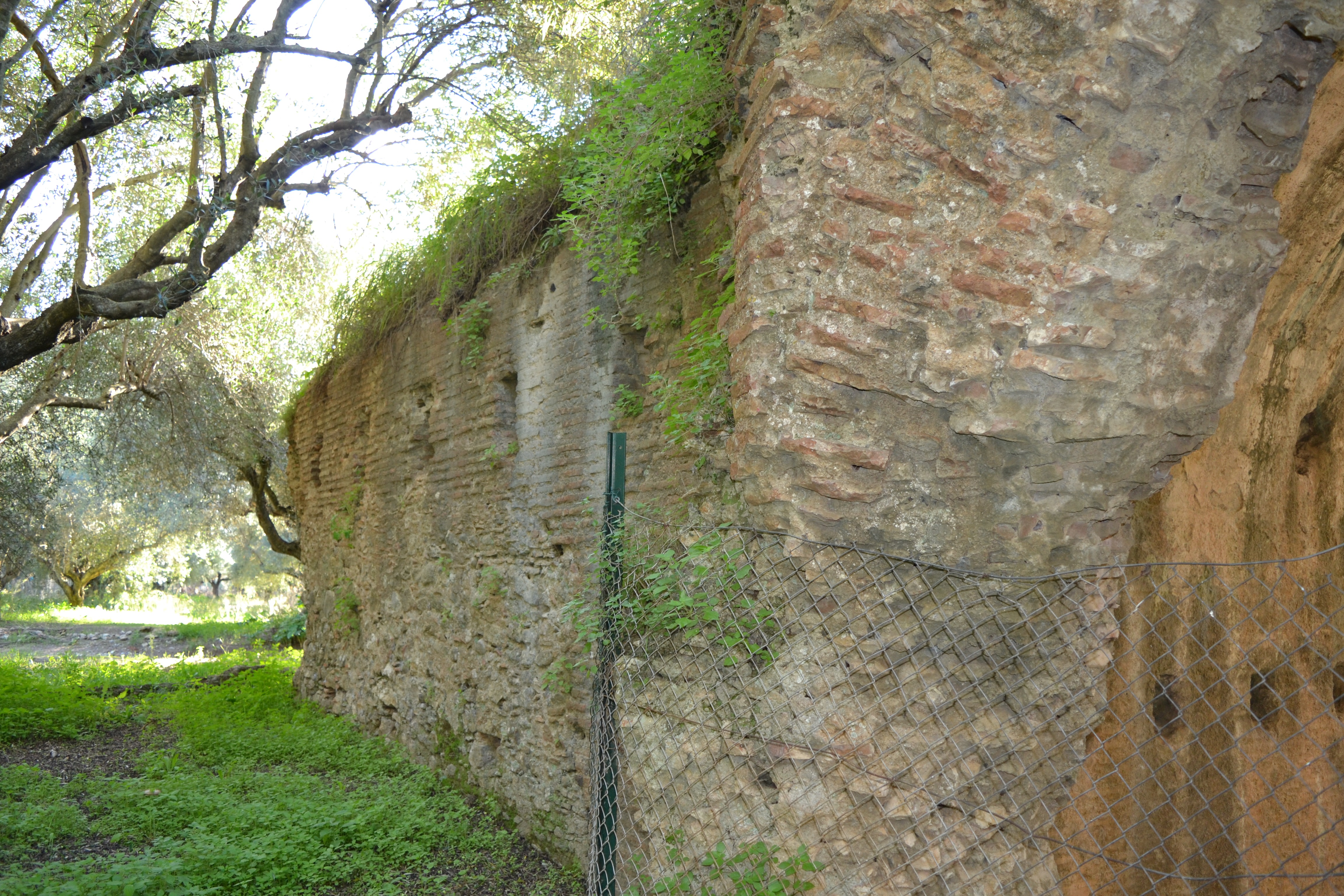
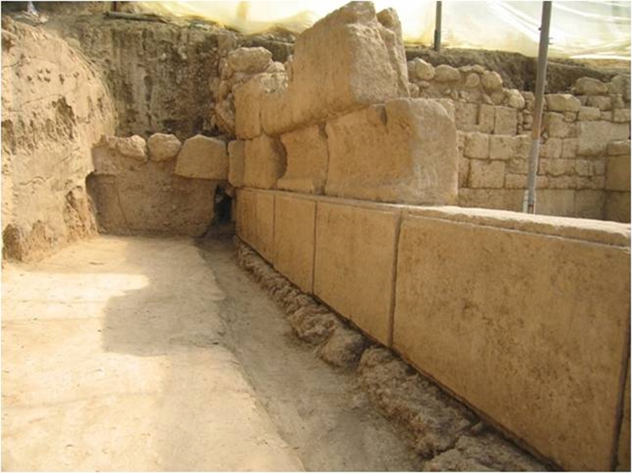
There among the dense bushes, the upper layers of an imposing polygonal wall were visible, apparently the remains of a retaining wall. The discovery of the massive retaining wall , which would certainly have held a large terrace, was the reason for beginning the excavation in the summer of the same year (2007), which continues to the present day.
At the northern end of the hill, where the ancient acropolis is located, there is visible a part of the ancient walls with rectangular fortification towers that are dated to the 4th century BC. Of particular interest are the tectonic signs that are clearly seen, inscribed on the surface of the blocks of the fortification walls.
The site was known as "Panagitsa" due to the little church located nearby which is built with a considerable amount of ancient architectural material, column drums, pieces of architraves, etc.
Ancient Thouria as a perioikos polis played a very important role in Messenia, as it was the most significant city of western Messenia and, after 369 B.C. when Messene was founded, the second most powerful city after Messene. For this reason, the sea area from the regions of Avia and Phares up to the Pamisos River was called the "Thouriates gulf". For this reason, the sea area from the regions of Avia and Phares up to the Pamisos River was called the "Thouriates gulf".
In 182 B.C. Thouria along with Pharai and Avia were detached from Messene and became members of the Achaean League as independent cities. After the historic naval battle of Actium in 31 B.C., Augustus gave Thouria again to the Spartans as a punishment because the Messenians had sided with his enemy, Antonius.

The ruins of the ancient city are located on an elongated ridge, in a north-south direction, located approximately 10km northwest of the city of Kalamata, on the right side of the Kalamata-Tripoli motorway, to the north (approximately 4km) from the modern town of Thouria.
The excavation of ancient Thouria at the site called "Panagitsa", approximately 10km north-west of Kalamata, started in 2007 under the then Director of the 38th Department of Prehistoric and Classical Antiquities of Messenia, Dr. Xeni Arapogianni and continues to the present day.
In 2009 the excavation became "systematic" under the auspices of the Archaeological Society at Athens under the same Director.

According to the archaeologists of the 26th Department of Byzantine Antiquities, the church of Panagitsa was built during the period of the Frankish occupation (13th century). Later, it underwent additions and renovations until the post-byzantine period (16th-17th centuries). To the modern period belongs the addition that took place in the western part of the half-collapsed church.
Between two retaining walls the remains of a construction with steps was uncovered, which obviously constitutes part of the superstructure of the retaining wall 2.
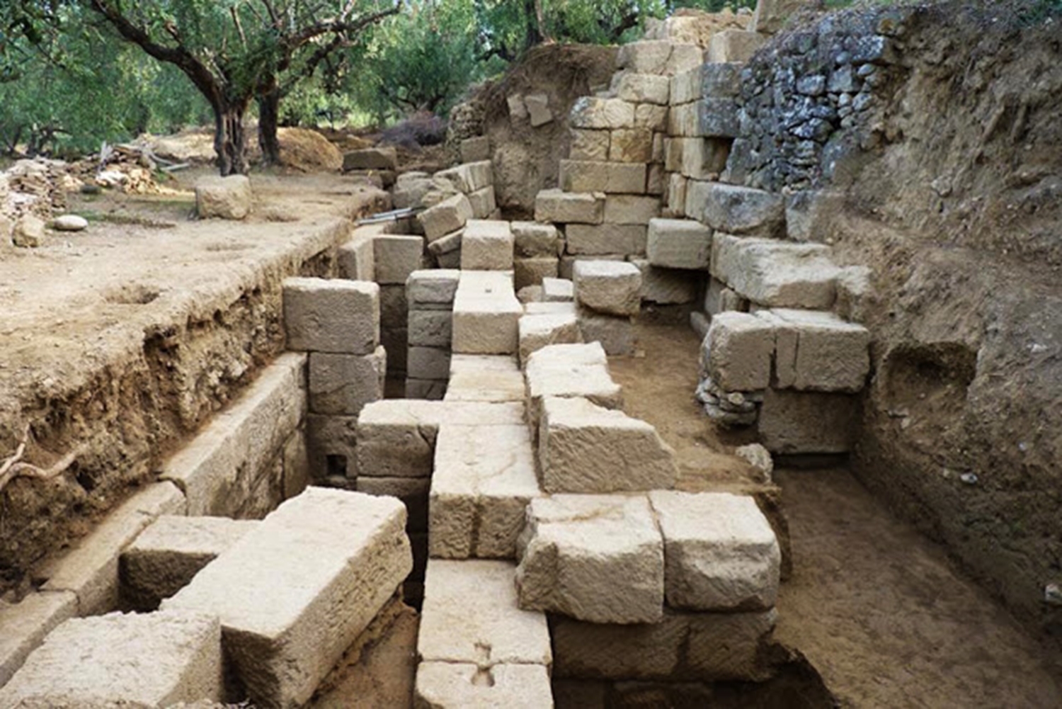
On the upper wide terrace that occupies an area of about 600 square meters the excavation brought to light three buildings (Building A, Building B and Building C) on the axis North-South.

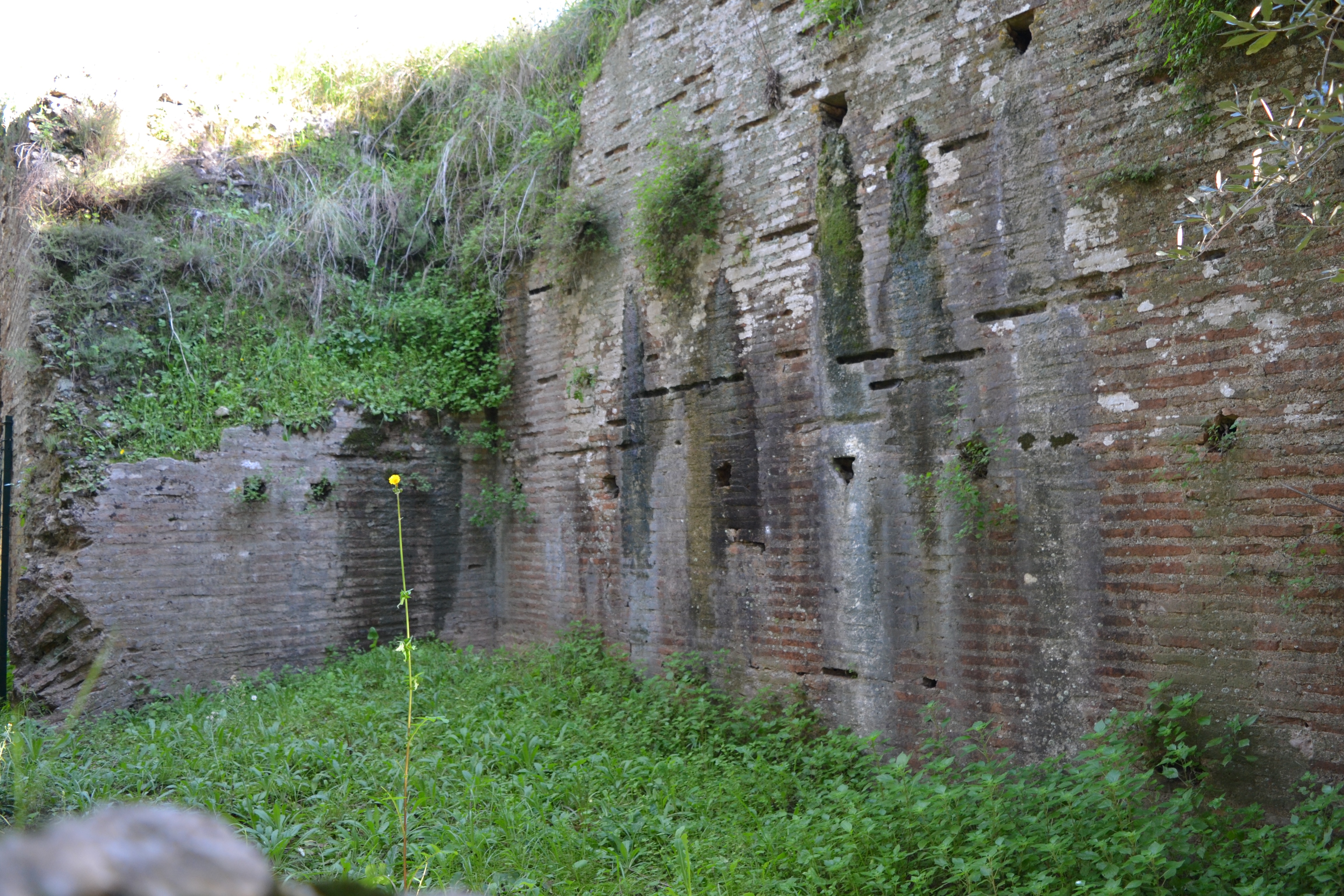
Building A' with direction E-W is constructed with large rectangular porous-blocks built according to the isodomic system. Three sides have been uncovered; the narrow western side, which was probably destroyed, has not been uncovered yet. The entrance is towards the centre of its southern side, where the traces of a threshold can be seen.
The stereobate of building A consists of one line of irregular conglomerate medium size stones on top of which the first line of blocks is placed. The foundation layer was undisturbed and consisted of ceramic tiles of Laconian type. Some of them have preserved on almost the whole surface the initials LA (i.e. Lacedaemonians) painted in deep red color.
The dimensions of Building A are: 7.15m length, 5m width, and the maximum height that is preserved in the eastern narrow side is 2.40m. The building has gone under renovations, while in the latest constructional phase fluted drums of ionic columns were used for its construction.
This part of Building A bears periteneia (a type of carved decoration on the exterior side of the stone), while of great interest is the upper wall construction of the northern long side of the building, where in the second line carved blocks shaped in secondary use - which possibly belonged to a stone drainage system - are visible.
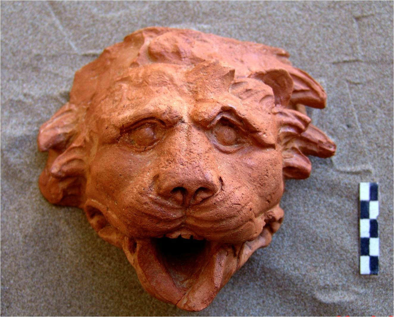
The building must have been destroyed by fire, as under the top layer there was a thick layer of ash. There were fewintact findings from the excavation of building A and apart from the fragmentary ceramics that are dated to the late Classical- early Hellenistic period only one burnt part of a relief plaque with the figure of Athena with helmet and shield in the left hand was found.
This single find, however, does not constitute sufficient evidence to suggest that the use of the building should be attributed to the cult of this goddess.
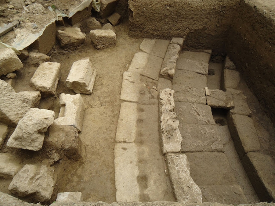
At a distance of 4.20m south of Building A, and with direction parallel to it, the stylobate of an ionic colonnade with the bases of four columns was uncovered in situ. The stylobate is built of one line of large rectangular blocks. Its uncovered length is 11m and its width is 0.60m. Its eastern edge has not been uncovered yet, while its western edge is destroyed. Along its interior side a slot for a floor slab is distinguished.
The excavation of Building B part was particularly hard because the eastern part was located under compact masses of rocks, which had fallen from the overlying slope that rises above the terrace to the east. The eastern part B was uncovered under almost 2m of soil.
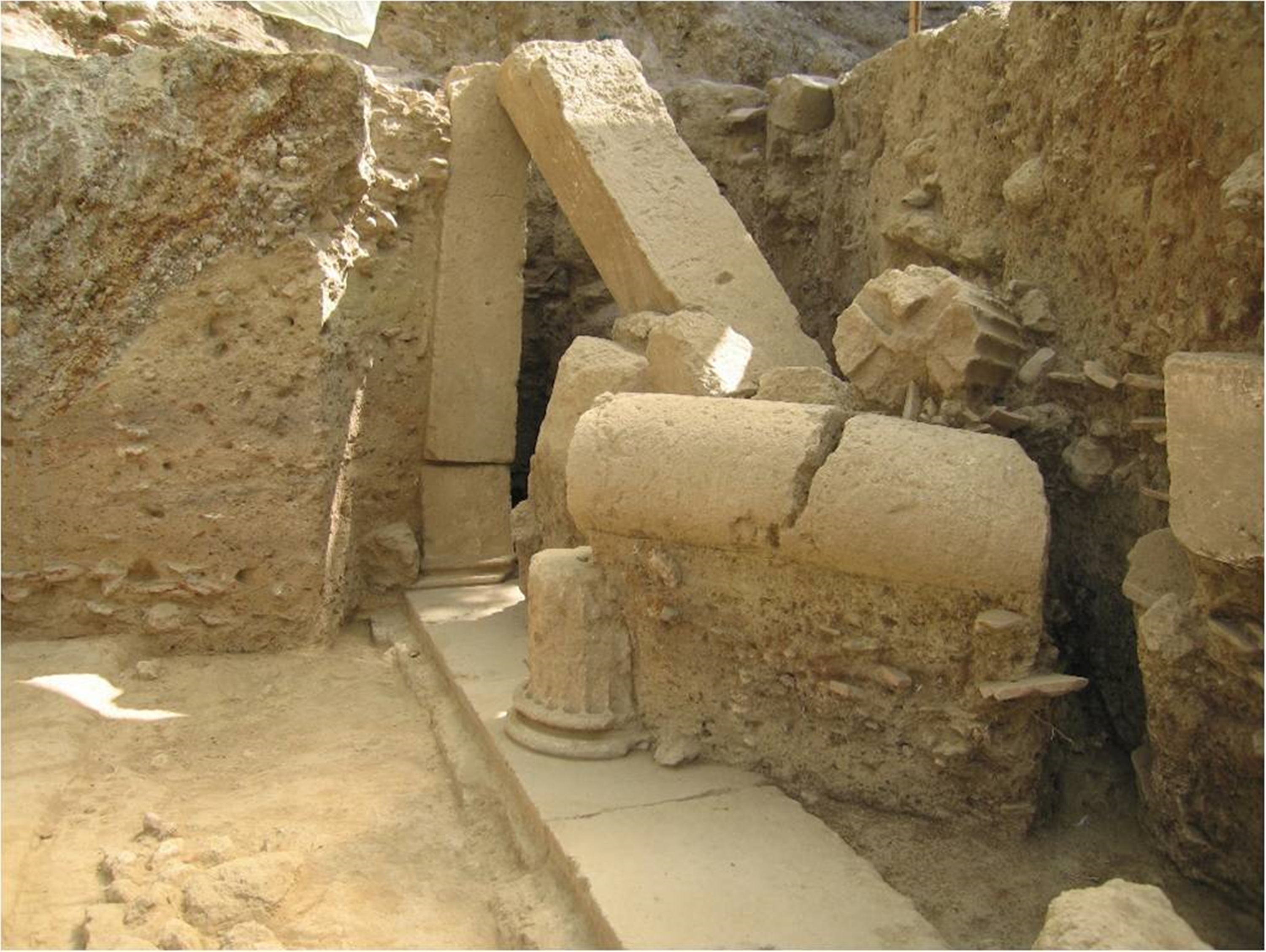
In the western side of the pilaster, part of an architrave was found fallen sideways along with a number of other architectural members in a large mass, which included part of a well preserved cornice with jagged projections, the drum of a fluted column, two parts of unfluted columns and two parts of an architrave.
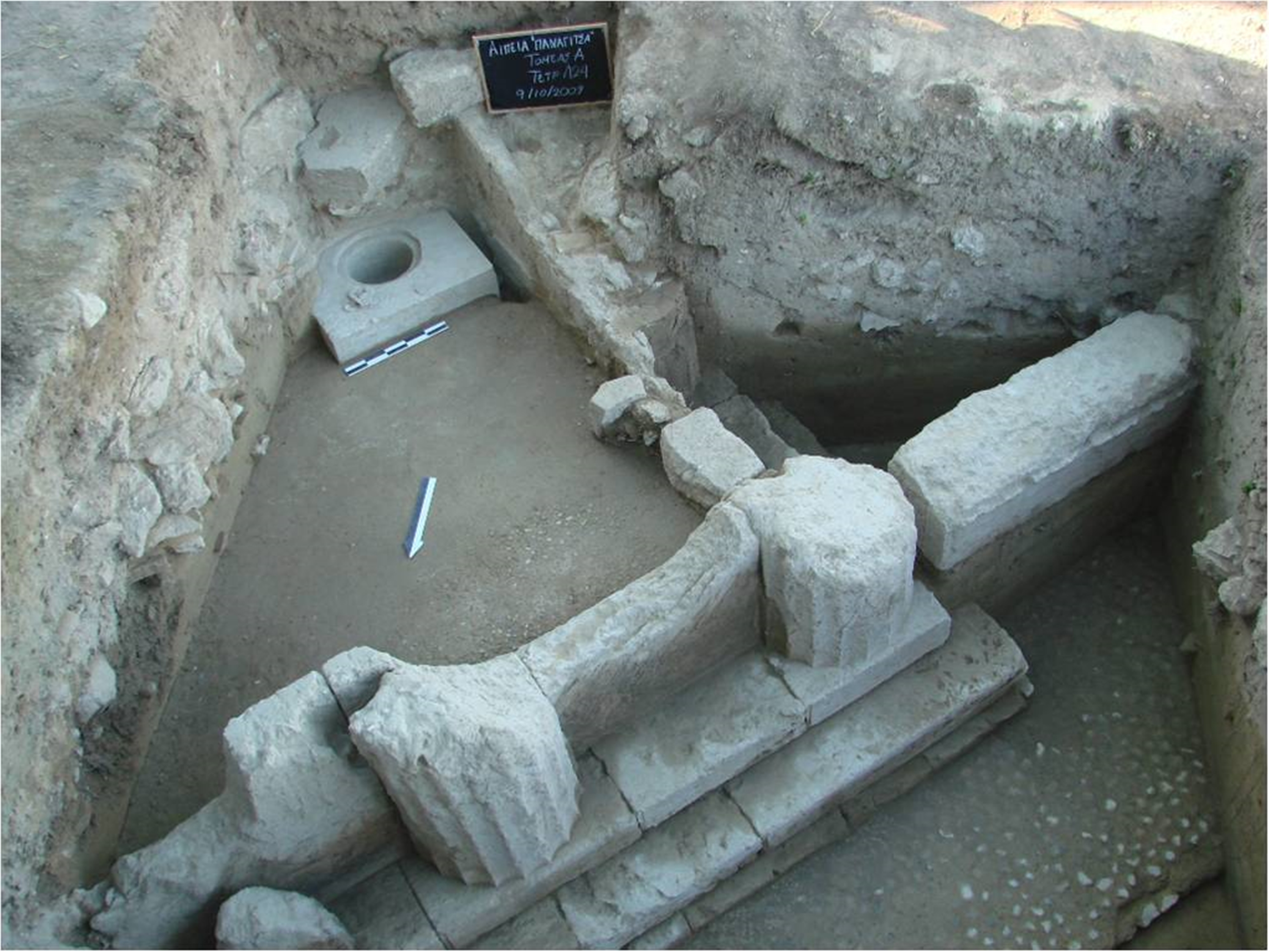
The continuation of the excavation uncovered almost the whole Building C. This is obviously a temple with four columns at the narrow sides and six columns on the long sides. The northern narrow side of the monument that has been totally uncovered is 5.45m long.
Almost in contact with the western wall of the cella, a "treasury" was found in situ, cubic in shape and built into the pebble floor. "Treasuries" were usually placed inside the temples and constituted their formal safes.
The upper part the "treasury" would have a lid with an opening for throwing coins inside. The lid would be of metal and would securely locked with double lock, they keys of which would be kept by trustworthy magistrates, usually the priests of the temple.
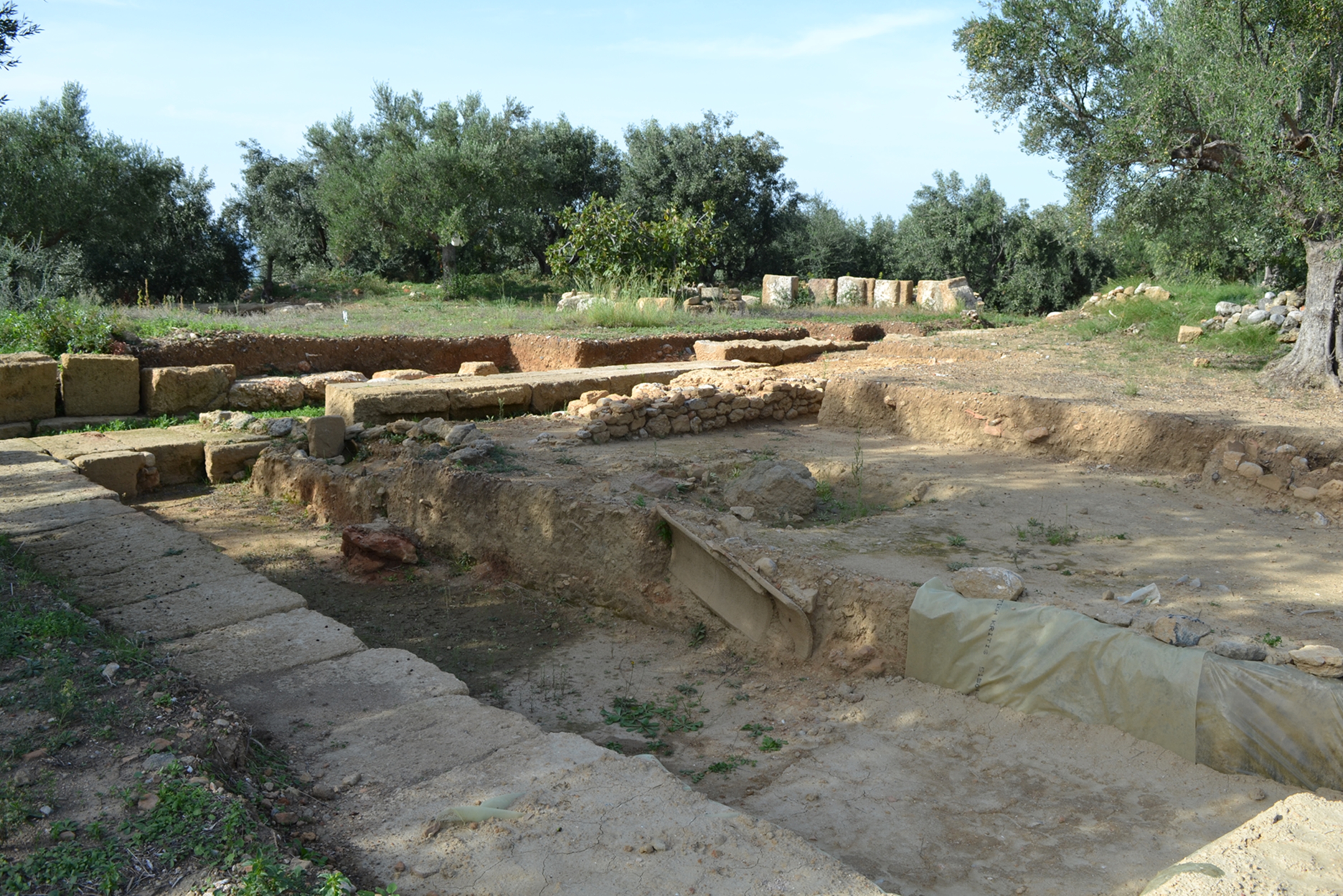
One of several test trenches excavated in 2016, revealing the existence of many more large buildings.
The extremely impressive large number of scattered ceramics in a large extending area, as well as of the stone architectural material indicate the size of the ancient city that has suffered great destruction, at least during the last 100 years due to intensive cultivation of the rich soil, a fact that had as a result the altering of the morphology of the area.
On the southern side of the ridge, there are parts of walls or individual blocks in secondary use and built into the modern supporting walls for agriculture, as well as scattered parts of fluted columns.
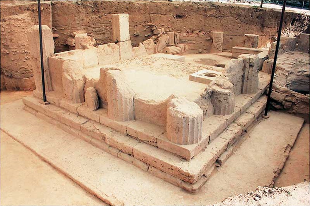
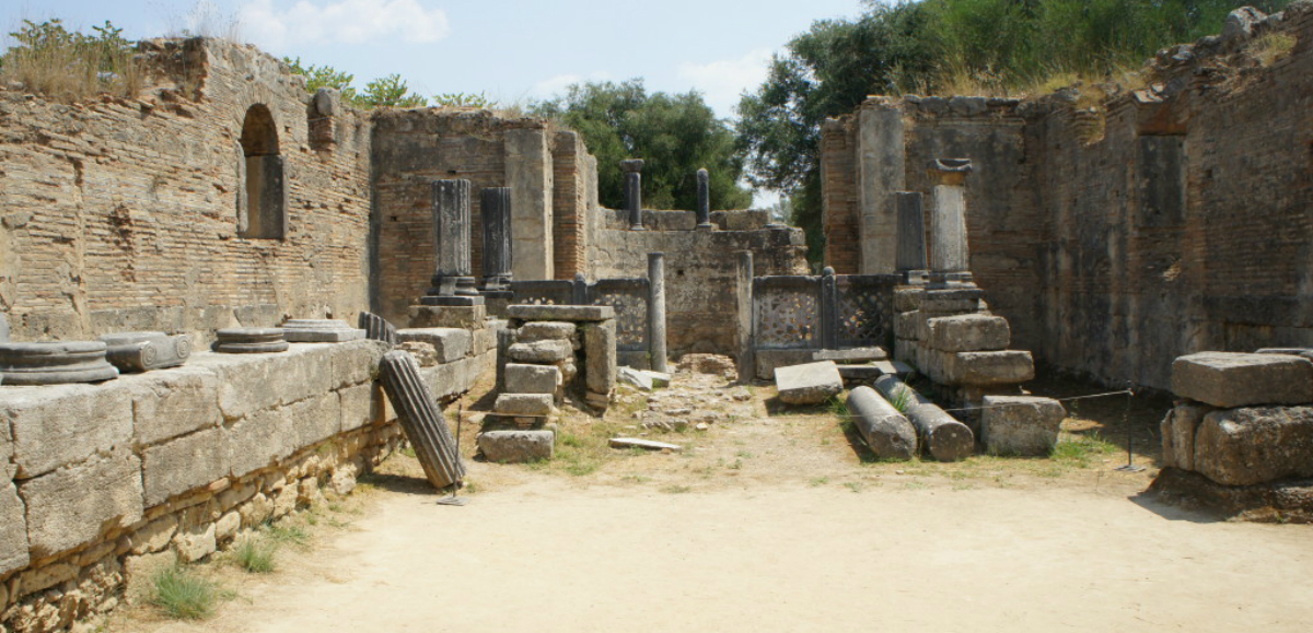
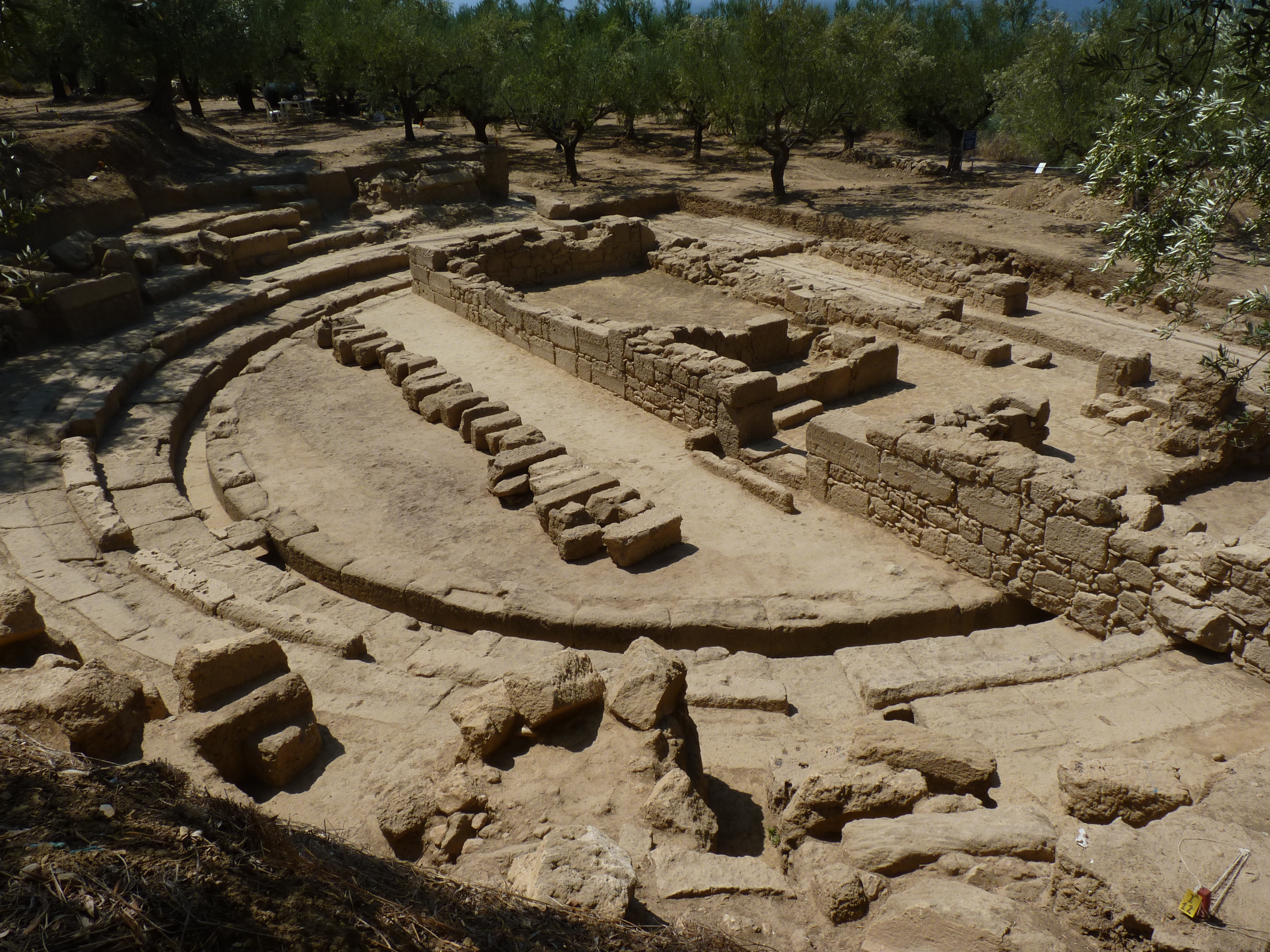
In the 2012 excavation season, the Doric temple dedicated to Asclepius and Hygeia was fully uncovered so that the whole monument has now come to light. During the partial removal of the wine press, a large number of architectural members were found, which come from the ancient buildings of the sanctuary and had been secondarily used as building material.
The facade of the temple, which was uncovered after the removal of the earth filling that covered the area in front of the monument, is also preserved in excellent state
The ramp (3.03m long and 1.34m wide) of the entrance to the temple is of extremely careful construction; it is preserved intact and is flanked on each side by impressive statue bases preserved in situ.

The top flat surface of the crowning of both pedestals preserve traces of footprints that belong to bronze statues representing small children, now unfortunately lost.
The dedication inscription that is written on the facade of one of the pedestals states that two parents named Damofantos and Nikandria dedicated to Asclepius and Hygeia the statues of their two sons, Damothales and Eythymos.
Two smaller almost cubic limestone bases are placed in front of the two pedestals. The first, supports a rectangular pillar, with a dedicatory inscription to Hermes on the facade.
Almost in contact with the western wall of the cella, a "treasury" was found in situ, cubic in shape and built into the pebble floor. "Treasuries" were usually placed inside the temples and constituted their formal safes.
The upper part the "treasury" would have a lid with an opening for throwing coins inside. The lid would be of metal and would securely locked with double lock, they keys of which would be kept by trustworthy magistrates, usually the priests of the temple.
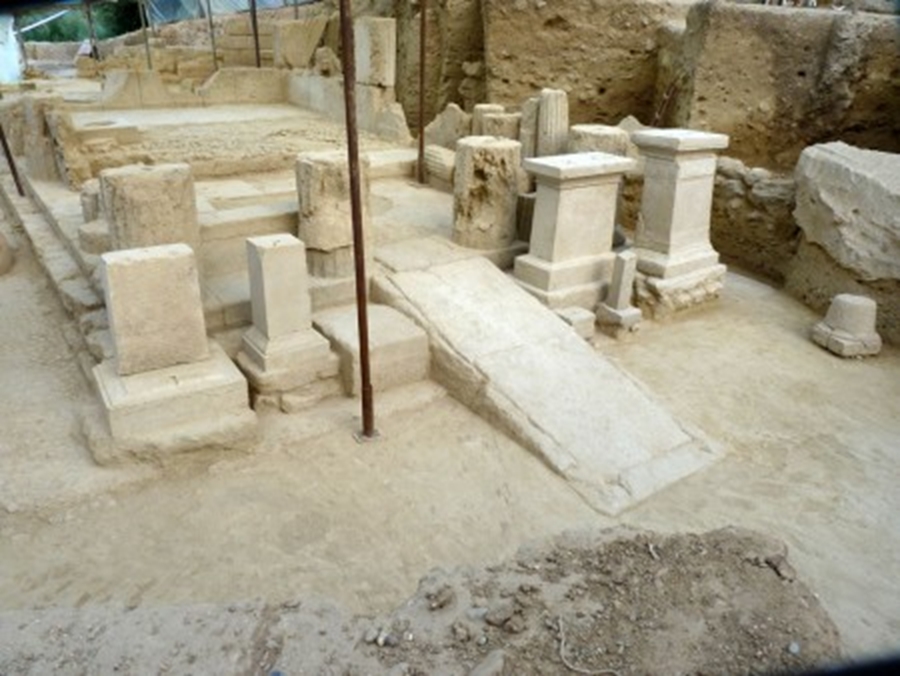
The facade of the temple was uncovered along with its three altars, while at the same time part of the foundations of the ionic stoa was uncovered, which seems to continue towards the east defining thus the area of the sanctuary from the north
The finds in the area of the stoa were very wealthy: large number of clay figurines, relief plaquettes, and feminine masks, inscriptions, coins and bronze medical tools.
Parts of stamped ceramic tiles were also found with inscriptions that confirm the public character of the buildings.
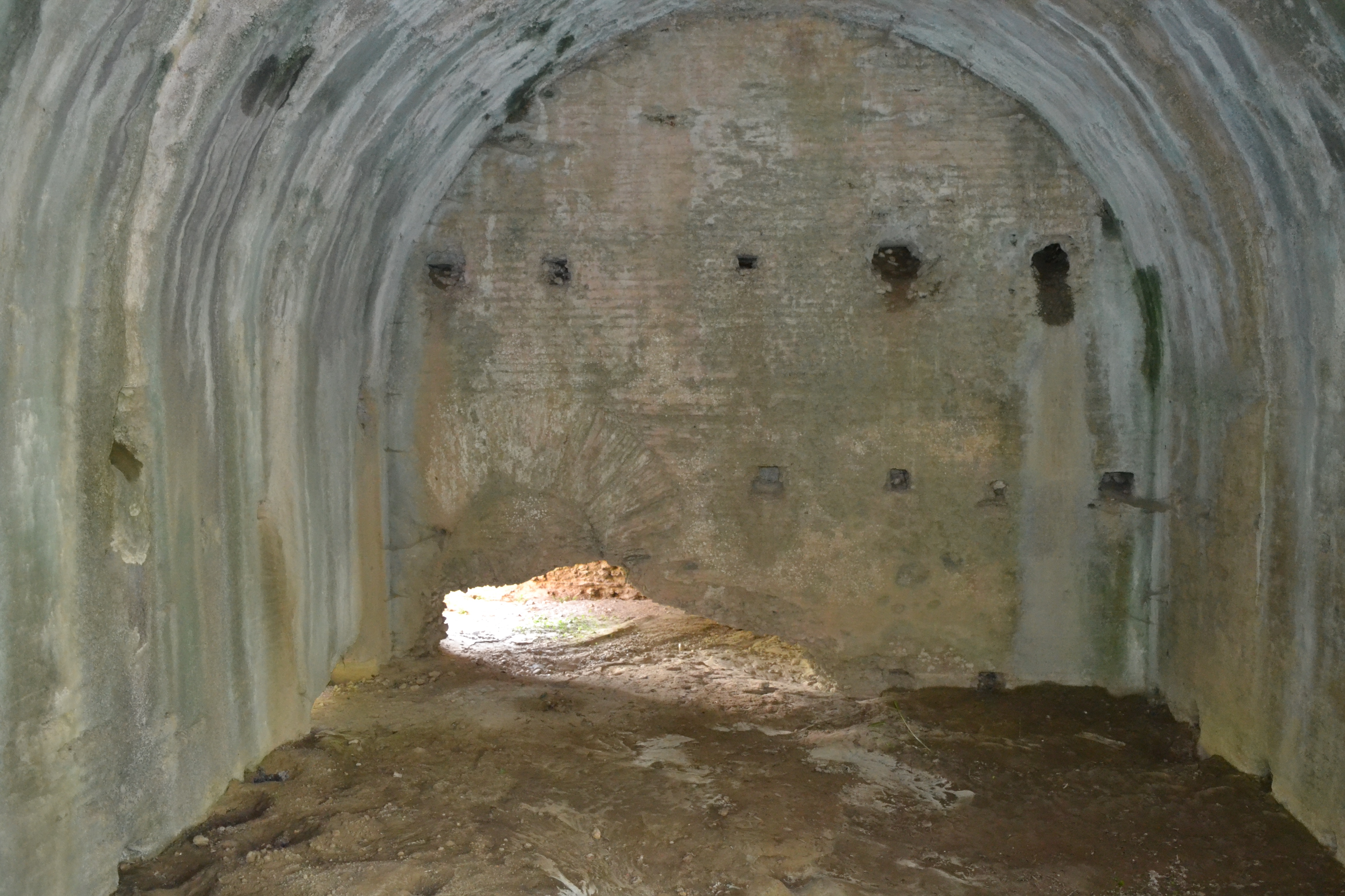
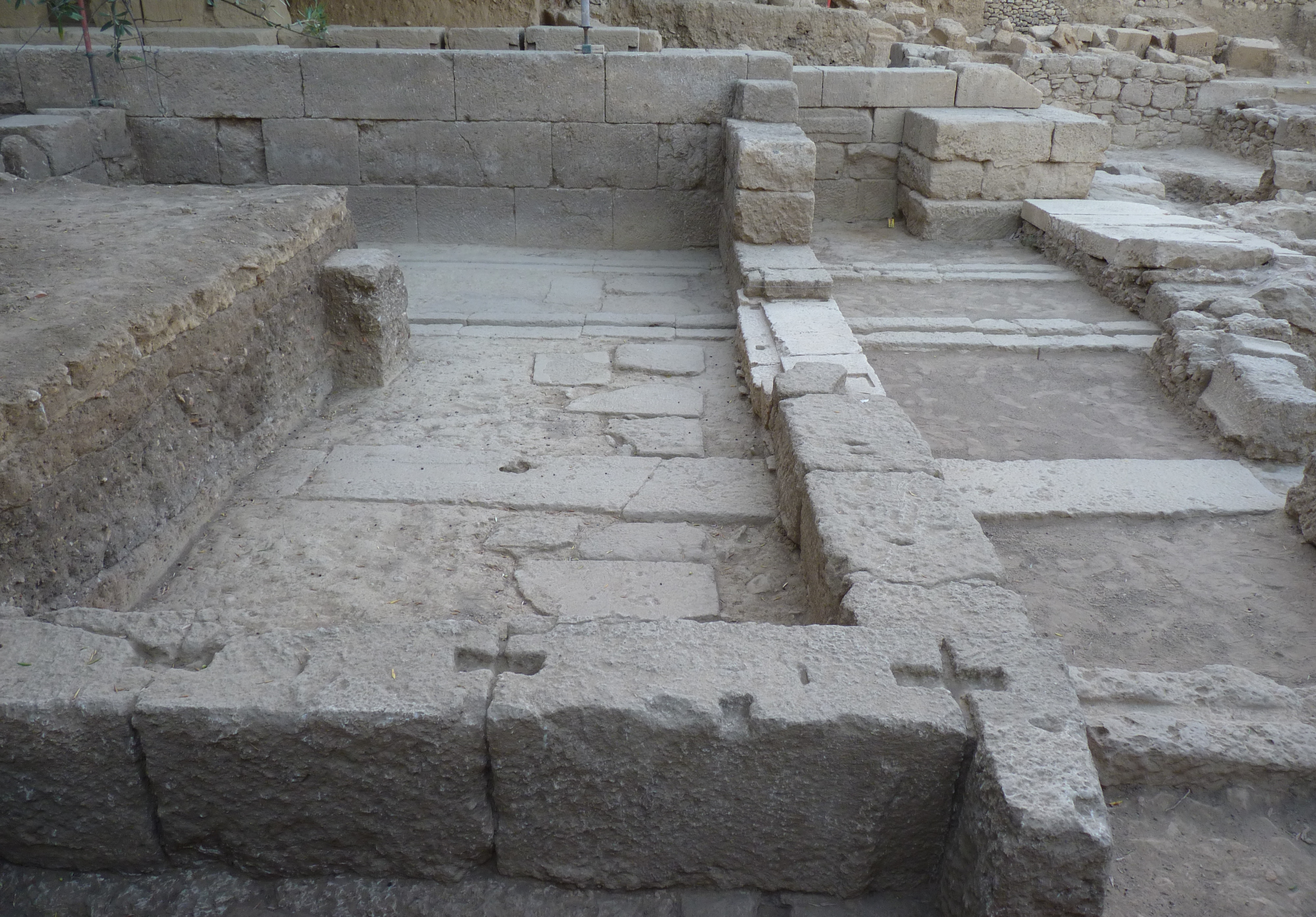
During the 2016 excavation clear remains of the ancient theater were discovered, in the site called "Hellenica". The site is located at the highest point of the western side of the hill, where the ancient city of Thouria spreads.
The excavation brought to light the strong retaining wall of the theatre's auditorium (cavea), which was revealed as 12.3m in length and 4m in height. The wall has a N-S orientation and was carefully built with rectangular stone bricks in pseudo-ashlar style strengthened by buttresses.
Apart from the retaining wall, a perfectly preserved double isodomic wall was revealed at the left parodos (length: 18.35m, width: 1.25m, max. preserved height: 3m). Vertical buttresses built inside and outside this wall ensured its stability.
A big part of the circular orchestra of the theatre was also revealed (5.45m in length and 3.14m in width). In front of the seats there is a very well preserved aisle around the orchestra, for the spectators to go through. The aisle is built with big rectangular stone blocks. The first row of the stone seats were found in situ, as well as one step of the staircase leading to the theatre's kerkides. Also, an open rectangular stone rainwater drainage pipe, in a perfect state of preservation, runs around the orchestra.
In the cavity behind the in situ preserved seats, a big number of fallen stone architectural members and seat fragments came to light. These belonged to the destroyed kerkides at this part of the theatre. The theatre is built with yellowish white sandy limestone (porous stone) and according to a preliminary analysis it dates back to the Early Hellenistic period.
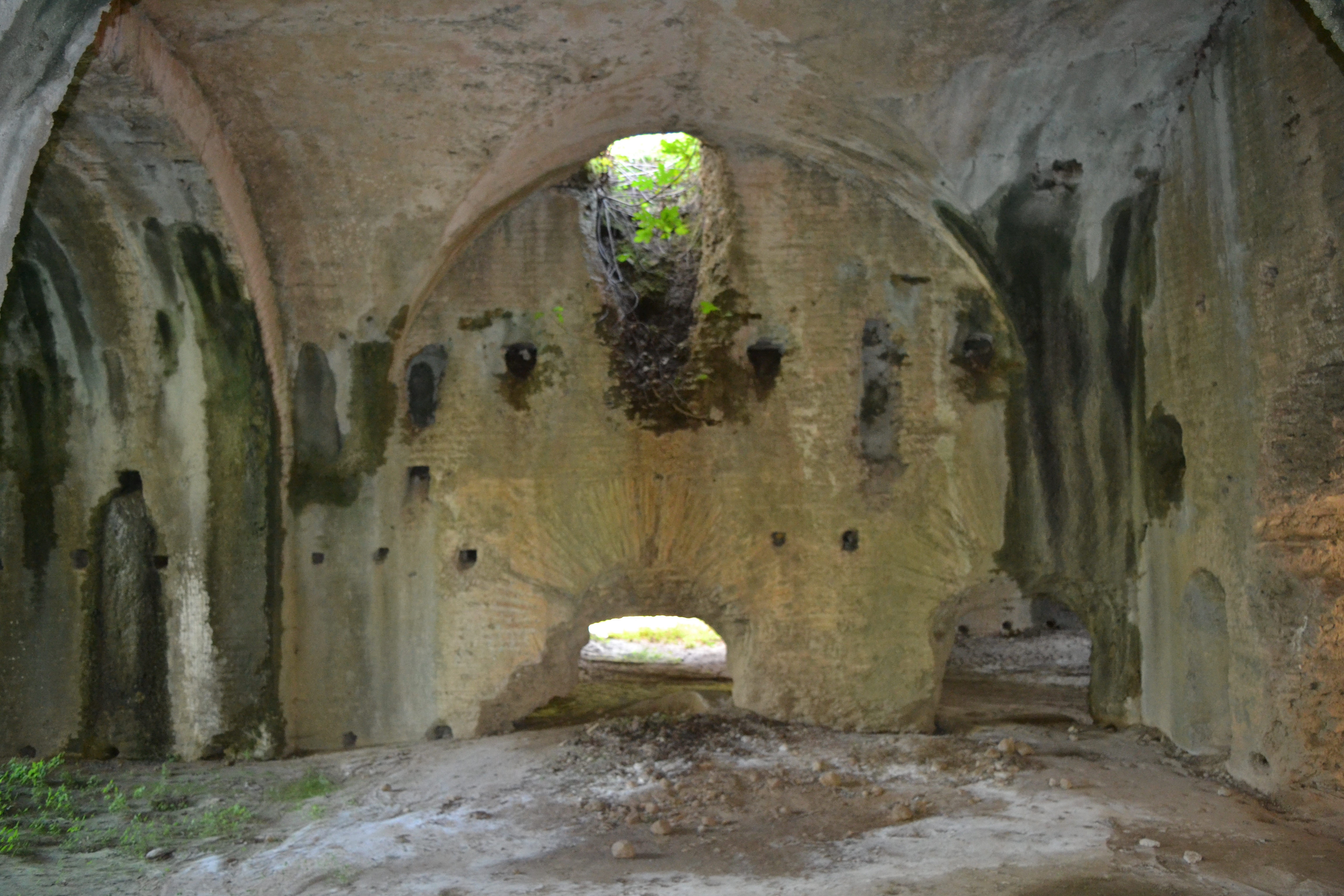
The systematic excavation at the theater of ancient Thouria that began in 2016, continued in 2018 for the third consecutive year.
The whole area of the orchestra was revealed, large part of which is occupied by an elongated building of later years, apparently of rural use. The building is entirely constructed of ancient building material coming from the theatre, mainly of stone blocks of the seats, in second use.
The excavation of the retaining wall of the Southern parodos (side entrance) was completed , while large part of the area of skenotheke came to light that occupies the northern side of the theatre. Impressive is the excavated section of the skene that is crossed N-S by three stone grooves (of 30m uncovered length) on which the wooden movable skene would slide.
The first row of the stone seats of the koilon was found in place (average dimensions of each of the seats: length: 1.54m, width: 0.35m, height: 0.,40m) as well as one of the steps of the staircase that leads to the tiers of the theatre.
In front of the seats and very well preserved exists the corridor for the movement of the spectators around the orchestra. The corridor is constructed of large rectangular stone slabs perfectly assembled together.
In the cavity behind the preserved in situ seats, a large number of fallen stone architectural members and parts of seats came to light that come from the damaged tiers of the theater at this part.
A large rectangular drainage duct for the rainwater runs around the orchestra. The duct is of stone, open, preserved in perfect condition, while in place was also found a covering slab, which was designed to facilitate the movement of the spectators over it.
The extremely impressive large number of scattered ceramics in a large extending area, as well as of the stone architectural material indicate the size of the ancient city that has suffered great destruction, at least during the last 100 years due to intensive cultivation of the rich soil, a fact that had as a result the altering of the morphology of the area.
The portable finds comprised mainly Hellenistic ceramics (fourth- to second-centuries BC), prominent among them being many moulded bowls of excellent quality, fragments of antefix, two bronze coins (one Messinean of the 3rd century BC), a few bone astragaloi and one in glass and a black-glaze shard.
The acropolis of the classical period was never fully abandoned but continued to be inhabited in the Roman times, in the medieval period and during the Ottoman occupation.
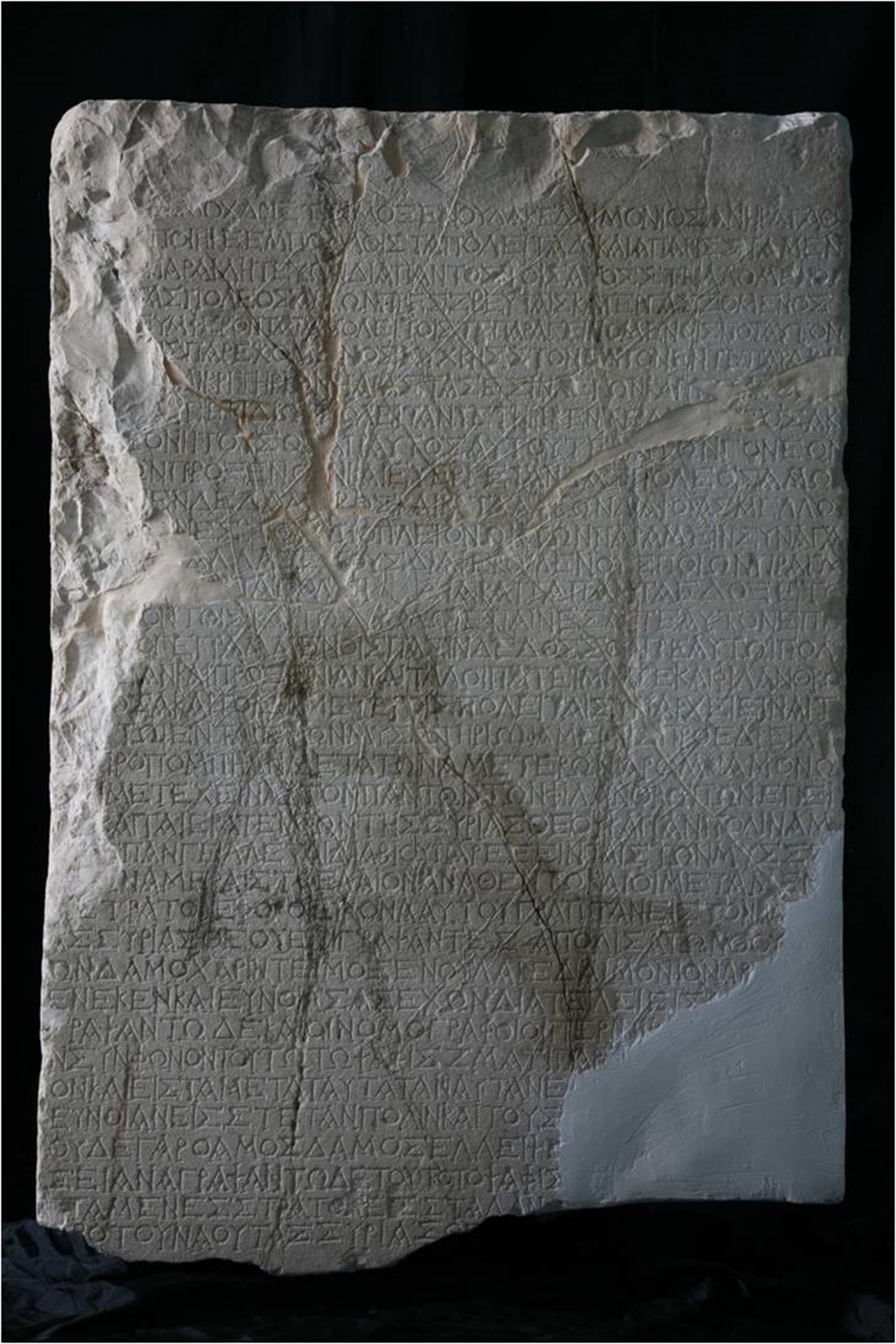
After the founding of Messene in 369 BC., Thouria became a member of the free Messenian state. In a very important decree, inscribed on a stele (stone slab) which has inscriptions on both sides and which was found in Thouria, the borders of the territory of Thouria with those of Megalopolis were determined under the arbitration of the city of Patras.
The stele is dated to the 2nd century BC and is exhibited at the Archaeological Museum of Messenia, in Kalamata.
On the back of the stele a decree was inscribed in the time of Augustus in honor of the Lacedaemonian Damocharis. The text of the decree supplies evidence on the ritual of the Syrian Goddess, during which initiation rites were taking place by means of a mystic ceremony for the Syrian goddess, in a special area, called "oikos" and there was also a procession for the mysteries.
In 182 B.C. Thouria along with Pharai and Avia were detached from Messene and became members of the Achaean League as independent cities. After the historic naval battle of Actium in 31 B.C., Augustus gave Thouria again to the Spartans as a punishment because the Messenians had sided with his enemy, Antonius.
There were many temples in Ancient Thouria, but it seems that goddess Athena was a particularly honoured deity, as her priest was the eponymous magistrate of the city (i.e. the magistrate who gave his name to the year). It is characteristic that on Roman coins Athena is represented with helmet and spear in her left hand and a phiale (open vessel) in the right hand.
It is very likely that this type corresponds to the cult statue of the goddess that once existed in Thouria.
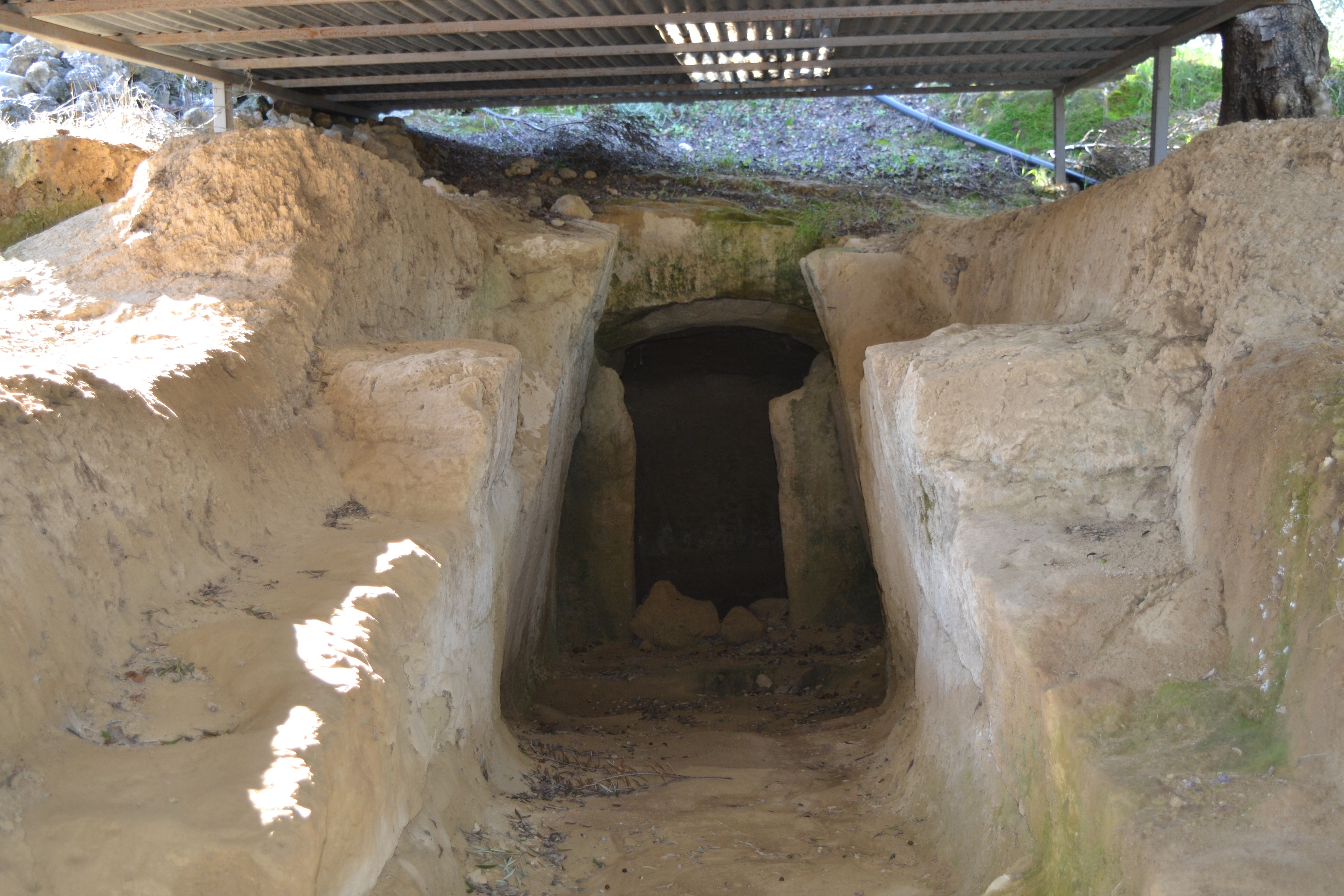
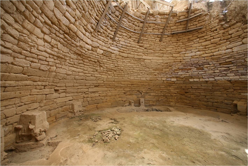
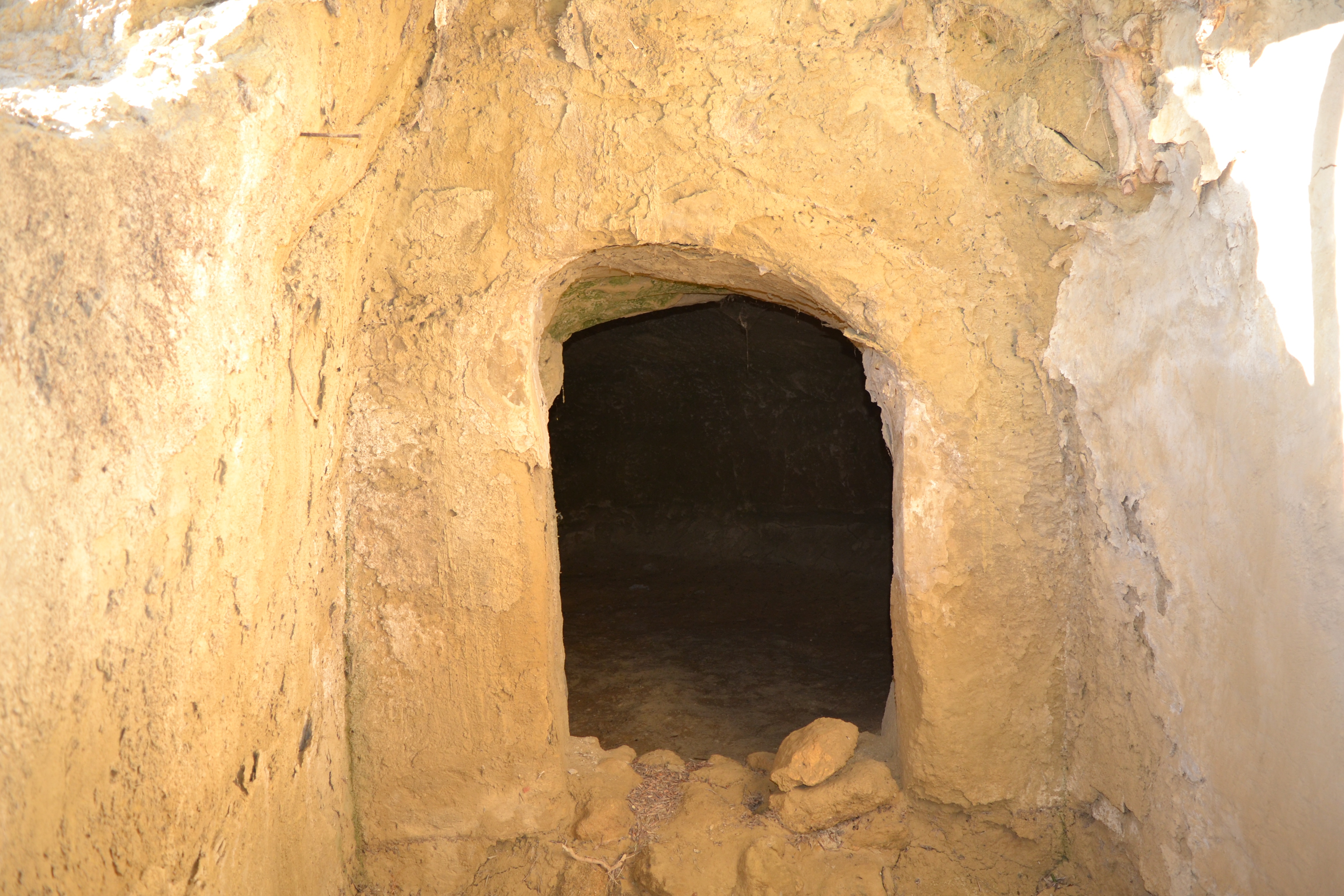
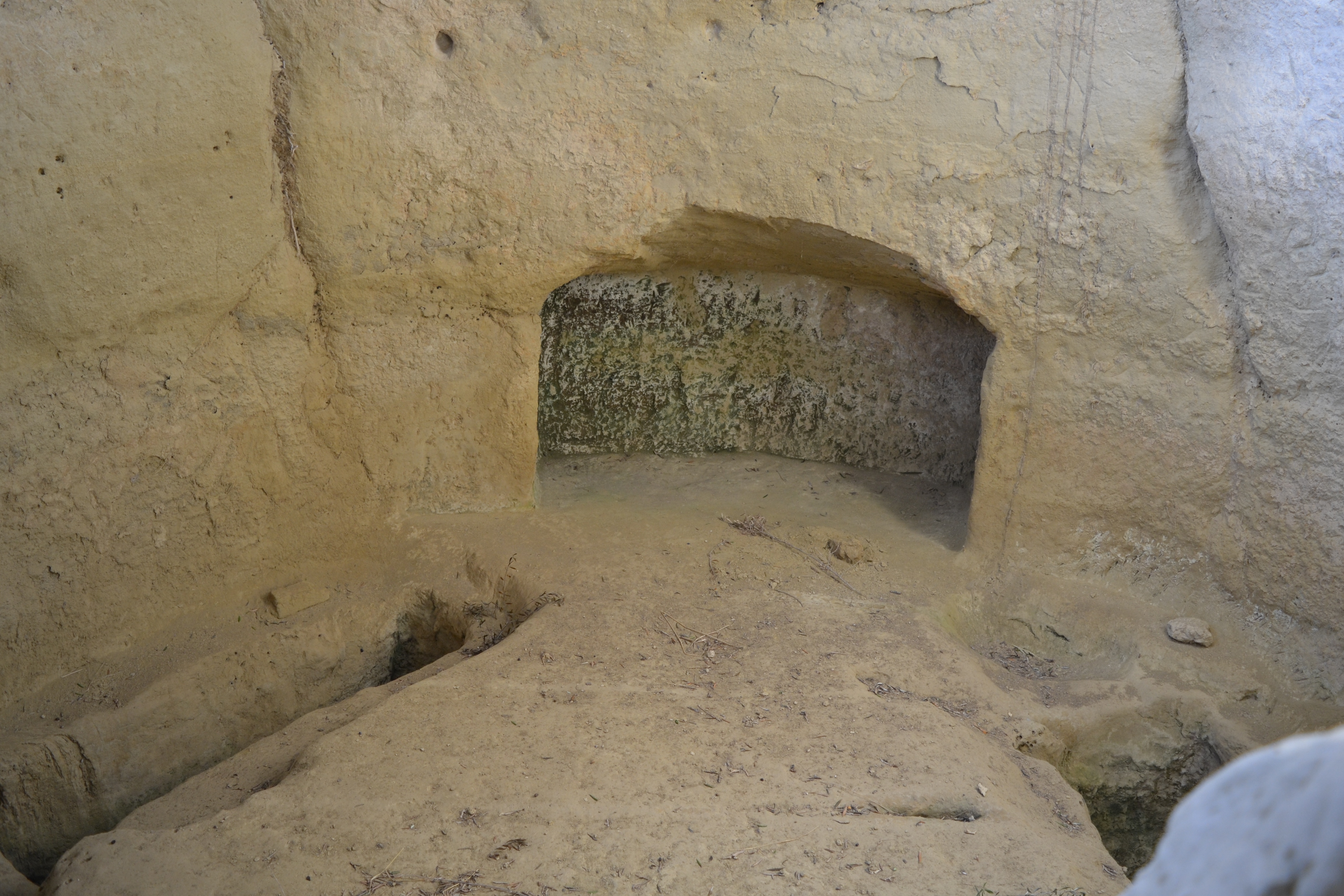
Clear remains of habitation of the early Helladic and late Helladic periods have been identified on the three low tops that are formed on the southern end of the ridge, at the site called "Hellenica", where part of a large Mycenaean necropolis has been excavated consisting of 16 chamber tombs.
To the north, near the village of modern Antheia, a large tholos royal tomb with rich offerings has come to light. (See below)
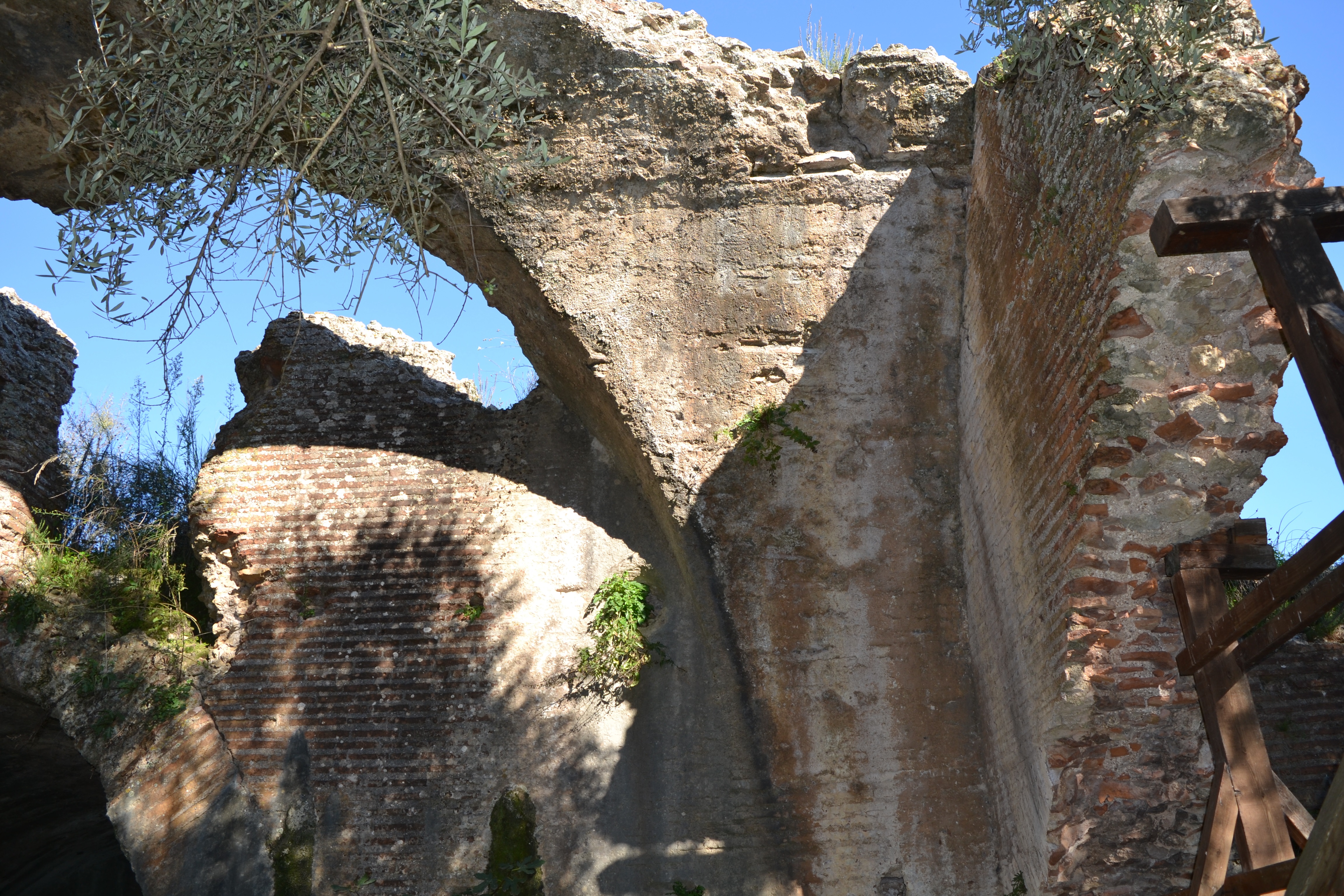
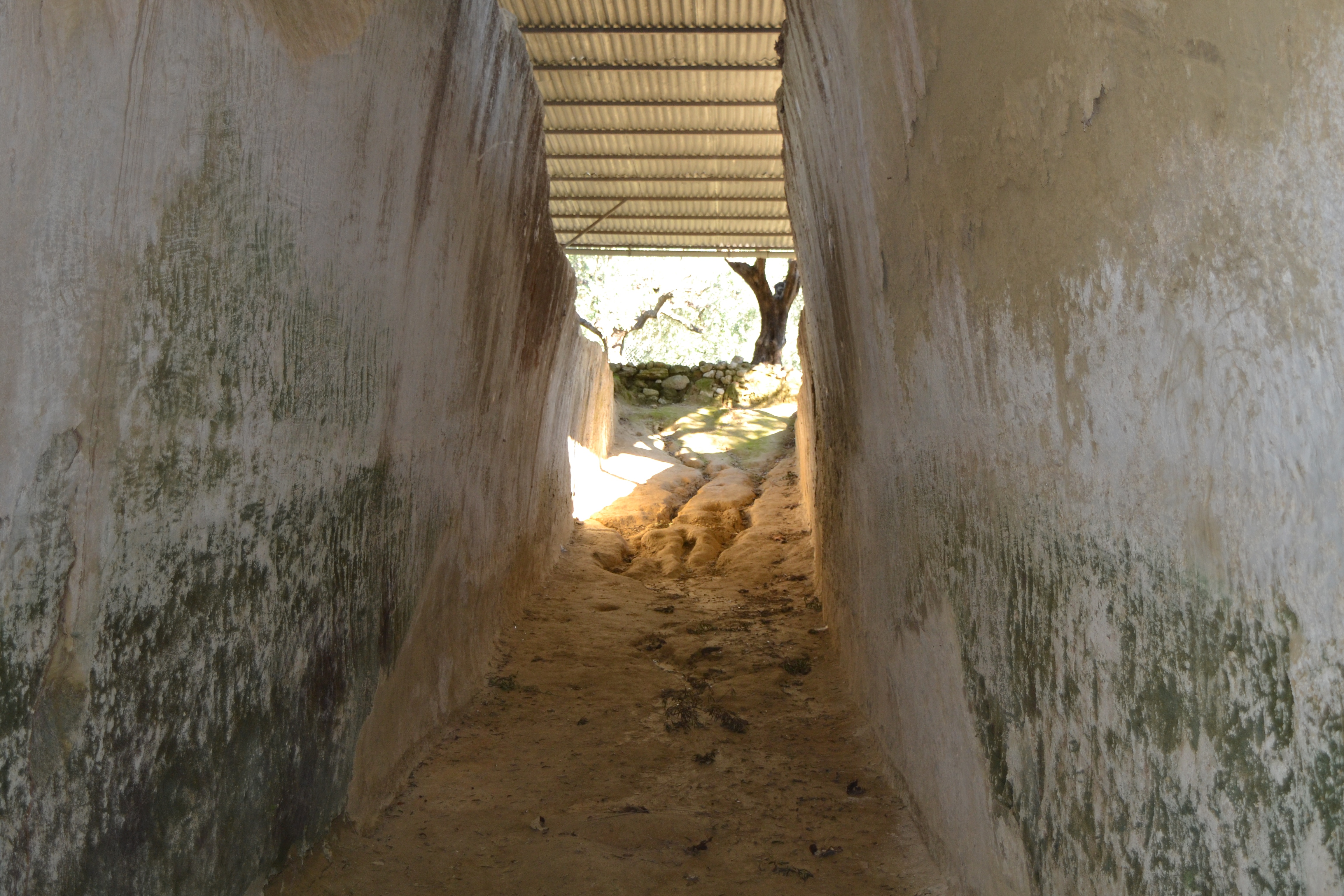
A large rectangular water cistern on the west side of the site, below the citadel. (See below)
When the traveler Pausanias visited the area (2nd century A.D.) he noted that the city had moved from the highlands and extended to the west, on the foot of the hill.
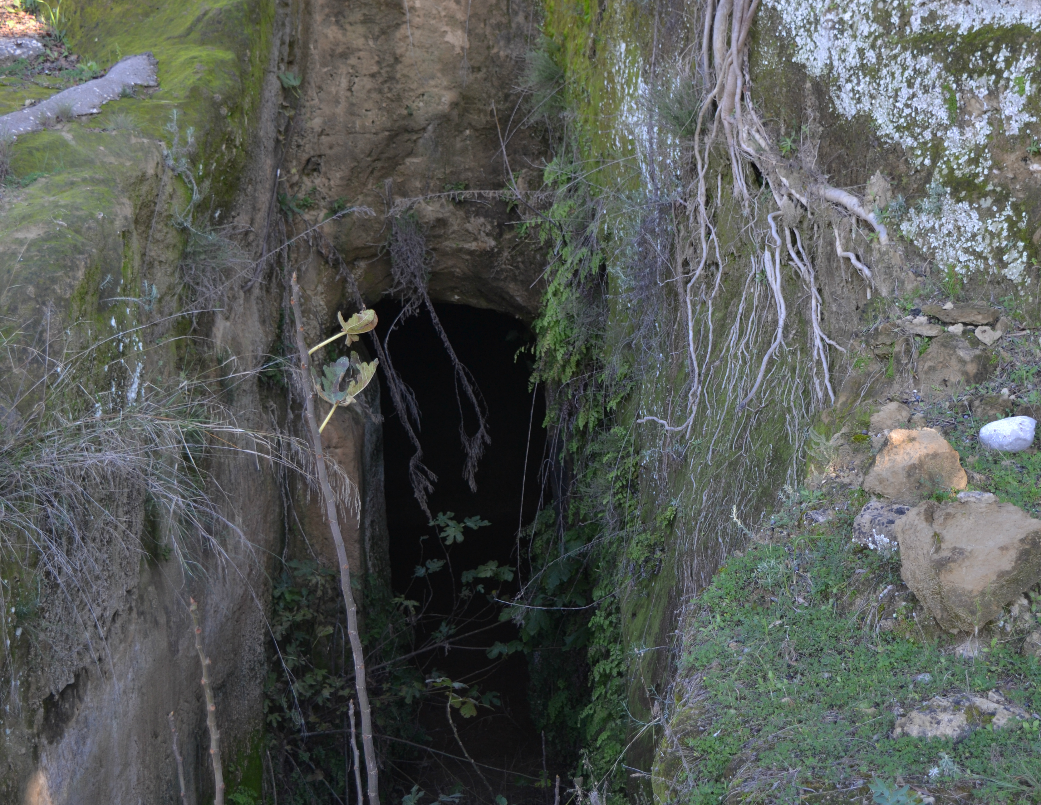
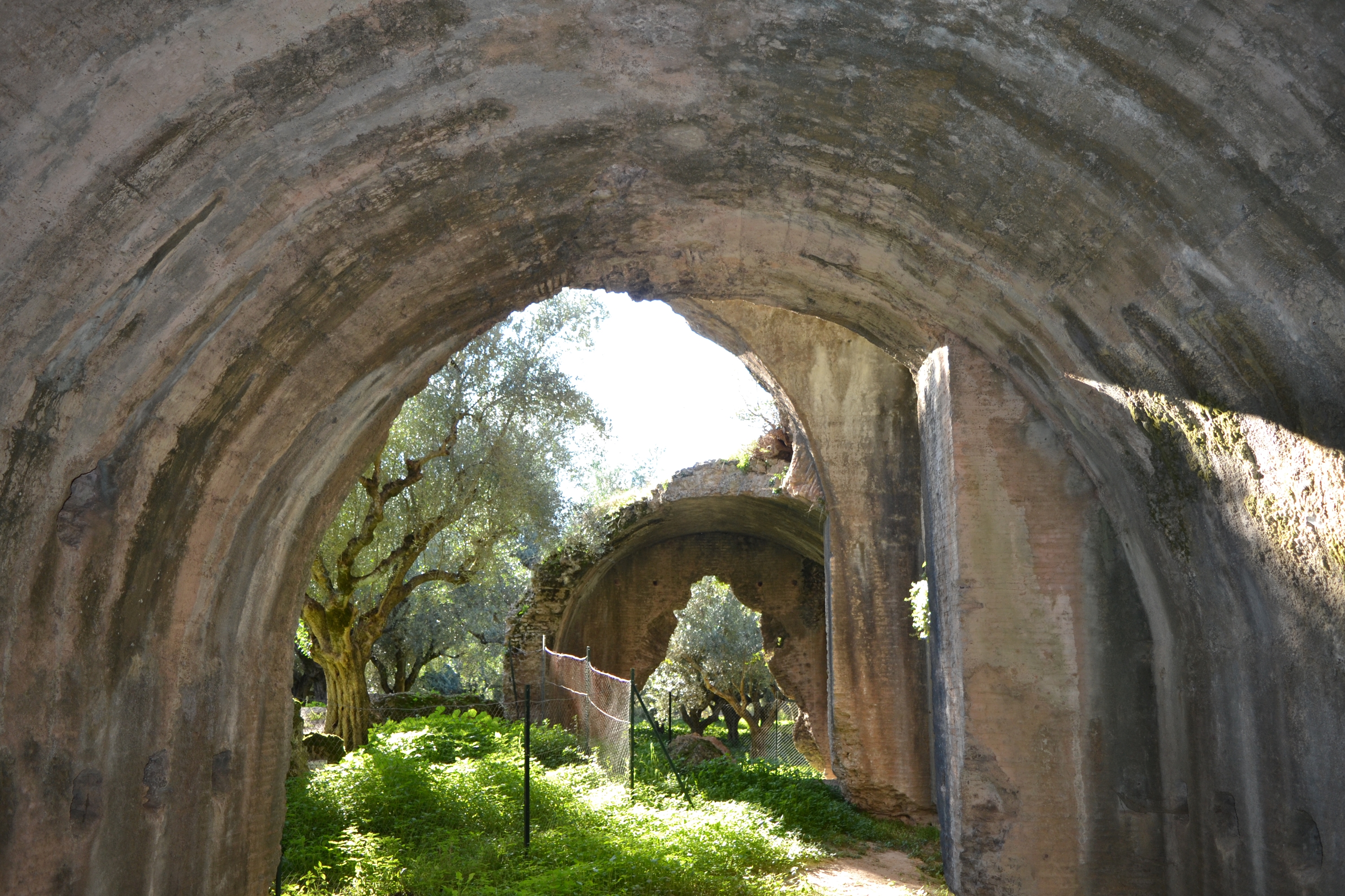
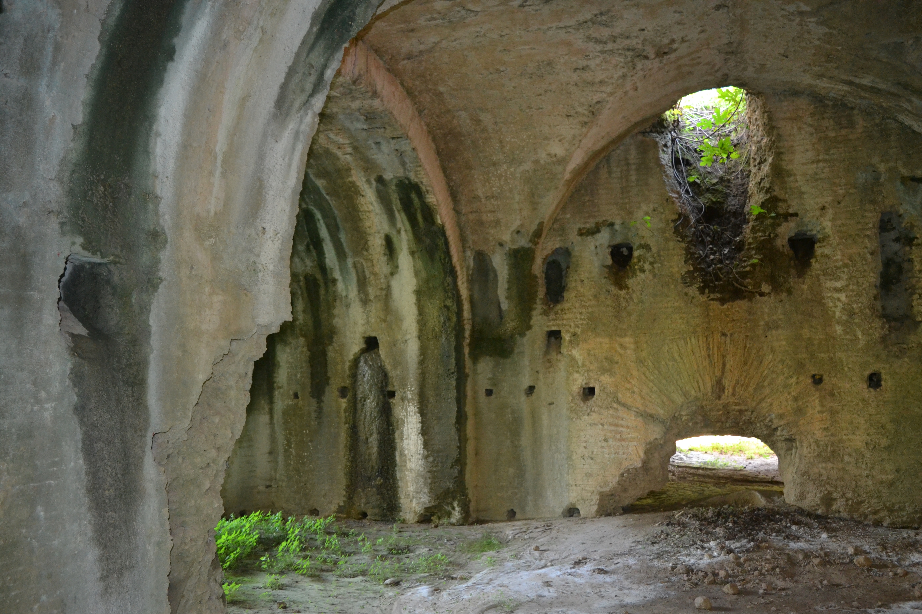
The impressive ruins of the roman baths at the site called "Loutra" are preserved in great height and in excellent condition confirming the information provided. (See below)