RIO
Above is a photograph of Rio Castle taken from the ferry crossing the straits
PLEASE NOTE THAT ALL THE PHOTOGRAPHS ON THE SITE ARE CLICKABLE LINKS
Above is a photograph of Rio Castle taken from the ferry crossing the straits
PLEASE NOTE THAT ALL THE PHOTOGRAPHS ON THE SITE ARE CLICKABLE LINKS

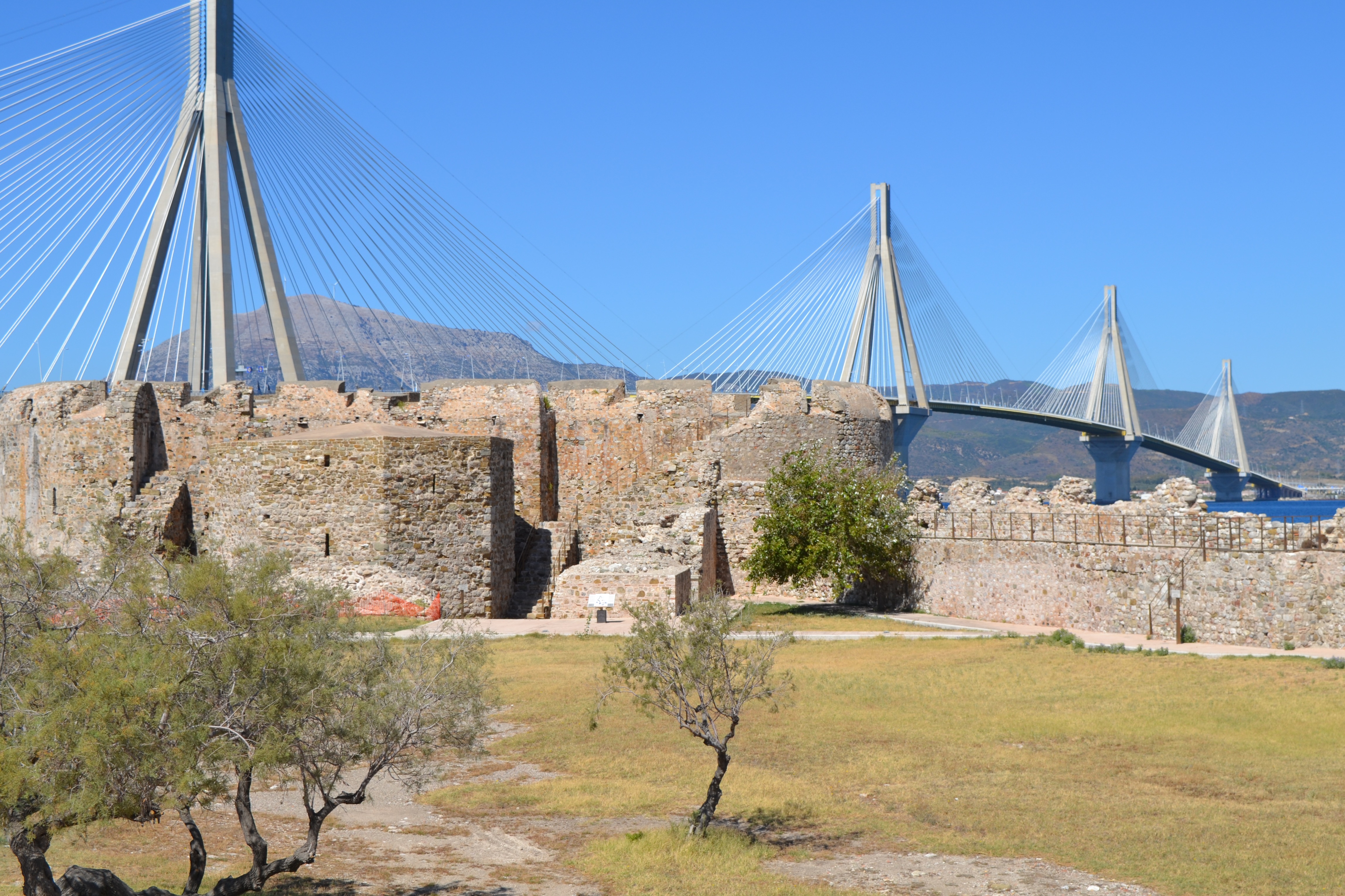
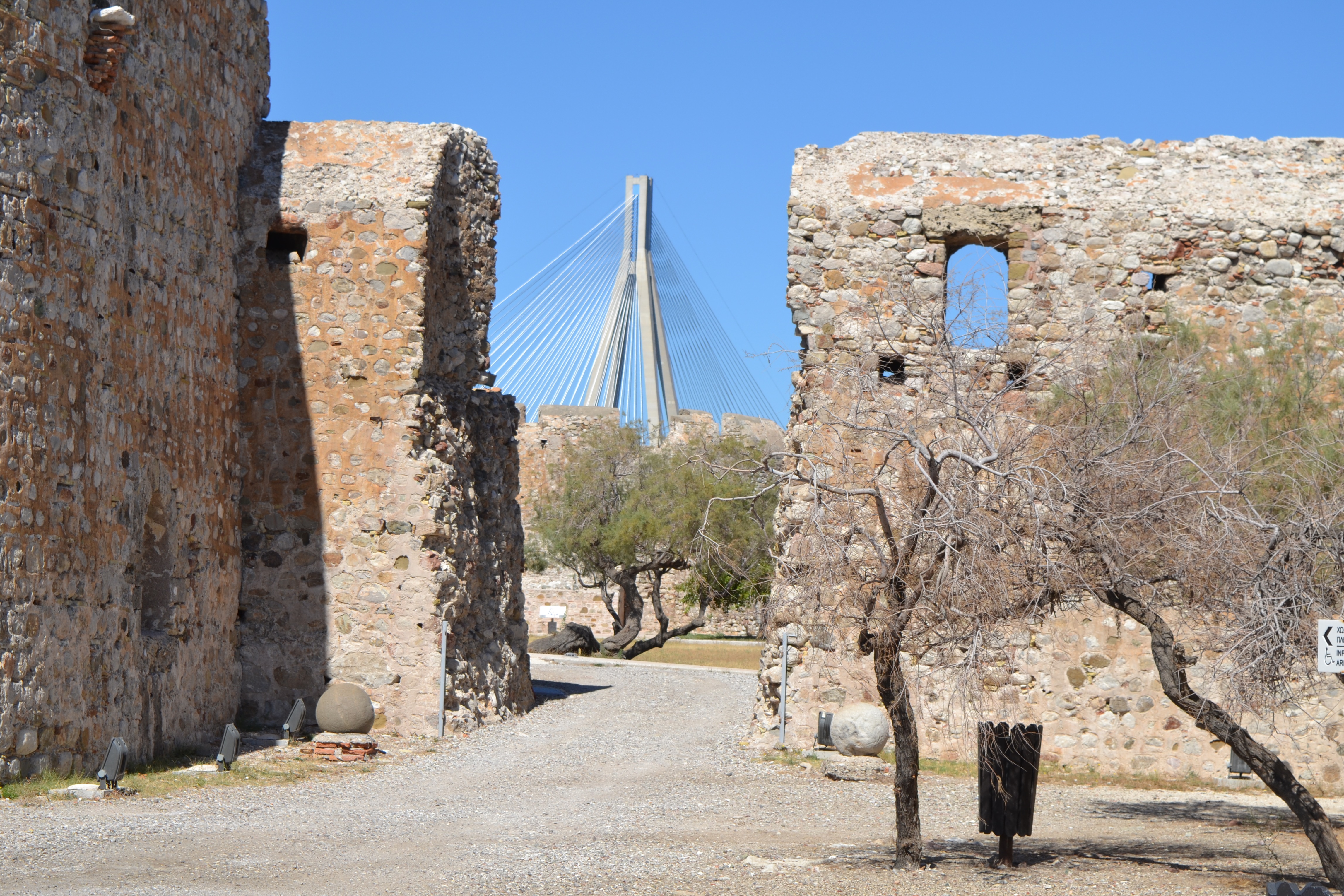
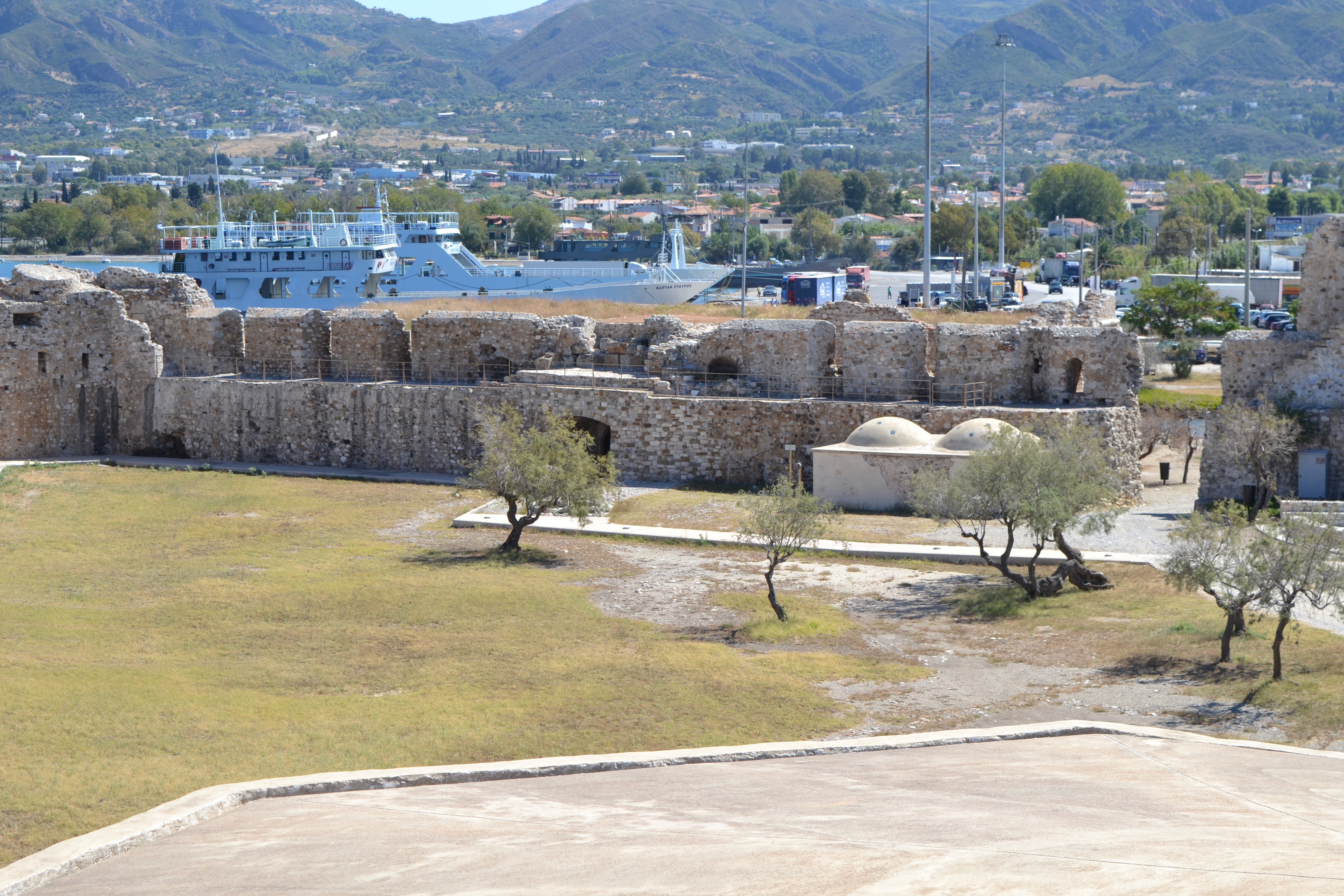
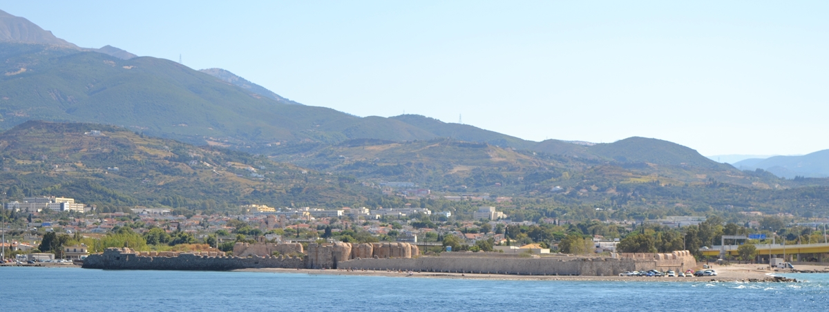
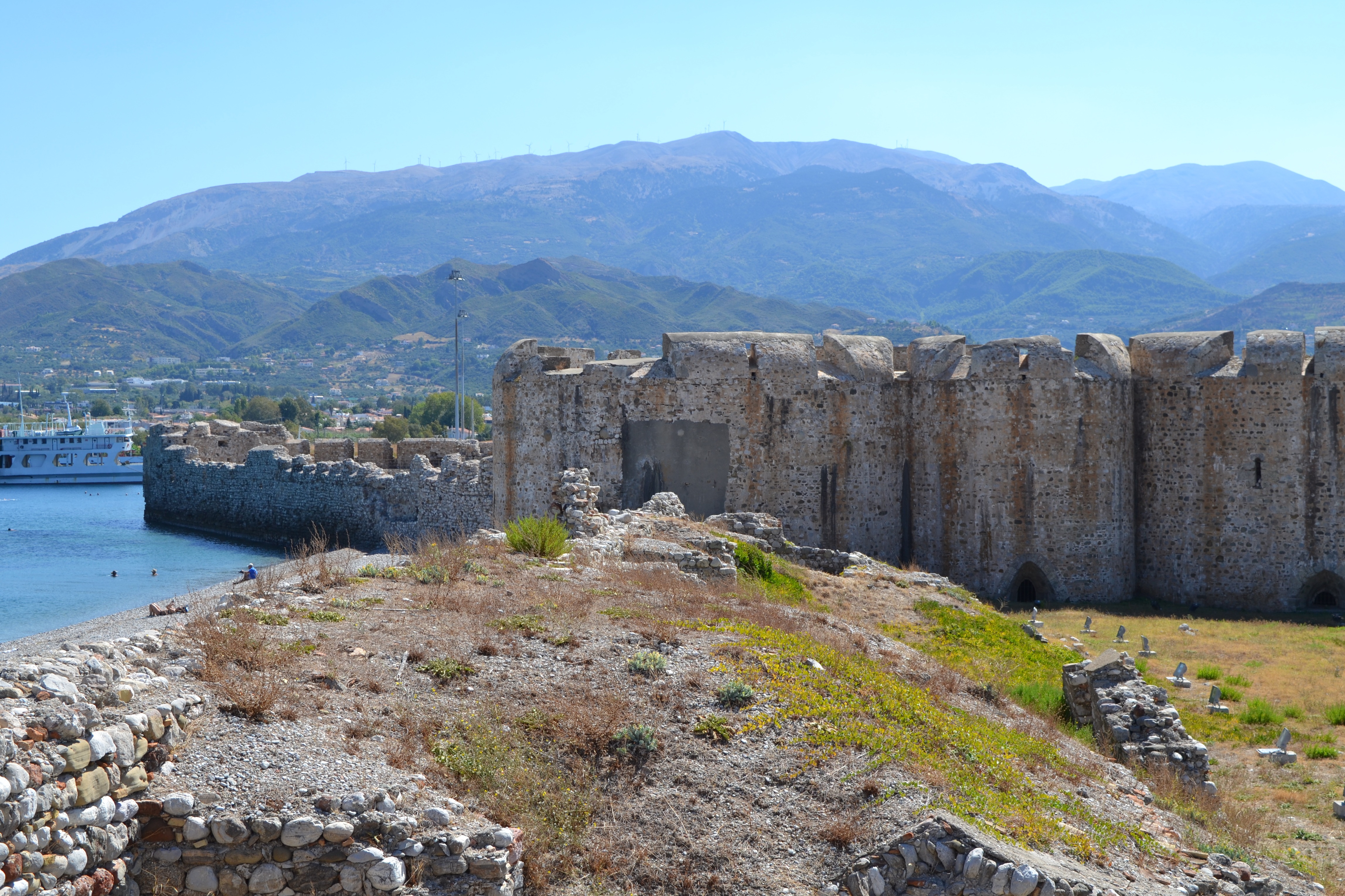
The Rio Castle is located at the north tip of the Rio peninsula in Achaea, Greece, at the entrance of the Corinthian Gulf. The Rio-Antirrio Bridge is located next to it, and the local ferry docks lie on either side of the mainland and the Peloponnese. Today it is used for cultural purposes, especially concerts and is a tourist attraction.
The castle was built by the Ottoman Sultan Bayezid II in 1499 on the ruins of an ancient temple of Poseidon, within three months.
Along with its twin, the Antirrio Castle, they were intended to protect the entrance to the Corinthian Gulf, and were nicknamed the "Little Dardanelles".
The castle was then repaired and handed over to the Greeks. It was used as a prison for a considerable time. During World War II the Germans established themselves there.
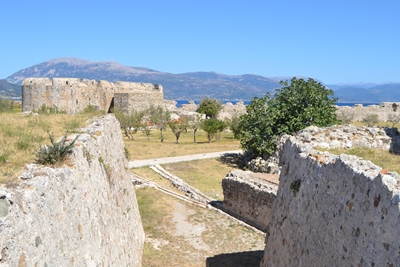
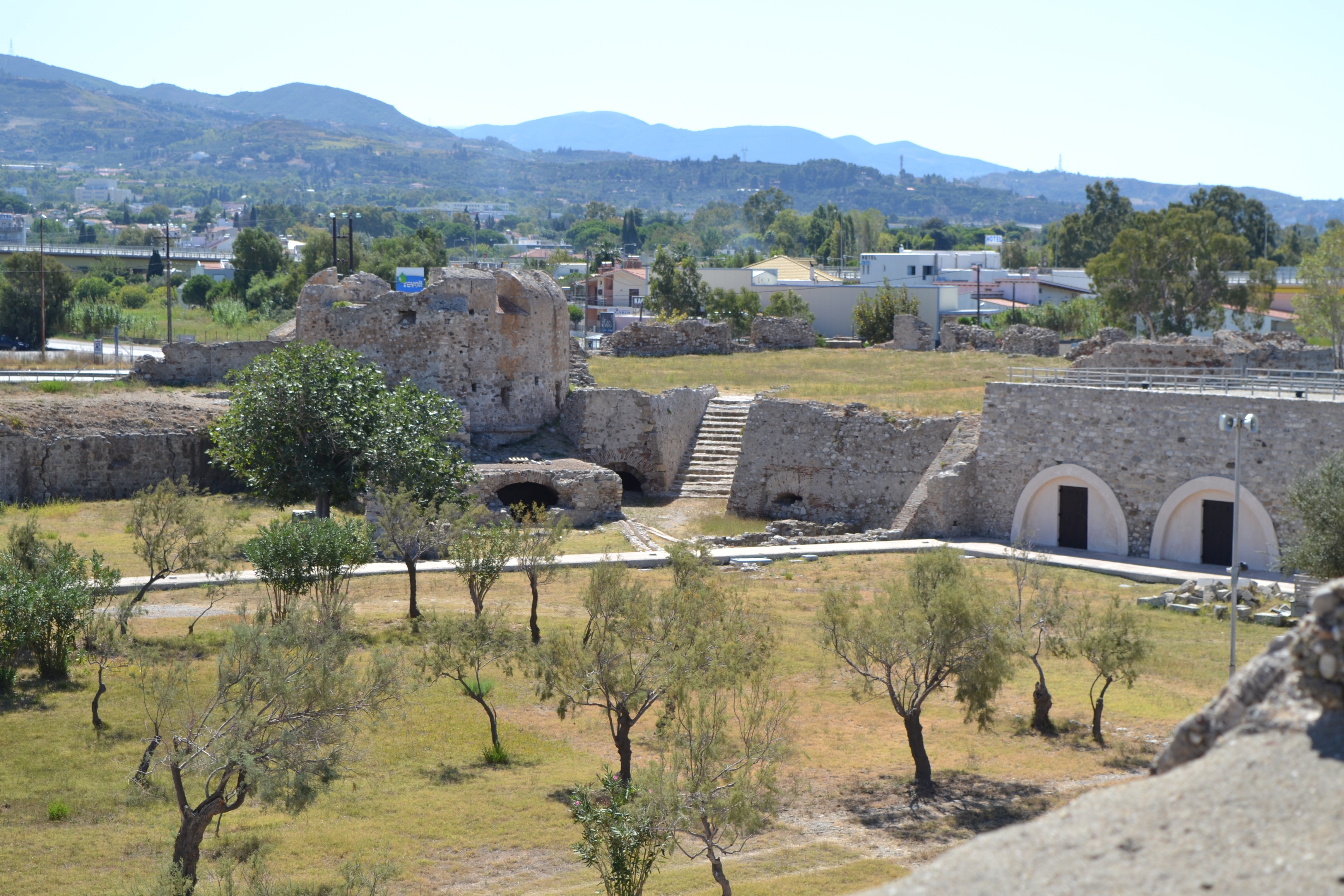
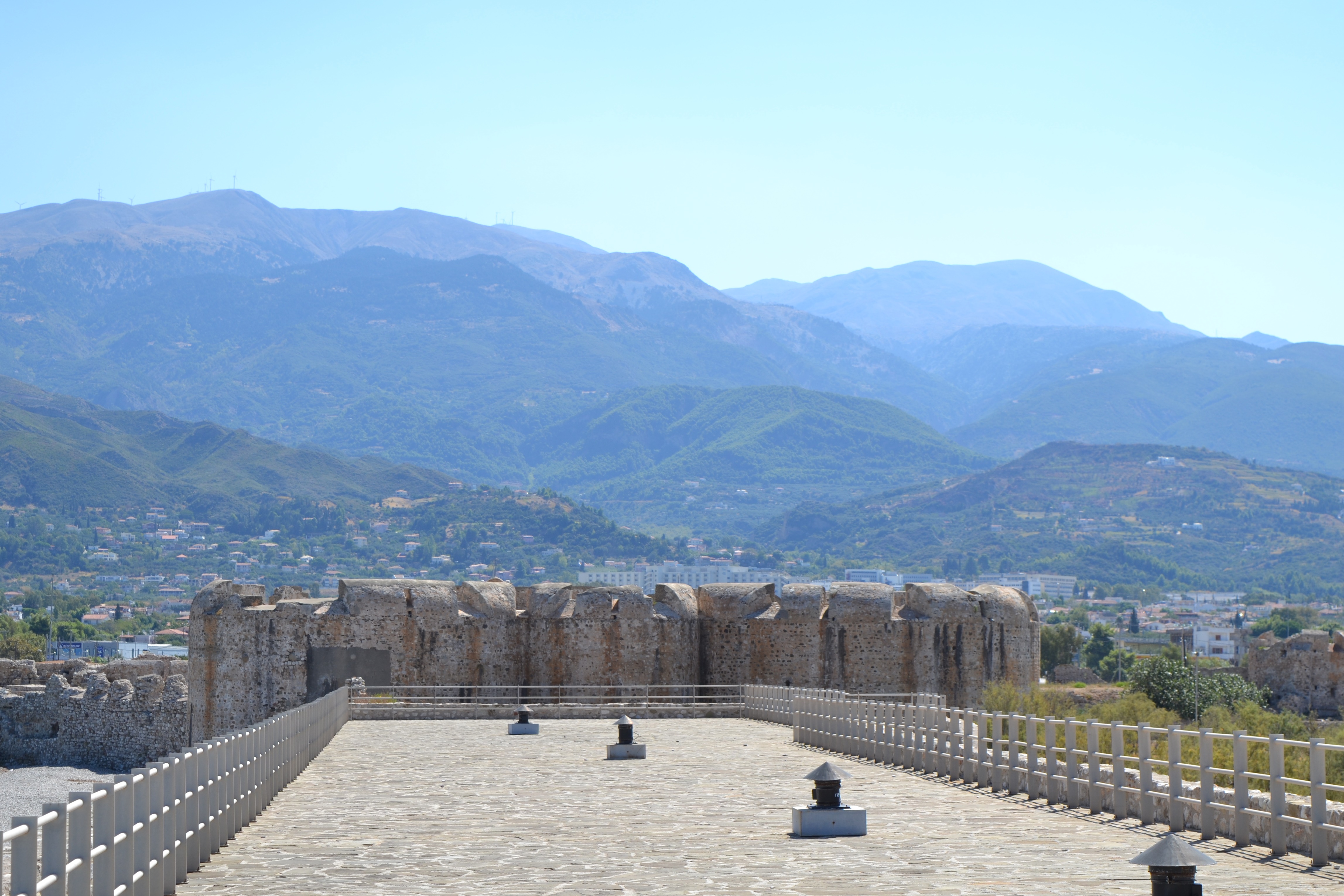
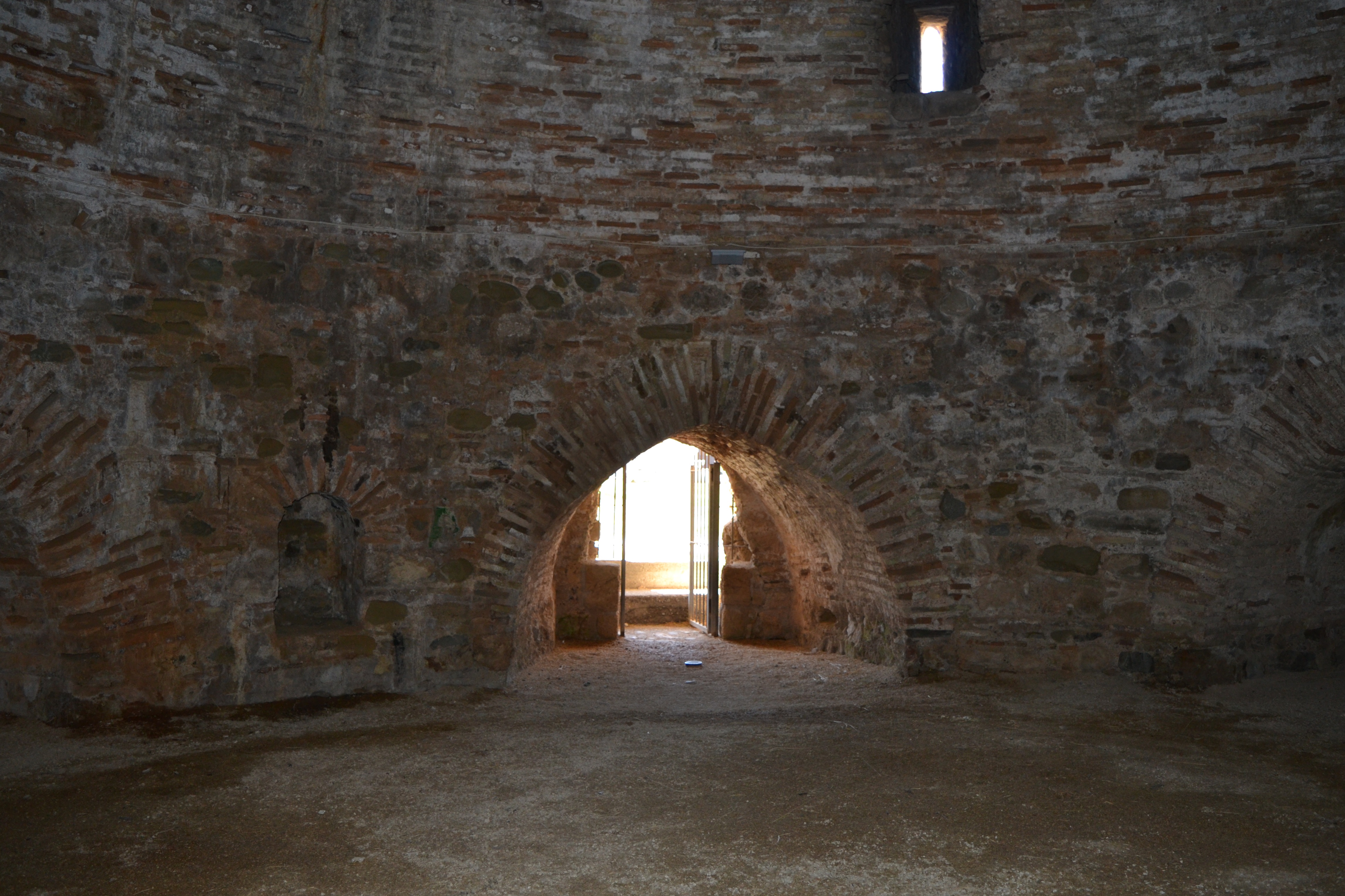
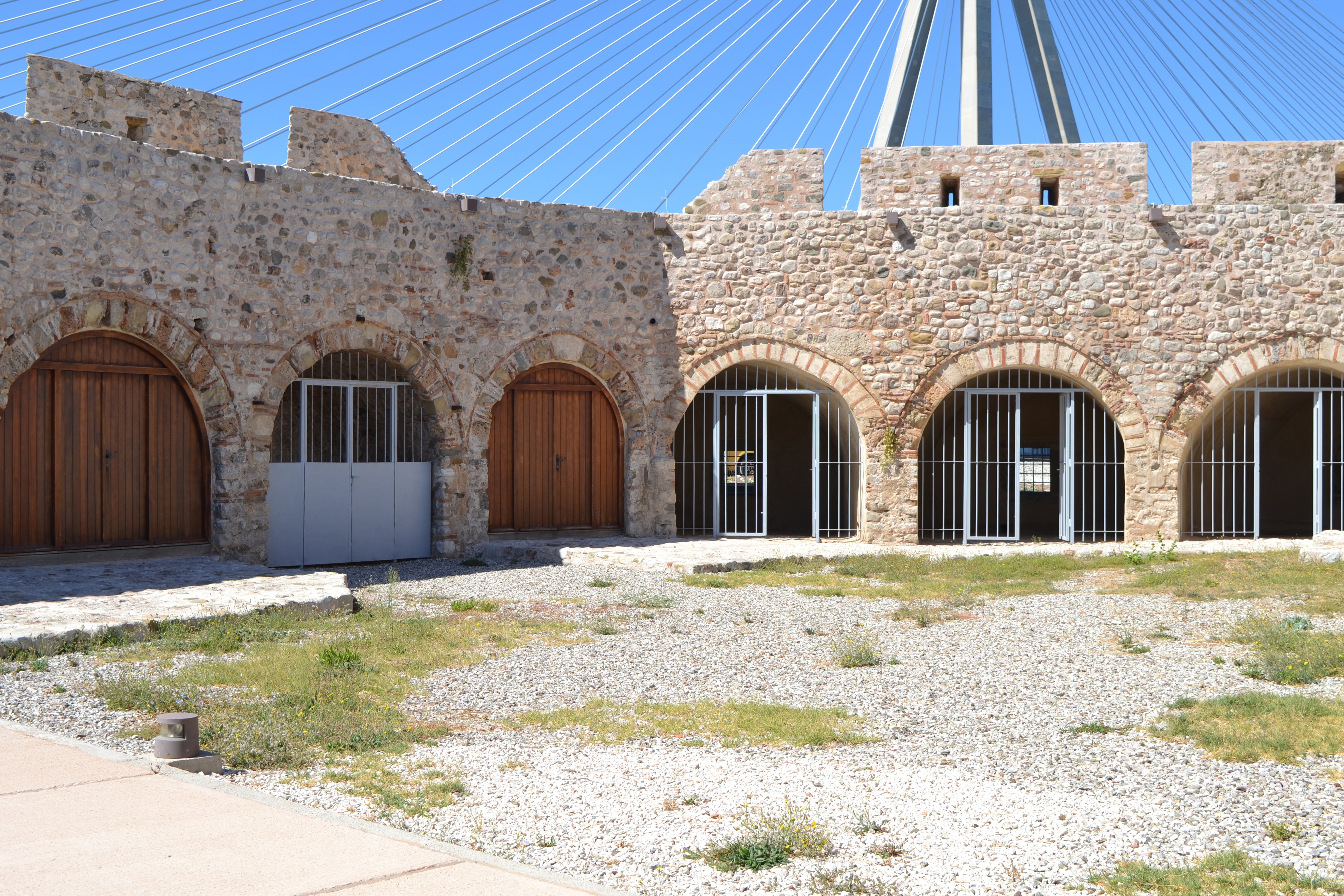
The castle is located on the sea shore, with its northern side protected by the sea and the southern by a broad moat, filled with sea water, and two outer bastions (ravelins), linked to the main fort by stone bridges.
It has two gates, the central one, facing landwards, and the sea gate.
The fortress on the Peloponnesian coast was called Castello di Morea (as the Peloponnese was named during the Venetian conquest), while the fortress on the opposite side of the narrows was called Castello di Rumelia (a synonym for Europe, deriving from the association made by the Arabs between Rome and Europe).
Today they are called Castle of Rio (Morea) and Castle of Antirrio (Rumelia).
In 1533, the castle was briefly captured by the Genoese under Andrea Doria, but the Ottomans recaptured it later in the year.
The narrows were forced in 1571 by the Christian fleet commanded by Don John of Austria. The battle which ensued is known as the Battle of Lepanto, the Italian name for Nafpaktos, a port 5 miles to the east of Antirrio Castle on the mainland.
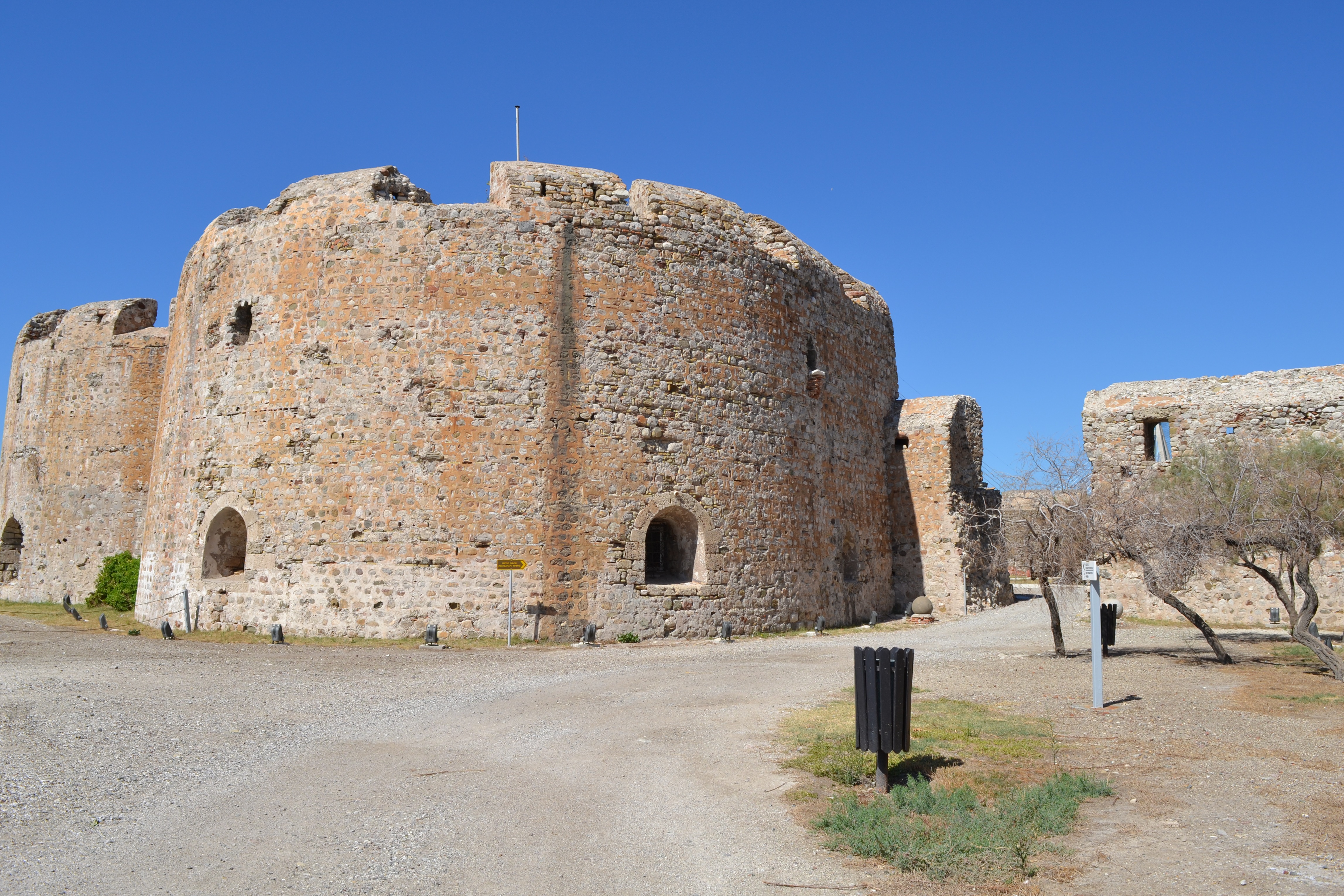
In 1687, during the Morean War, it was taken by the Venetians under Francesco Morosini. The Venetians rebuilt the castle, restoring and strengthening it by the addition of towers, giving it its final shape
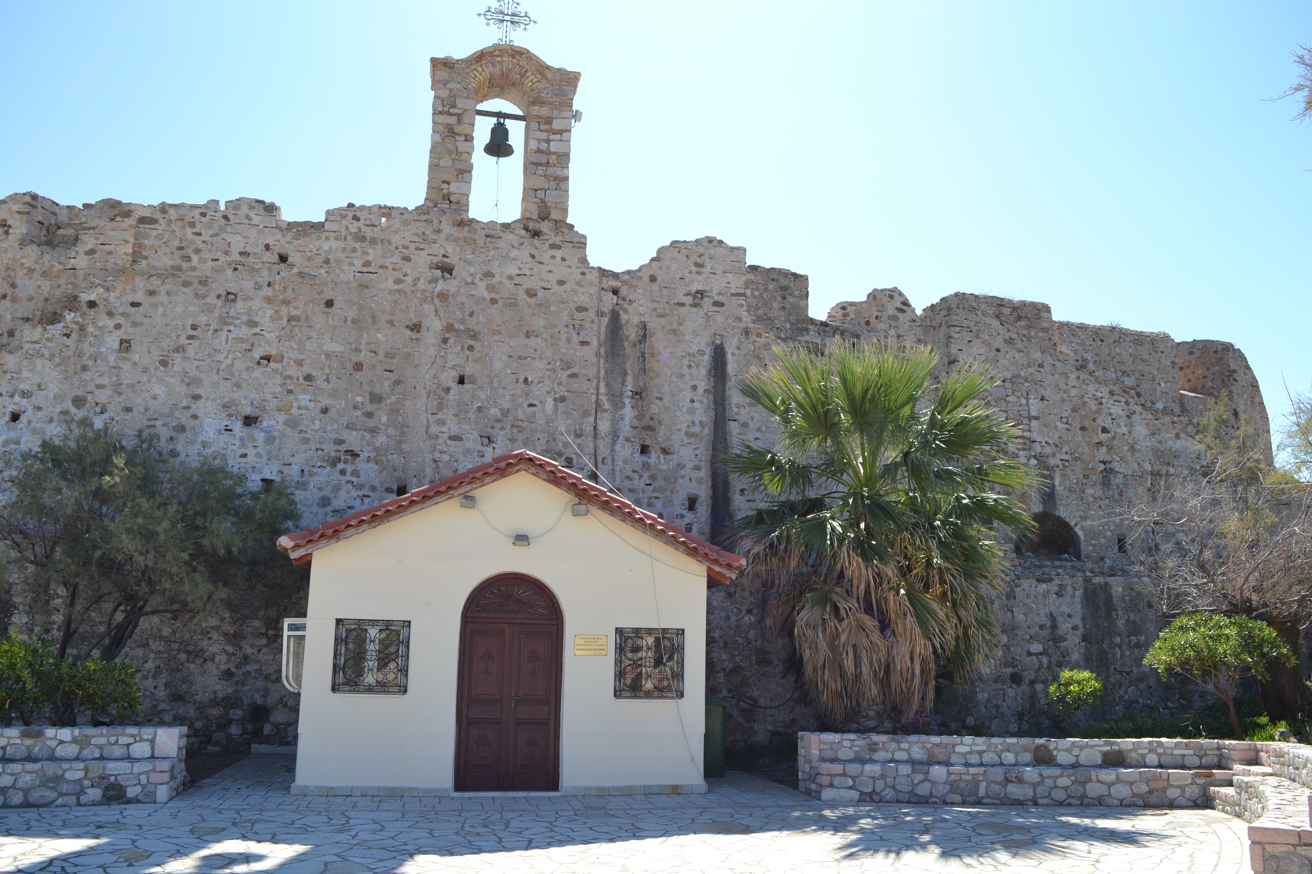
The Venetians also added the small chapel of the Life-giving Spring (Zoodochos Pege). I asked at the entrance booth if I could see inside the chapel but, unfortunately they would not open it for me!! (And there was no-one else there looking at the castle at the time).
The Ottomans retook it in 1715, and it remained with them until they surrendered it to French General Nicolas Joseph Maison.
Between 1831 and 1912, the castle was used as a military and then civilian prison, whose inmates were often used by the municipality of Patras for cleaning the streets of Rio. During World War II the Germans established themselves there.

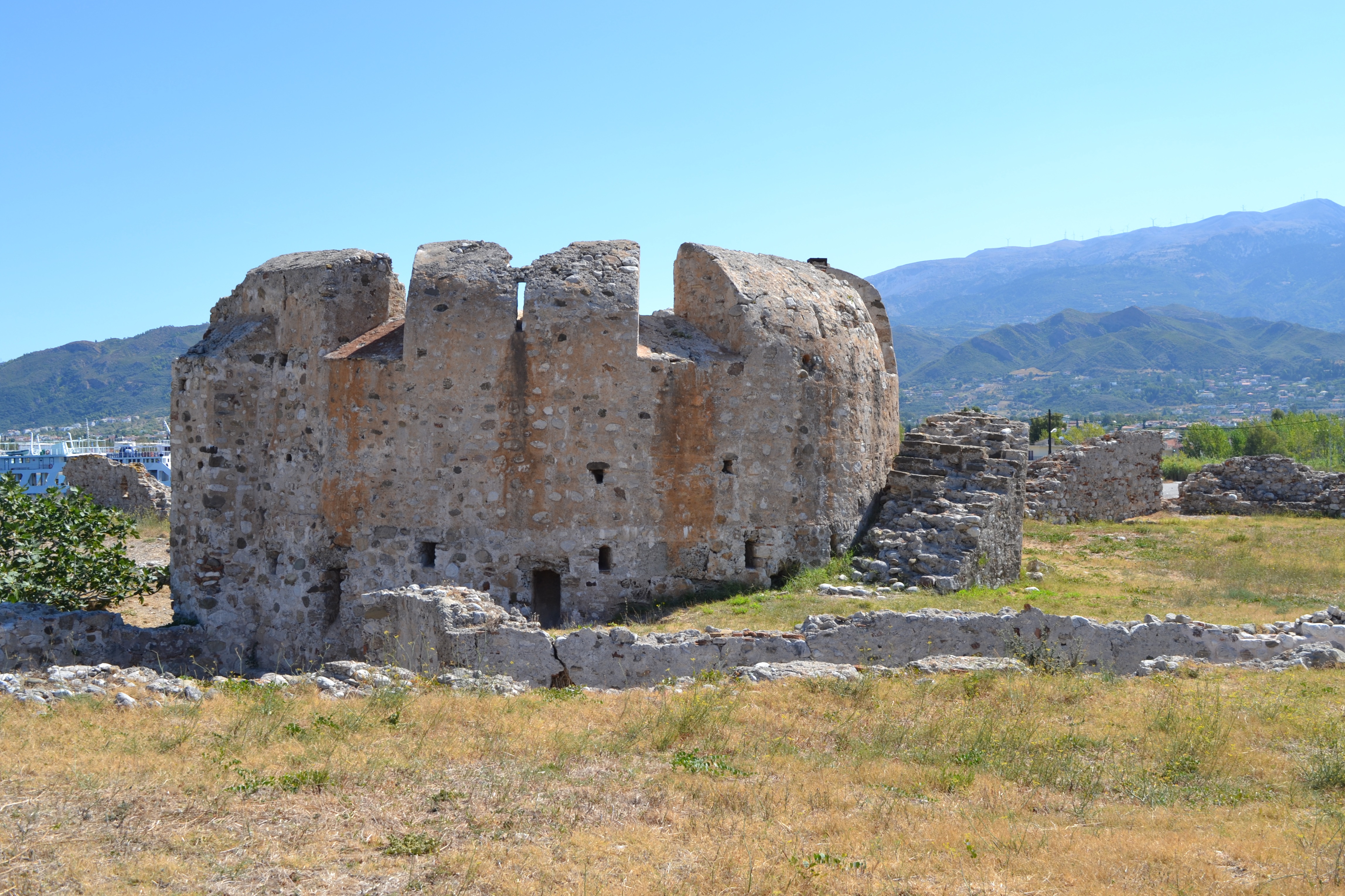
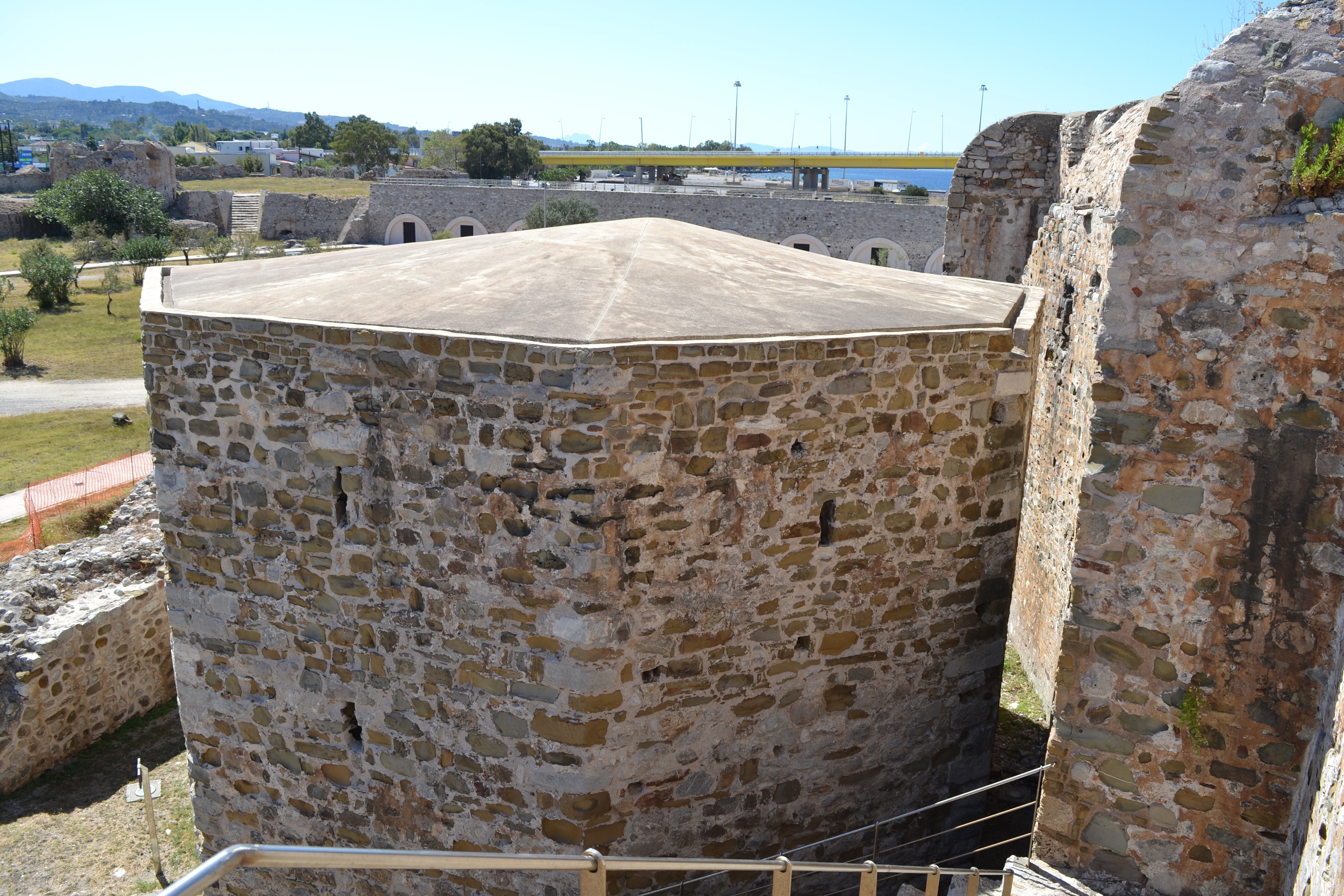
Rio Castle shows the enhancements made by the Venetians during their short occupation at the end of the 17th century. The fortress was completely separated from the mainland and large circular towers were built for placement of artillery on their tops.
The Venetians hoped that the Ottoman Empire would not have recovered from the effects of the disastrous war which had led to the loss of Hungary and Transylvania to Austria and of Morea to Venice (Peace of Carlowitz, 1699).
In 1714 however, the Turks, relying on the fact that the growing interests of Austria in Italy (acquisition of the Duchy of Milan, 1713) had weakened their alliance with Venice, invaded Morea and the Venetian fortresses, largely unmanned, fell one after the other before the Austrian intervention in 1716.
The West Venetian Bastion (baluardo or bastione) is located in the SW sector of the Fortress of Rio and was constructed by the Venetians within the years 1708-1714, during the enlargement of the Fortress and its transformation according to the principles of the Bastion system.
It belongs to the category of the earth filled bastions (terrapieno), it covers an area of 1395 m2, and it is trapezium in shape.
The walls have an outwards slanting front (scarpa) both towards the moat (fossa) and towards the internal courtyard. On the East and South face of the wall (faccia) is crowned with a continuous stone cordone.

The access to the terrace of the Bastion is reached by two ramps (rampe) situated at both ends. On the terrace of the Bastion 13 buttresses (speroni or contrafforti) trapezoidal in shape were revealed, belonging to the initial Venetian building period of the Bastion. The aim of their construction is the backing of the surrounding wall.
The occupation of the Fortress by the Ottomans in 1715 inaugurated a long period of reconstructions on the West Bastion.

The north-west corner of the courtyard of the Bastion is occupied by the almost square gun powder magazine (polveriera).
The latter was a building with a vaulted roof, it has an entrance from the East and reinforced walls 1.88m thick for the protection of the gunpowder.
The Venetians worked to repair and fortify the castle and the fort in its entirety. They made the fortress once again operable and they used the contained temple as a Christian church once again.
By 1828, the Turks, who re-occupied the fortress, surrendered it to the French General Maison.

The buttresses were repaired with the addition of a brick top layer in the shape of a 'pitched roof' constructed on their upper side. The space behind the no longer surviving parapets is occupied by 13 stone curviform reinforcing constructions. Between them and behind the cannon emplacements 12 stone floors are added serving as bases for the cannon.
The occupation of the fortress by General Maison in 1828 signified a new circle of repairs the major intervention being the replacement of the destroyed stone cordone for a new brick one.
During World War II, the Fortress was used as a fort both by the Greeks and by the Germans who finally occupied it in 1941.
The project "Consolidation - Presentation - Enhancement of the West Venetian Bastion of the Rio Fortress, Region of Achaea was implemented under the direction of the Ephorate of Antiquities of Achaea, with a duration from 01-04-2014 to 15-12-2015.
It was included in the Priority Axis 3: "Improvement of entrepreneurial environment" of the Operational Program: "Competitiveness and Entrepreneurship" of ESPA 2007-2013, with a budget of 340,000.00 euros.

The removal of the earth fill of the Bastion and the extensive research excavation undertaken as part of the project, revealed important archaeological evidence regarding the building phases and the morphology of the monument.
The aim of the interventions was the completion of the static and aesthetic restoration of the West Venetian Bastion along with the arrangement of the area into a space where the visitor can walk around, coming into contact with the initial form of the Bastion
The project included the following tasks by area.
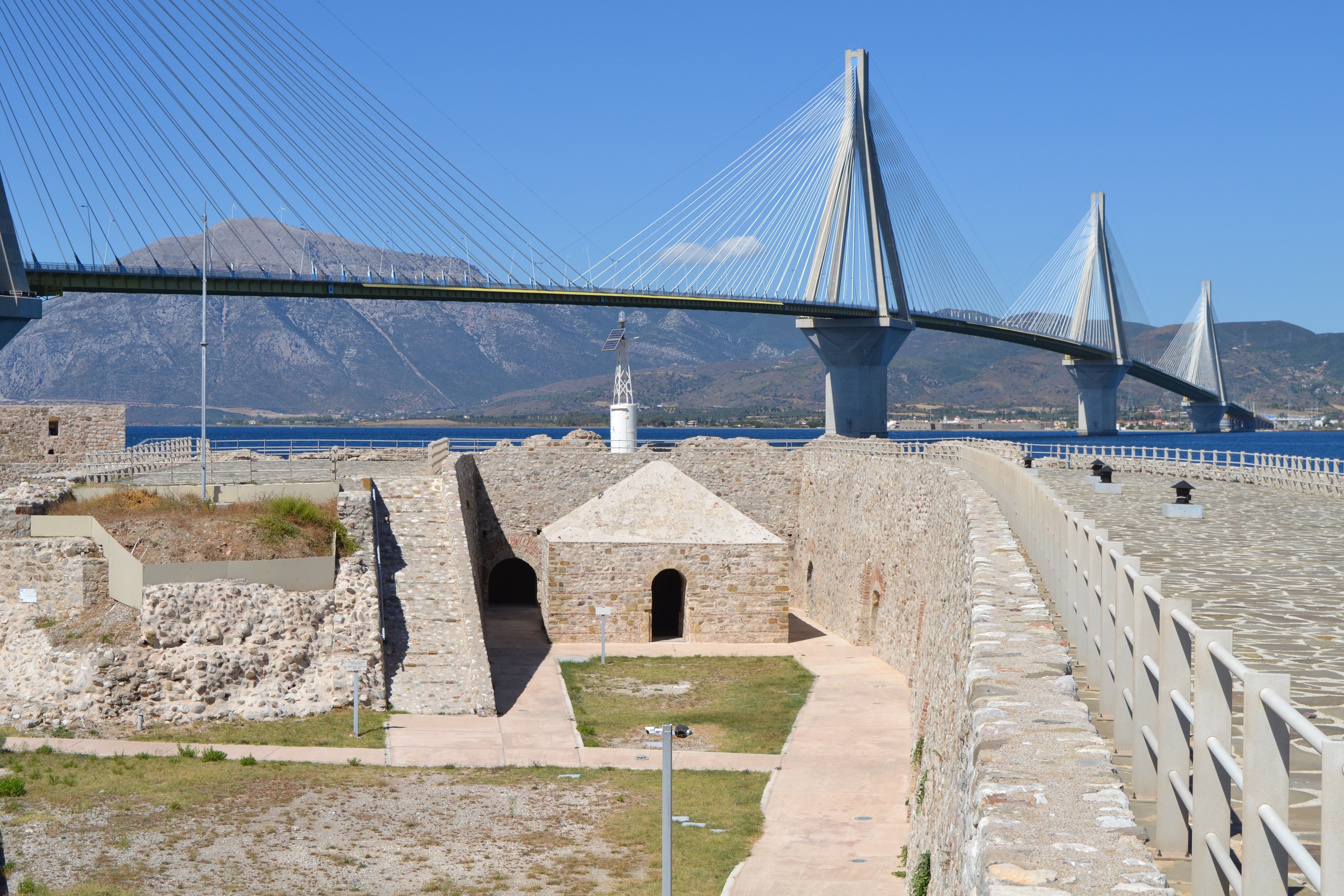
The Rio-Antirrio Bridge runs alongside Rio Castle as can be seen from this photograph.
*See page in Out & About section*

These excavated carvings were placed in the courtyard along with many other items.
Opening Hours: Tuesday - Friday, 8.30 - 17.00 October to April and 8.30 - 19.00 May to September, Saturday-Sunday 8.30 - 15.00. The entrance fee is 2euros.
The entrance is at the port of Rio, very close to the NT Patra-Athens (Rio exit) and under the Rio-Antirrio Bridge.