ZARNATA
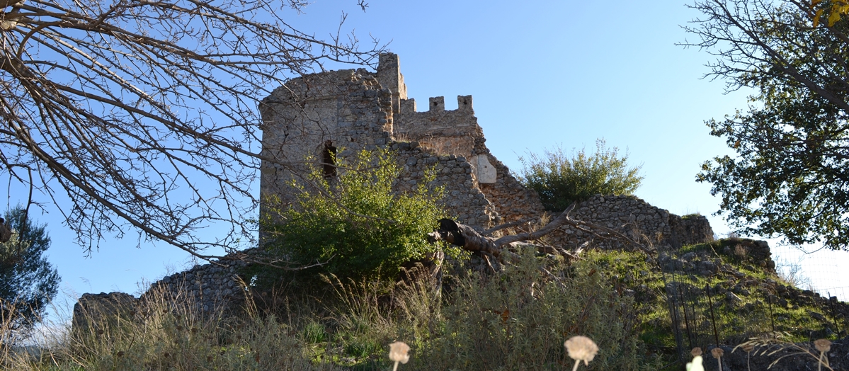
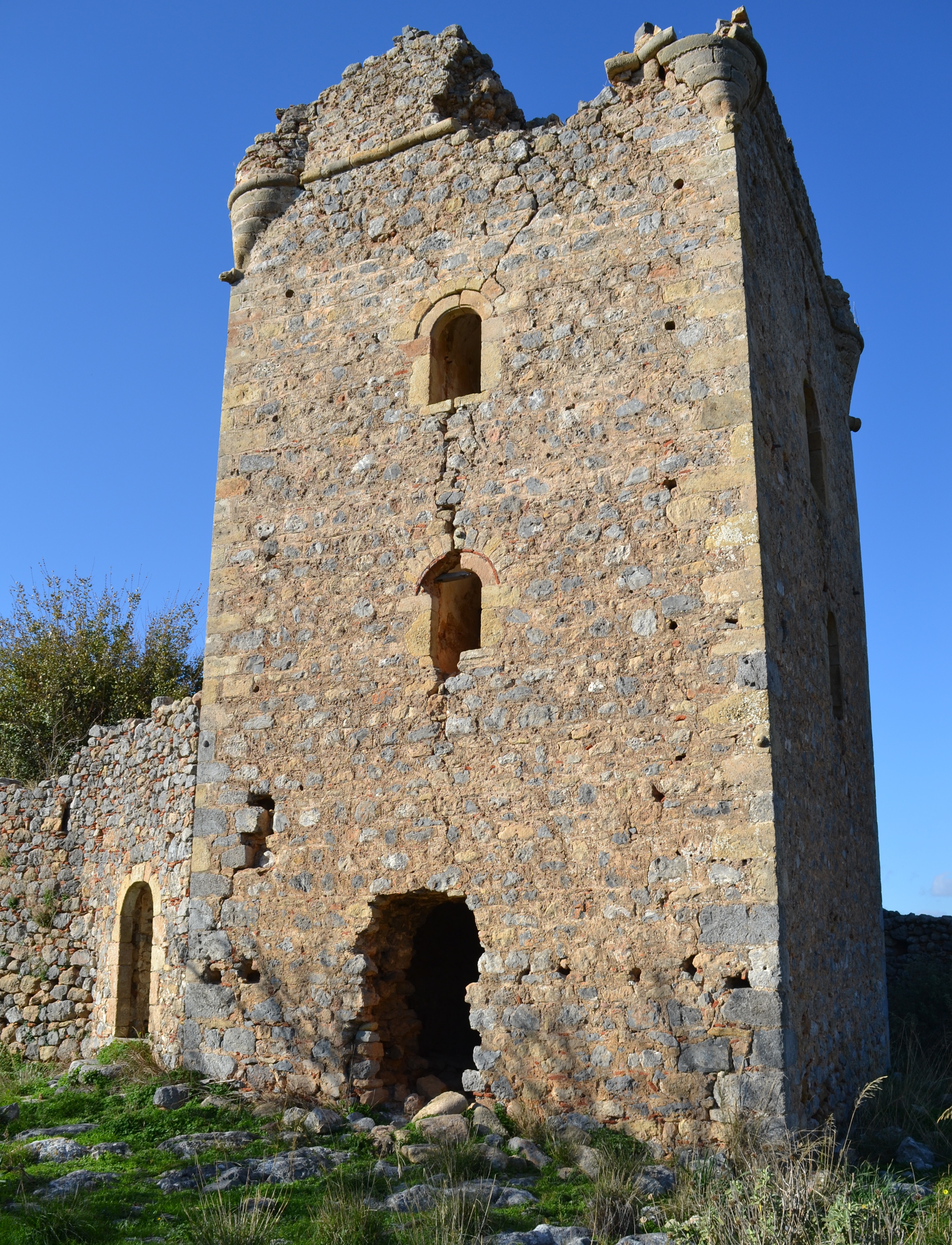
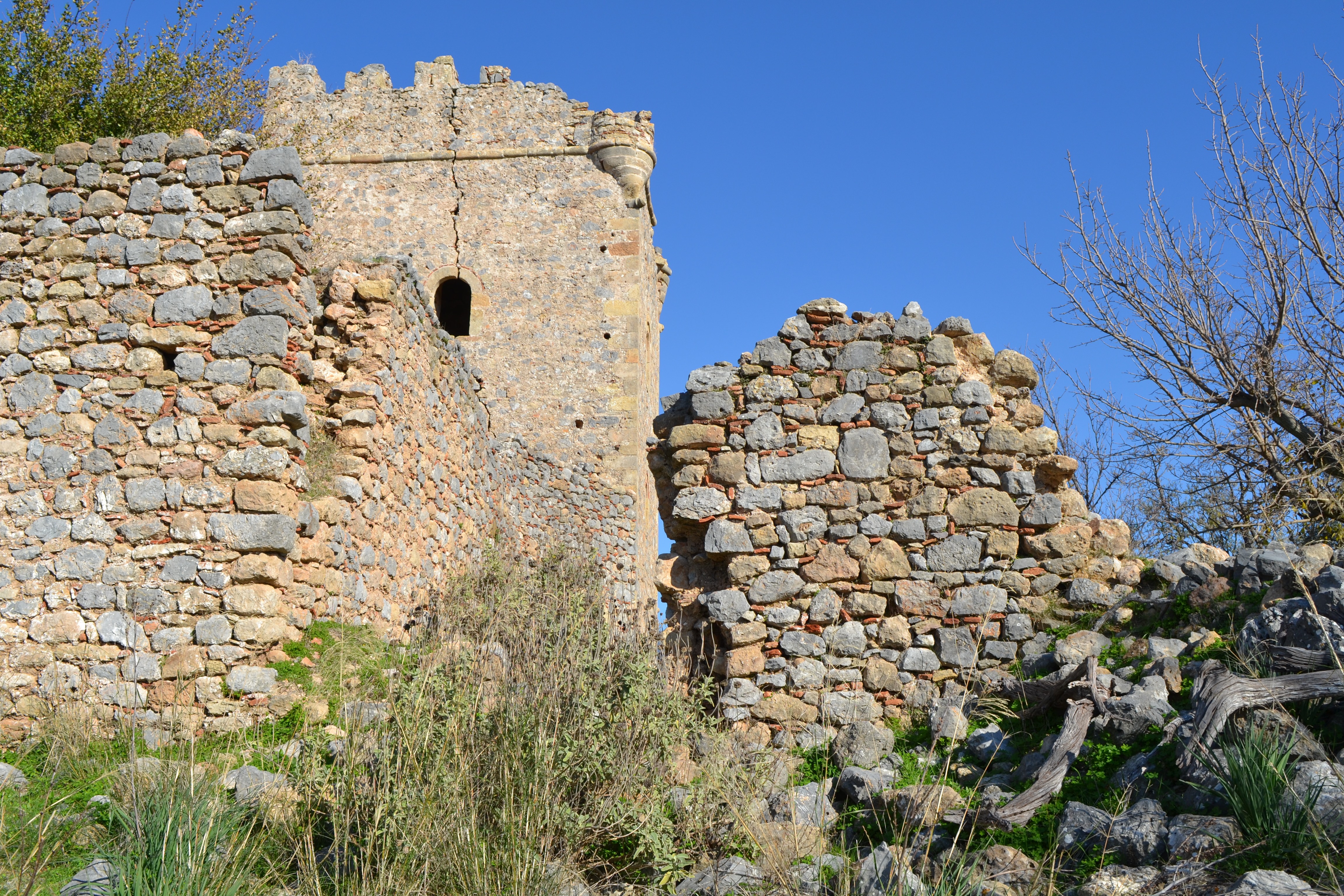
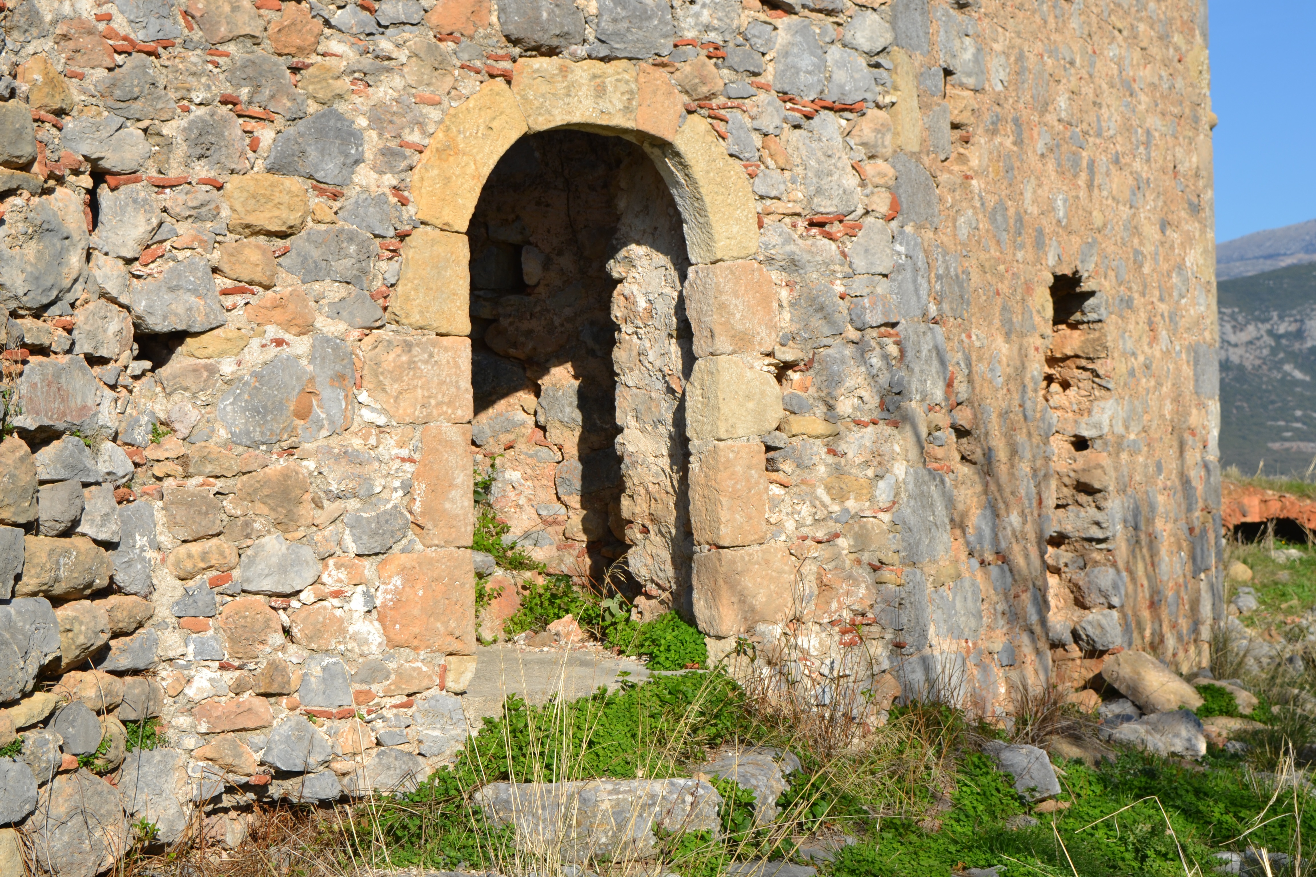
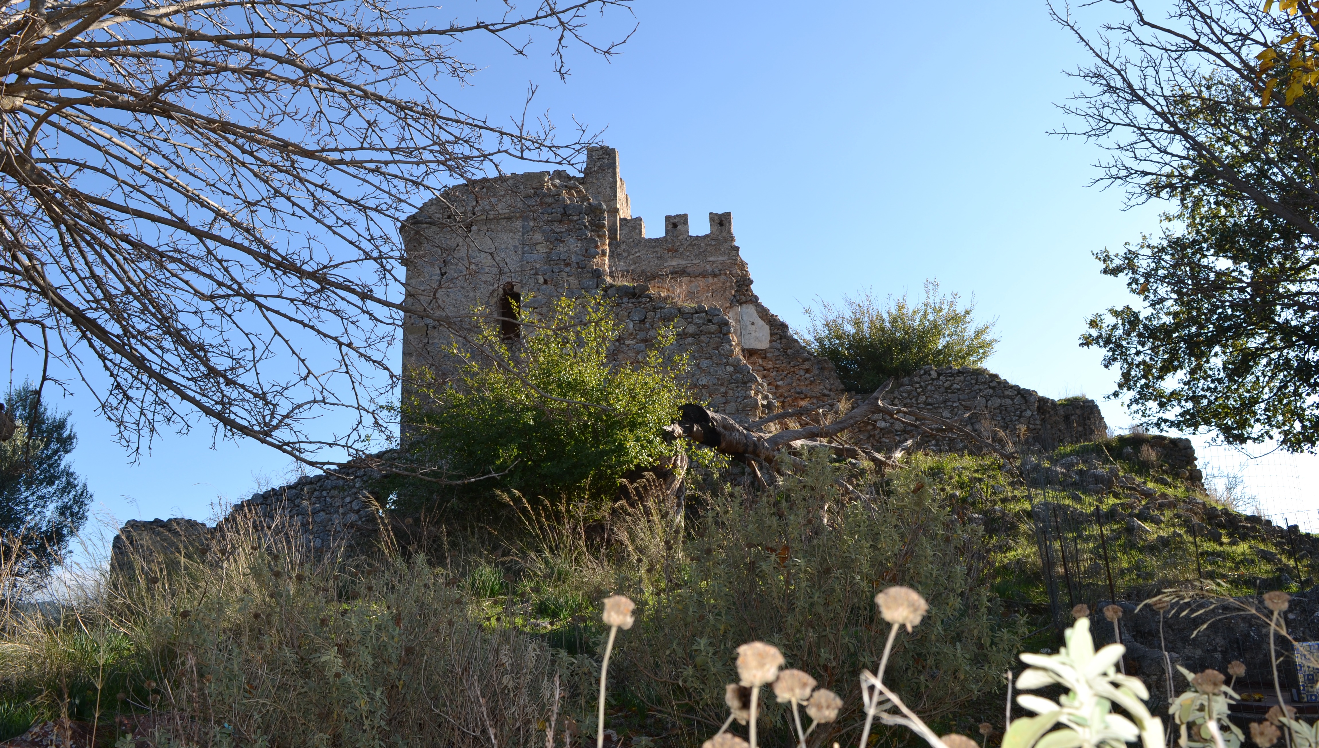
Above is a photograph of the remaining ruins of the Castle of Zarnata
PLEASE NOTE THAT ALL THE PHOTOGRAPHS ON THE SITE ARE CLICKABLE LINKS
Above is a photograph of the remaining ruins of the Castle of Zarnata
PLEASE NOTE THAT ALL THE PHOTOGRAPHS ON THE SITE ARE CLICKABLE LINKS

Zarnata is one of the 4 major castles of Mani. It is a castle of the Late-Byzantine period and was destroyed by the Ottomans who rebuilt it in the 17th century.
In the late Byzantine era there is mention of Zarnata being passed from the Despot Theodoros Palaeologos to the eventual last Emperor of Constantinople, Constantine.
The walls show a steady development from ancient times and it is thought by some to have Frankish remains but there is no reference to the fortress in Frankish sources - though it seems unlikely that any occupying power would leave such a dominating position vacant.
According to the 17th century Turkish traveller and sometime civil servant, Evliya Celebi, the fortress was seized by Sultan Mehmet II and his commander Khotsa Mahmud Pasha at about the same time as Corinth and Mystras - in other words around 1460.
Not long later, however, the locals warriors, the Maniates, revolted and took the castle. It is obvious that the Zarnata area changed hands a number of times in the 16th century although it was not in good contition at all during that period.
The castle is known to have been occupied by the the Turks in 1671 just after one of their most concerted attempts to subdue Mani. Evliya Celebi who accompanied the Turkish troops gives details of the siege of Zarnata, which he describes as "the key castle of Mani", by the Ottomans in the spring of 1670.
The fortress seems to have surrendered without much of a fight, probably due to the sheer number of Ottoman troops who had surrounded Zarnata.
Celebi wrote, "Then the kastro had been thrown down in particular places and all the infidels of Mani had been subdued." He continues, "Later the Maniates, who had connections with the Europeans revolted and fortified the kastro by land and sea. They took a hundred thousand Muslim prisoners put them in chains, seized thousands of ships and pulled down thousands of villages, small towns and kastra."
Even allowing for Celebi's numerical exaggerations it is obvious that the Zarnata had a very chequered history.

Celebi reports that in the reign of Murad III (1574-1595) the Admiral Kilitz Ali Pasha had used the tribute from the Maniates to expand the size of the castle but that after time these outer walls had fallen into disrepair.
Evliya Celebi was entrusted by the Ottoman general Ali Pasha, with the task of obtaining troops and workmen from Albania to rebuild Zarnata from scratch. The defenses were not so much against the threat of the Maniates, who had been soundly crushed in the 1670 campaign as evidenced by the widespread emigrations from many locations in Mani in the following years, but against the Venetians who still harboured Peloponnesian ambitions.
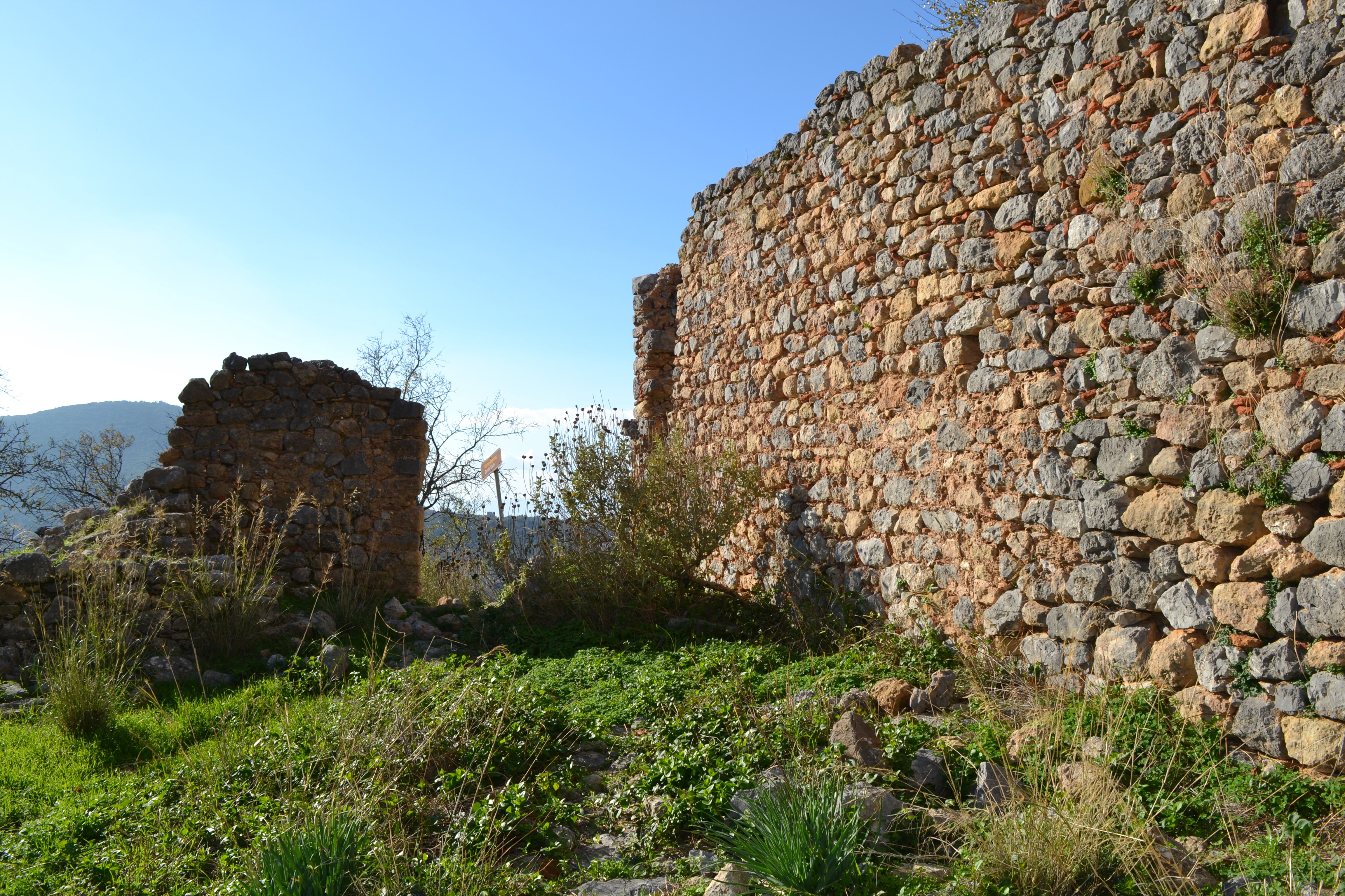
The fort was obviously well repaired and its walls were one thousand and seventy paces in perimeter, were four architectural pikhs wide and twelve high (a mason's pik is 0.75 metres - therefore the walls were approximately 9 metres high and 3 metres wide).
The castle had nine strong towers or bastions and Evliya boasted, rather rashly, that "It is an unconquerable stronghold".
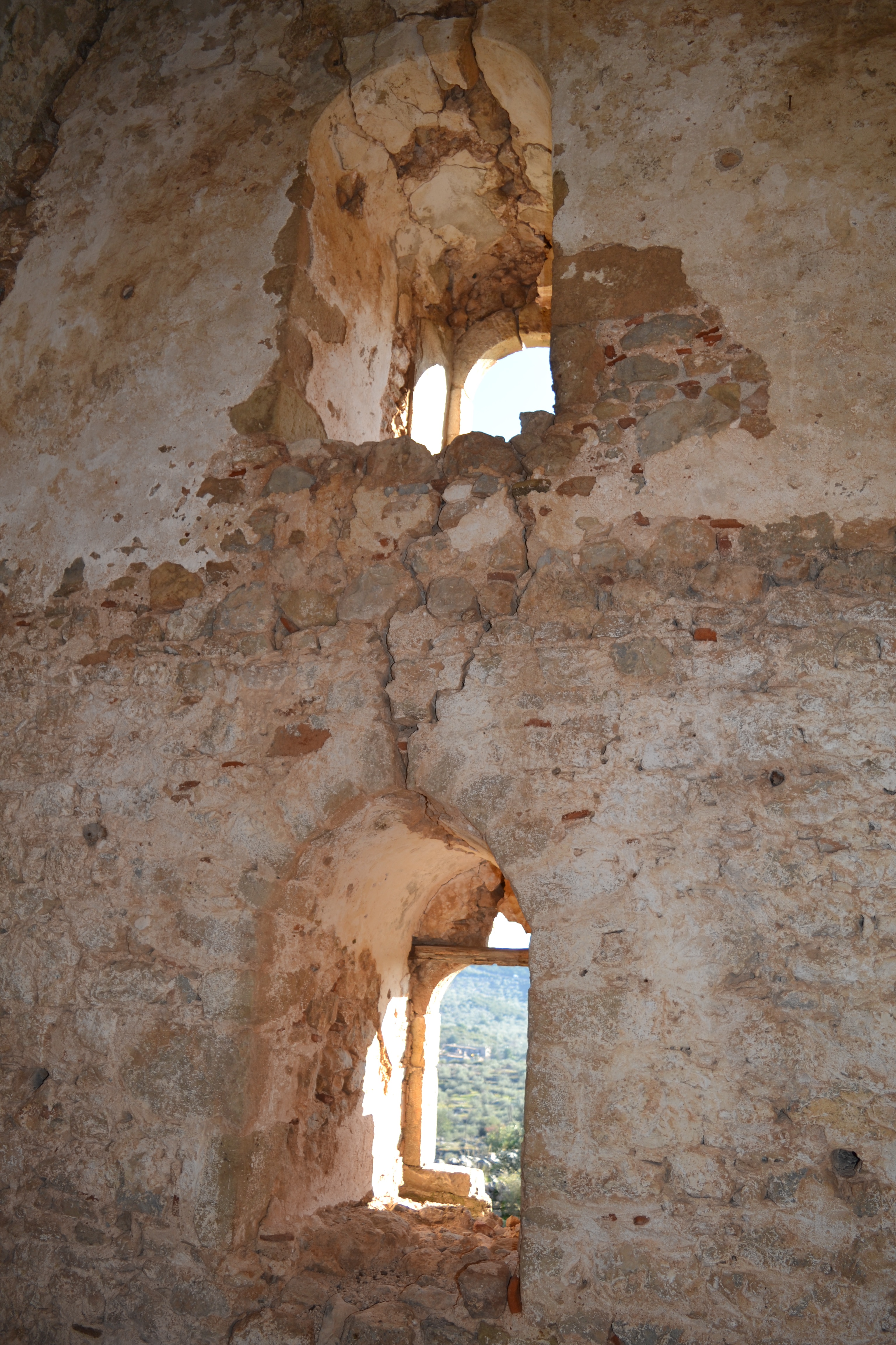
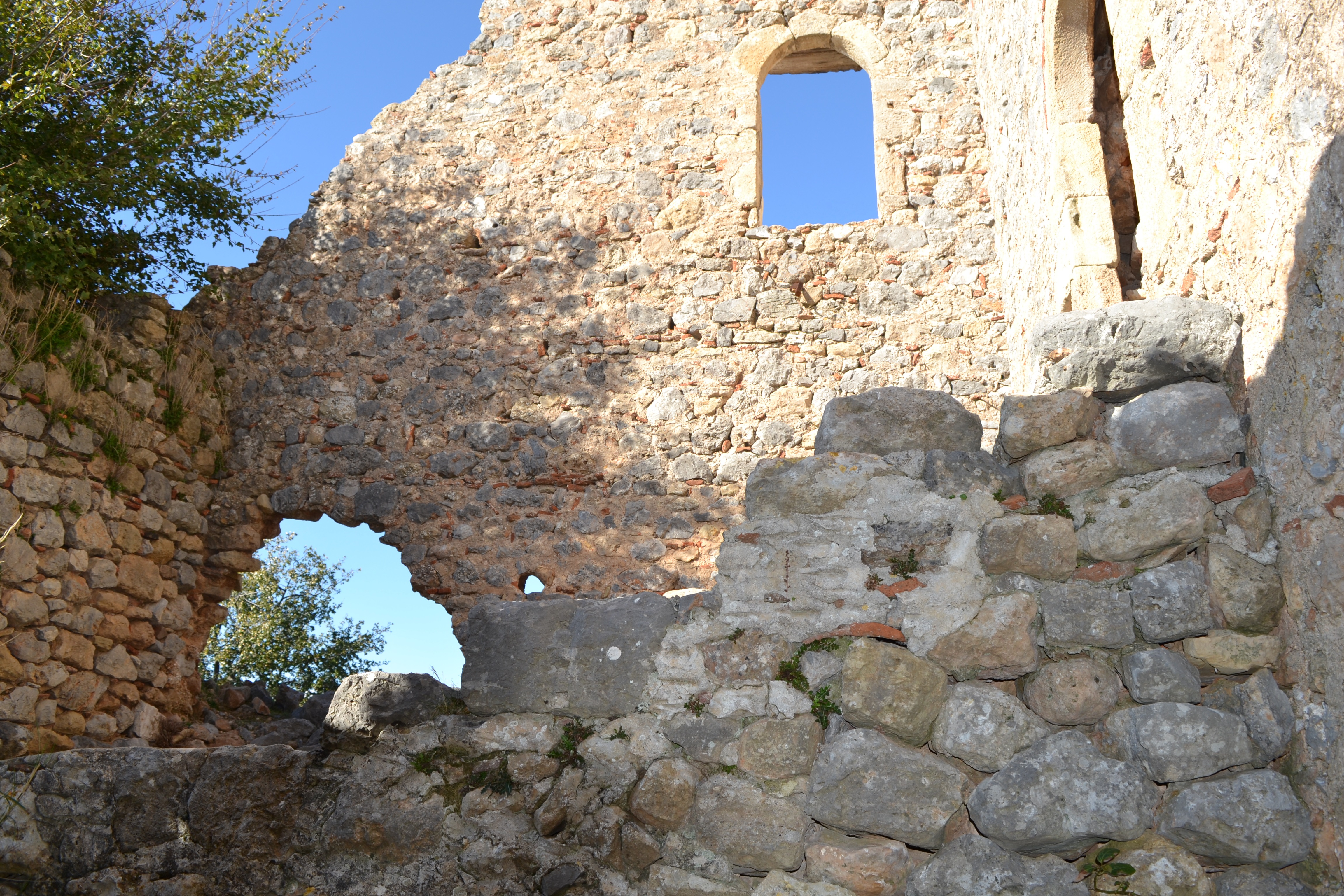
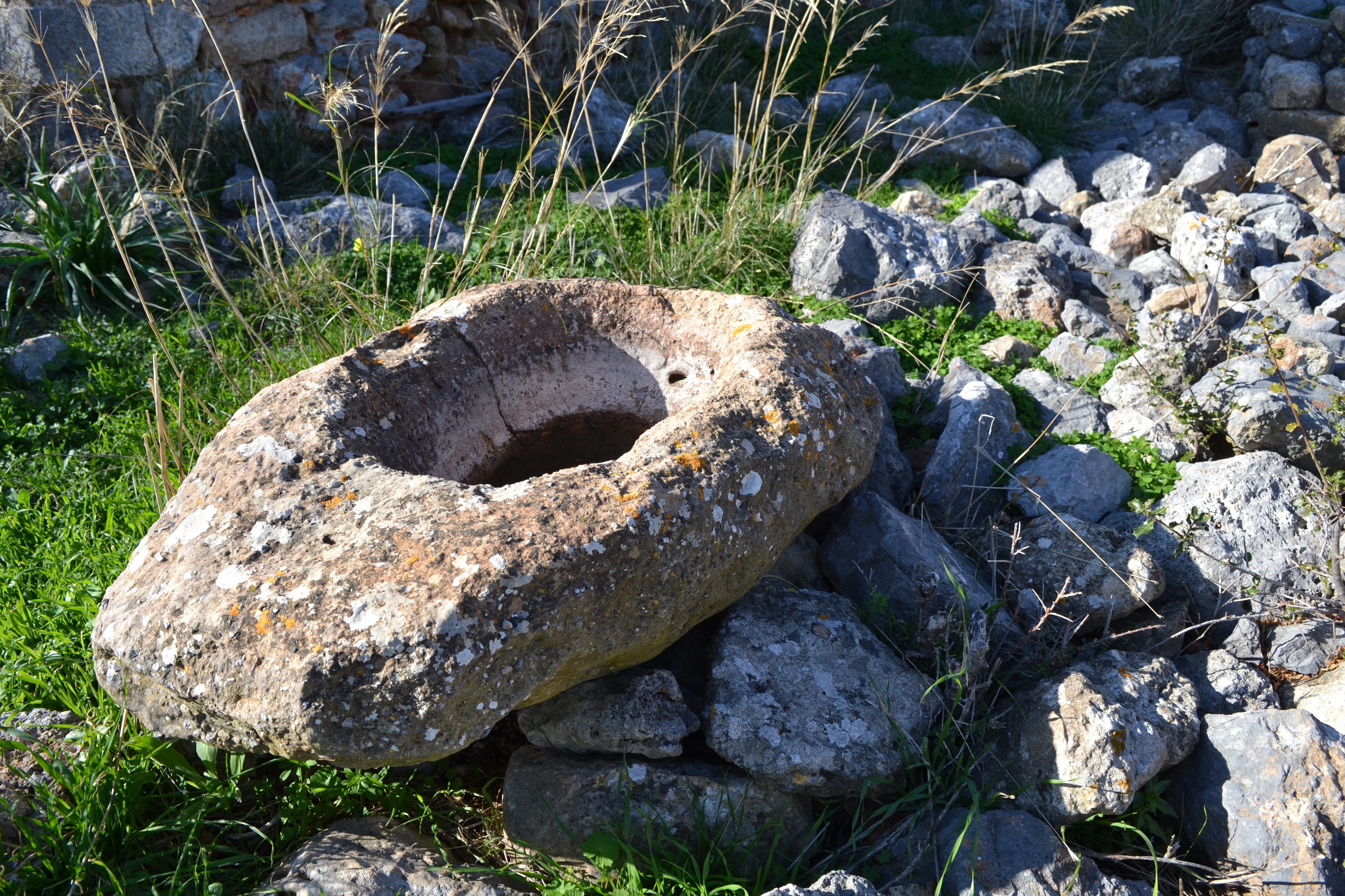
Zarnata obviously had many buildings within its compass. In 1670 the Turks found five hundred houses with tile and slate roofs. They expelled many Christians and destroyed their houses replacing them with Turkish schools, hamman (baths) and administrative offices for the garrison commander. Seven churches were converted into mosques.
Evliya describes these as "gleaming...their minarets embellished with gold and ornaments". Today there is little trace of these buildings, the cisterns which had been constructed, "so that there was no house without its cistern", or of the minarets which once graced the skyline.
In 1685, Morosini, at the head of a Venetian force invaded the Morea laying siege to Koroni on other side of the Gulf of Messenia. When this had fallen he crossed to Mani where, aided, but hardly abetted, by the Maniates (they spent most of the time squabbling with one another) he laid siege to Zarnata in early September 1685.
Although a large Turkish relief force was nearby Morosini intercepted their messengers and persuaded the Turkish garrison that they had no help at hand.
The commander Hasan Pasha surrendered on 11 September and was allowed to withdraw with his troops and sailed away to Elaphonissos island off the easternmost point of the Peloponnese, Cape Malea.
The castle fell to the Turks again in 1715 without a fight and it was, with Kelefa in the south, the Turkish bastions which attempted to keep the hold on the Maniate tribes during the late 17th century but the castle doesn't appear to have been re-occupied by the Turks in the 18th century.
The tower on the top of the hill, is a mainly 18th century construction of the local kapetani who became Beys of the Mani.
These were the Koutifaris and Koumoundouros families - one of the latter of whom, Alexandros, went on to be a late 19th century Greek Prime Minister and who sent in the troops to quell the last outbreak of inter family fighting in Kitta - deep Mani. His bust is to be found at the foot of the hill near his other family 'palace' and a Mycenaean Tholos tomb.
The castle was last used for its primary purpose as late as the Greek Civil War (1946 - 50) when the inhabitants of the local villages of Stavropigi and Malta moved into the site for safety from the violence between the communist guerrillas and the Nationalist troops
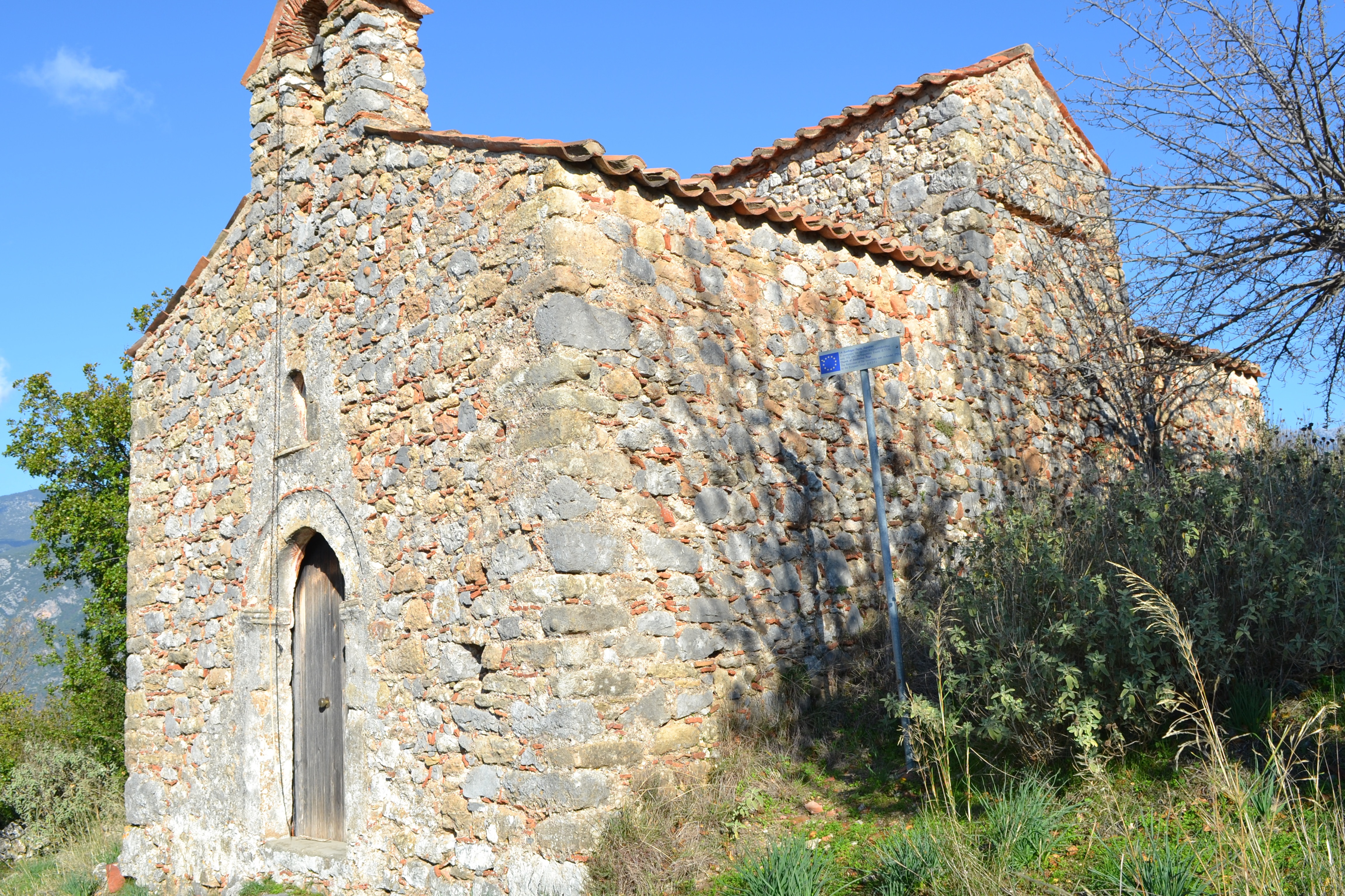
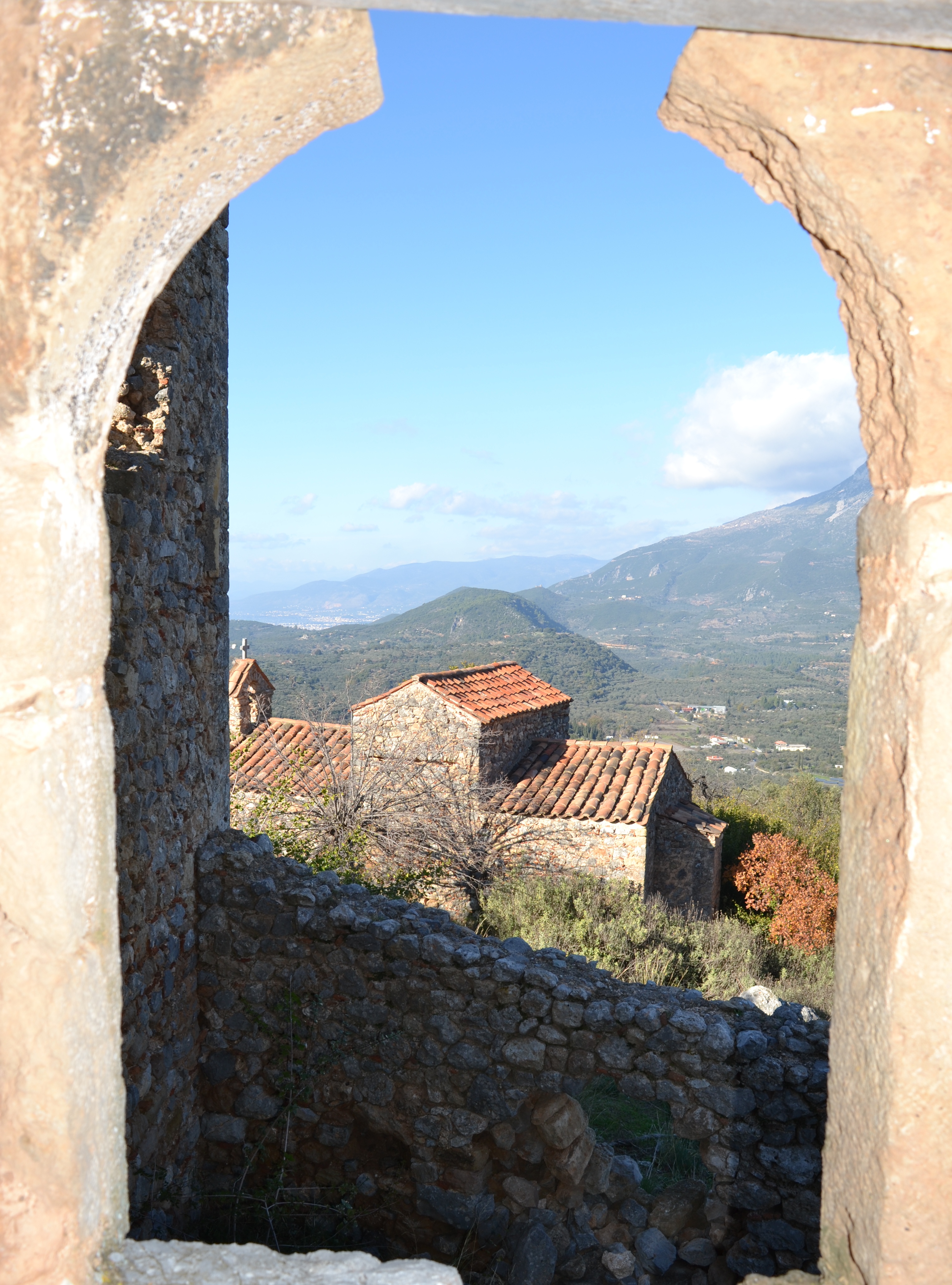
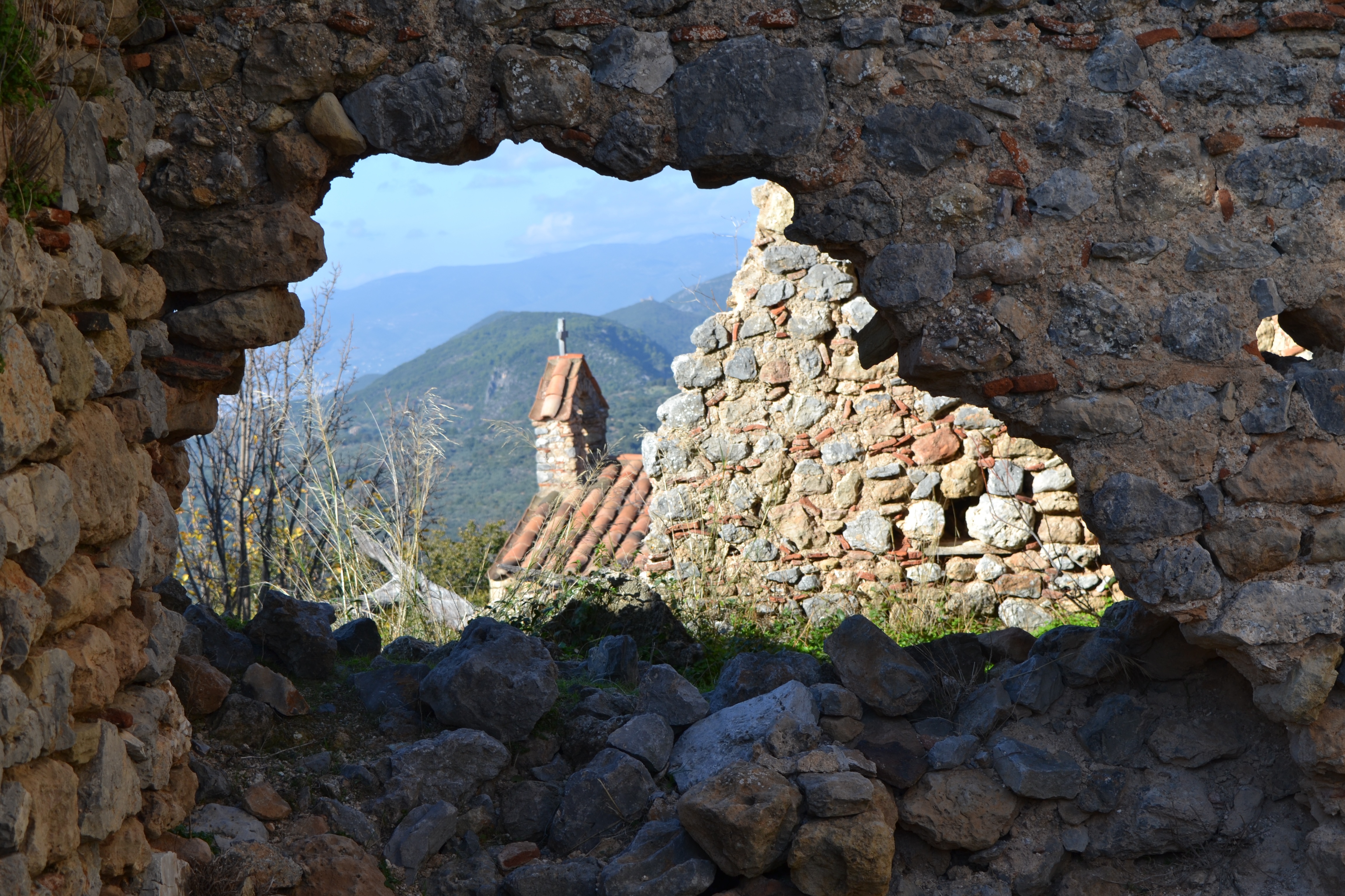
The church, which has been fully renovated on the outside, is just down the hill from the Tower to the north west in fact Drandakis calls it 'Panagia Kastrinis' or 'The Virgin of the Castle'. The church was locked when I visited so I could not look inside!
However, I understand that the church is fully painted with frescoes from 1787 by Anagnostes Kalliergaki of Proastio and Philippaki of Androuvitsa - these painters were active in a number of NW Mani churches at that time. They are in a reasonable condition with bright colours (possibly because the church has absolutely no external light except the doorway) and are almost complete.
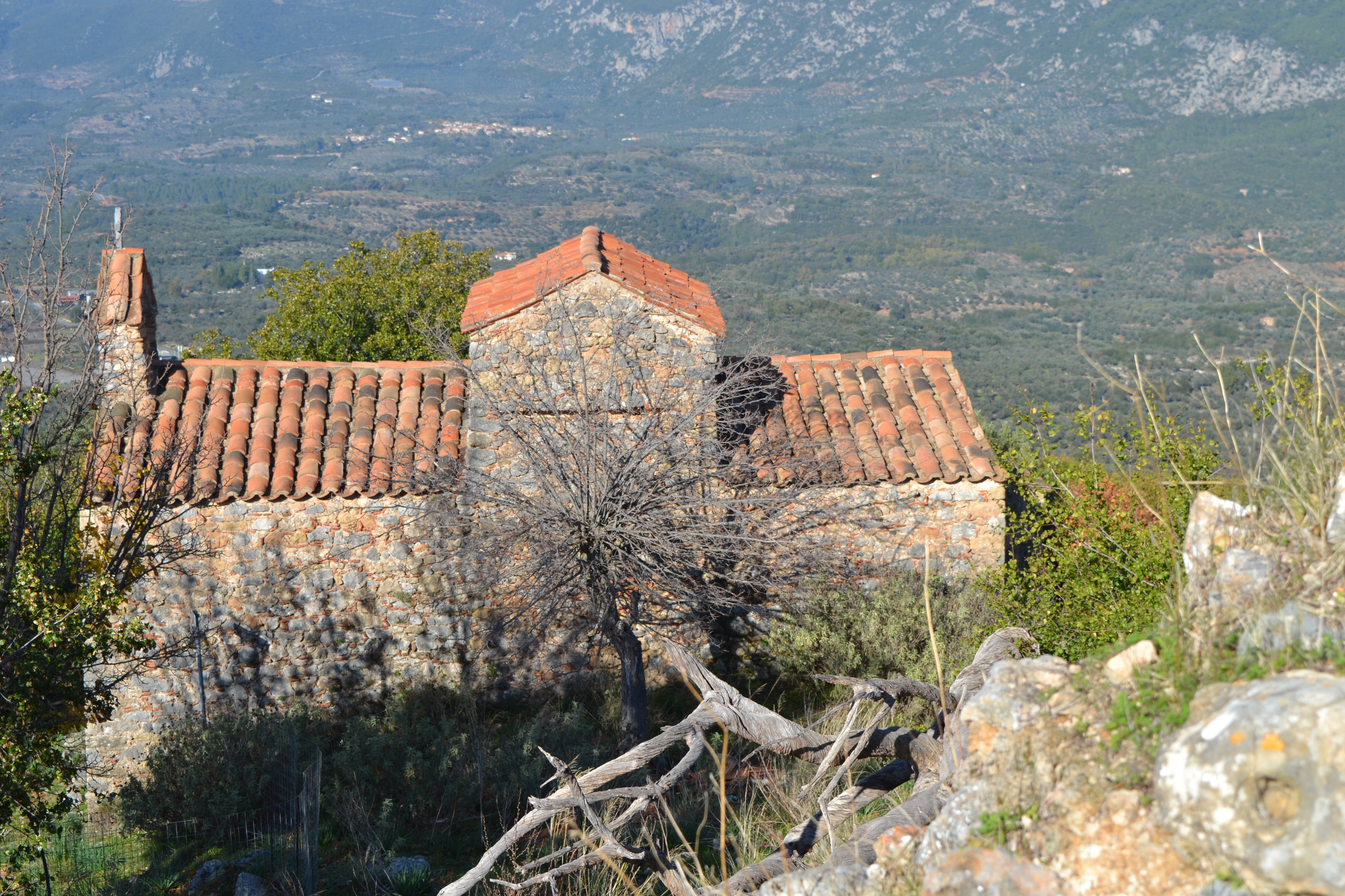
The church has no cupola merely a barrel vaulted transept. This style of church architecture is relatively rare in Greece (less than 100 examples) and there are other, medieval variations nearby at Kambos and Kalianeika but this church is late 18th century - there is a stone above the closed north side door which is dated 1780 and alludes to the church being built by craftsmen from Androuvitsa (Exohori) with contributions from the population of the local villages. The iconostasis is an impressively carved wooden edifice with some fine painted icons on the panels.
The legend of the name "Life Giving Spring" comes from the following: Outside the Imperial City of Constantinople, near the Golden Gate (Porta Aurea) used to be found a grove of trees. A shrine was located there with a spring of water, which from early times had been dedicated to the Theotokos. Over time, the grove had become overgrown and the spring became fetid.
On April 4, 450, as Leo was passing by the grove, he came across a blind man who had become lost. Leo took pity on him, led him to the pathway, seated him in the shade and began to search for water to give the thirsty man. Leo heard a voice say to him, "Do not trouble yourself, Leo, to look for water elsewhere, it is right here!"
Looking about, he could see no one, and neither could he see any water. Then he heard the voice again, "Leo, Emperor, go into the grove, take the water which you will find and give it to the thirsty man. Then take the mud [from the stream] and put it on the blind man's eyes.... And build a temple [church] here ... that all who come here will find answers to their petitions."
Leo did as he was told, and when the blind man's eyes were anointed he regained his sight.
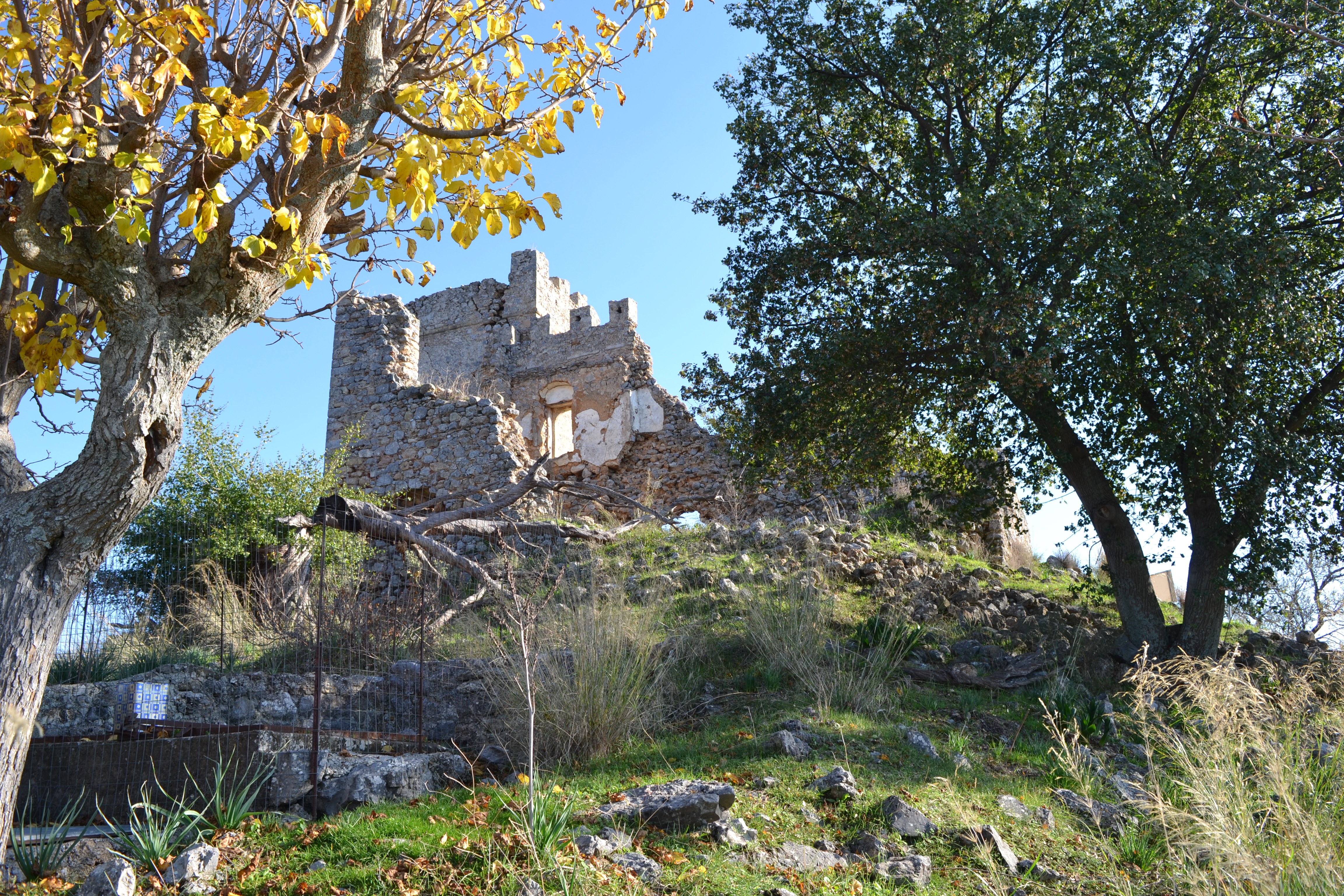
The castle is surrounded by a polygonal wall, at a length of 364 metres, and which was between eight and ten metres tall, with six towers - two round and four square ones - while in the centre stood a large tower with six canons, of a total of 51 which the castle had. Two gates, one in the south-east and one in the north-west, led to the castle's interior, which covered an area of 23,000 square metres'.
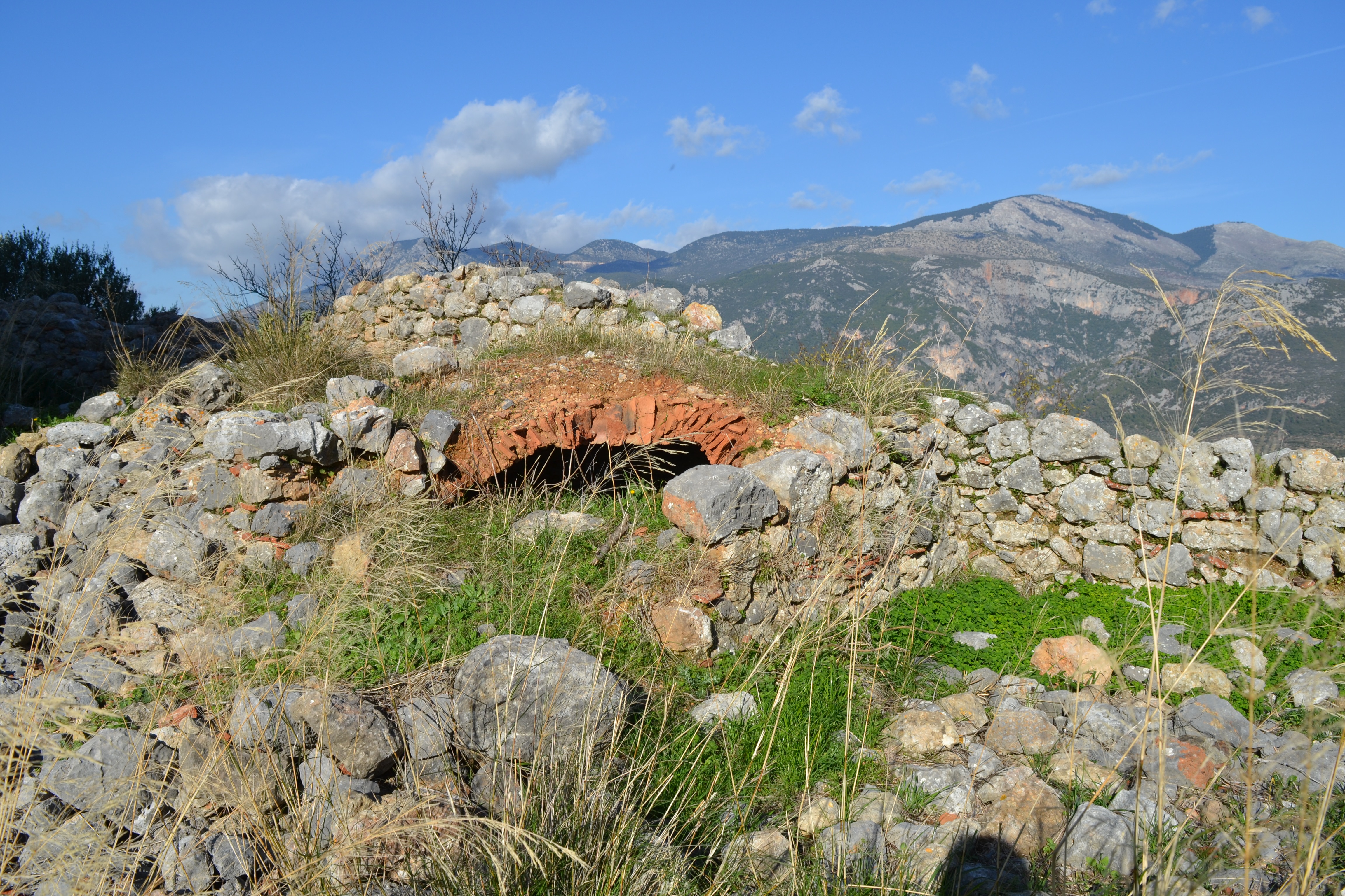
There is another ruined church in the grounds of the castle, Agios Nikolaos, but unfortunately I could not find it.
To reach the castle you drive into the village of Satvropigio, from the Kalmata - Kardamylli road. Take the left turn in the village and drive up the very narrow street, past the Church of Koimisis, continue a little further on and you will see a sign for the castle.
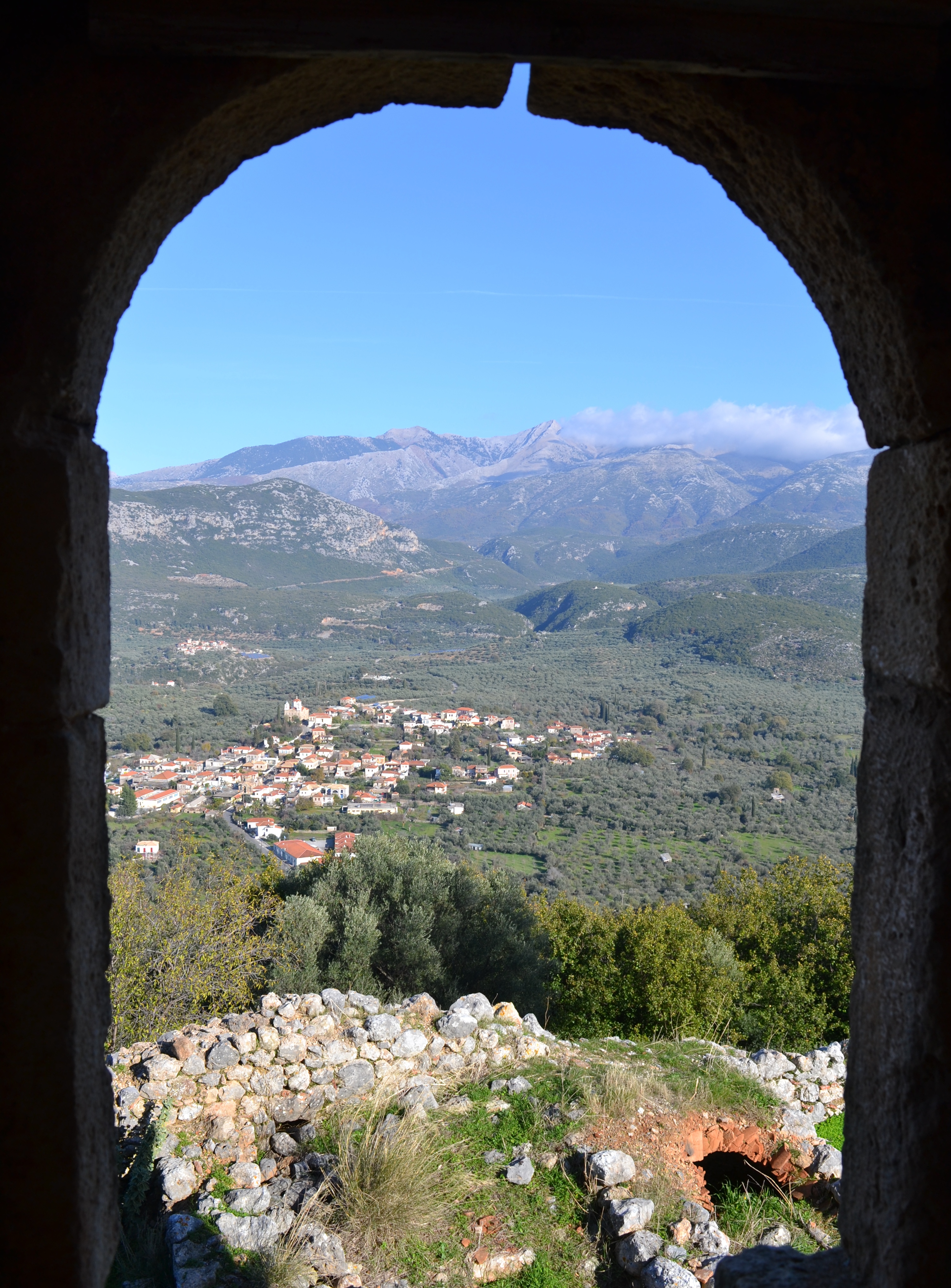
The track to the castle goes right up the side of a modern house and I had to negotiate some tied fencing further up the track (which I managed) then carry on up the hill. The track is not easy to follow but if you keep climbing you will eventually reach the castle. It was well worth the effort as the castle and the setting are absolutely beautiful.